This hike is suitable for people who know how to navigate and are able to cope with all types of terrain.


 Country:

 City:
City:


From Névache, head towards the Laval car park (shuttles run in summer; check with the Tourist Office).
(S/E) From the Laval Refuge, walk up the end of the road to the Laval car park. After the barrier, continue for a further 100 m, then leave the track and head left towards Lac des Béraudes.
(1) The path crosses the Clarée and then begins a very steep climb (ignore a path coming from the right). Continue to the rock and the cairn.
(2) Without crossing the Ruisseau du Moutet, leave the main path and continue straight ahead along the right bank for about 200 metres. At the large boulders, the path turns left (south) and reaches a grassy plateau. Cross this, keeping well below the scree. Continue to the foot of the climb.
(3) The terrain changes; the path becomes much steeper and rockier. It’s very dusty when it hasn’t rained for a long time! You’ll cross the return route.
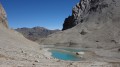
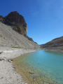
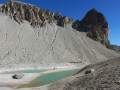
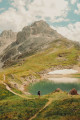
(4) Carry on straight ahead. The path leads to a small pass from where you can see Lac Rouge, whose water level varies with the season. Several paths, at varying altitudes, allow you to walk round the lake.
(5) Return to the pass, then carefully begin the descent to the fork you passed earlier.
(4) Turn left to cross the scree slope to the cairn and its fork.
(6) It is best to take the path that branches off to the right at the same level to join the path leading up to Lac des Béraudes.
(7) Continue the ascent towards the pass, keeping to the left of the lake. Carry on to the fork at an altitude of 2,580 m.
(8) Leave the Col des Béraudes path and head right towards the stream of the same name. Cross it and begin climbing up the grassy slope to an overhang.
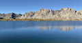
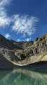
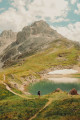
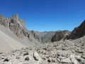
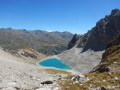
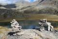
(9) Continue along the level ground, beneath the rocks, to reach a first small pass. Look opposite, to the right, for a path that crosses a scree slope beneath the Crête de Moutouze. To reach it, veer to the right and continue until you reach the lovely view over Lac des Béraudes. Then take the path that branches off to the left and climbs gently towards a pass at an elevation of 2,726 metres. Note: in late summer, Lac Sorcier is dry! Begin the well-marked descent through the scree. Continue along a clearly marked path that descends into the mountain pasture before rejoining the signposted path to Lac des Béraudes.
(10) Continue the descent until you reach the junction from the outward journey.
(2) Follow the path you took on the way up in the opposite direction to return to your car or the shuttle bus. (S/E)

 Visorando Member
 Moderate
 Extremely difficult