


Refine your search for walks in Lac de Rif Bruyant
Lac de Rif Bruyant walks


 Rif Bruyant lake
 Visorando Member
 8.26 mi
 +3,622 ft
 -3,619 ft
 6h 55
 Difficult
 Departure from Lavaldens (Isère)
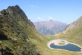
A very pleasant hike. First along the Rif Bruyant stream, through beech and then fir and larch forests, and finally in a high mountain setting in the middle of the Cirque du Coiro.
Well-marked trails make the elevation gain on this hike easier.
Walks near Lac de Rif Bruyant
Lac du Vallon - Le Bourg-d'Oisans
 8.76 mi
+1,070 ft
-6,886 ft
5h 00
Difficult
Departure from Chantelouve (Isère)
The last stage begins at the large Vallon Lake. You will then cross the Col du Rochail, which rises to an altitude of 2,756 metres. After this climb, your path will take you to the Refuge des Sources, then to Villard-Notre-Dame, a village offering a superb view of Bourg-d'Oisans, your final destination.
Lac Labarre - Lac du Vallon
 6.06 mi
+3,192 ft
-2,828 ft
5h 35
Difficult
Departure from Valjouffrey (Isère)
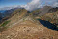
From Lac Labarre, the route follows part of the GR®54B. You will cross the Col de la Romeïou, the Cabane de la Selle, then the Col du Paletas. From there, a wild hike along the ridges, passing by the Neyrard at an altitude of 2,796 m, will take you to Lac du Vallon.
Lake Plan Vianney – Valsenestre
 9.30 mi
+2,680 ft
-5,696 ft
6h 35
Difficult
Departure from Le Bourg-d'Oisans (Isère)
Second day of hiking. More rocky but fairly varied landscapes
Crossing two mountain passes during the day
Friendly wildlife: a lovely colony of marmots at Lac Labarre.
Valsenestre - Refuge de la Muzelle
 6.07 mi
+4,541 ft
-1,886 ft
6h 45
Difficult
Departure from Valjouffrey (Isère)
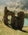
A short 10 km stage but with 1,400 m of elevation gain, featuring the very technical and rocky ascent of the Col de la Muzelle. It requires the utmost caution, especially with a heavy rucksack. A narrow passage between two magnificent mountains, the Roche de La Muzelle and the Pic du Clapier du Peyron. Throughout the ascent, you are surrounded by mountain ranges over 3,000 m high. From the pass, there is a splendid view of the rest of the Glacier de la Muzelle, the lake and the corridor leading down to Valsenestre.
The Désert en Vajouffrey via the Col de Côte Belle
 6.61 mi
+3,458 ft
-3,547 ft
6h 05
Difficult
Departure from Valjouffrey (Isère)
When you’re in the Valbonnais region, as you move from one valley to another, this walk allows you to gain a little altitude and discover the many peaks in this part of the Écrins massif. These peaks overlook both Valsenestre (suggested starting point) and the Désert in Valjouffrey (finish). Of course, you’ll need the weather to be on your side!
Refuge de la Muzelle - Lodge l'Emparis in Mizoën
 9.89 mi
+3,045 ft
-6,040 ft
7h 10
Difficult
Departure from Vénosc (Isère)
After a challenging and technical day on this trek, today is a transitional stage leading to the magnificent village of Mizoën. The descent to Venosc is absolutely stunning, featuring beautiful waterfalls.
Then, after a cable car ride reducing the elevation gain to 300 m, you’ll cross the resort of Les Deux Alpes, dominated by the Girose Glacier. You’ll reach Lac Chambon and the splendid village of Mizoën with its Lodge l’Emparis.
Le Désert-en-Valjouffrey - Valsenestre
 7.01 mi
+3,330 ft
-3,278 ft
6h 05
Difficult
Departure from Valjouffrey (Isère)
Ethird stage involving the ascent of a pass with no major technical difficulty, though the gradient is steep in places and differs slightly from the route shown on the IGN map. From the top of the pass, there is a splendid view of the Col de la Muzelle, the Roche de la Muzelle and the Pic du Clapier du Peyron on either side, promising a beautiful stage for the following day. During the descent, you pass through a maze of large, intertwined slabs of slate clinging to the mountainside.
Le Bourg d’Arud – Lake Plan Vianney
 6.61 mi
+4,731 ft
-390 ft
7h 10
Difficult
Departure from Vénosc (Isère)
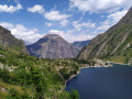
First day of hiking. Spectacular scenery. Nothing but uphill. Morning walk along a tourist trail to Lac du Lauvitel. Don’t miss the panoramic view of the lake!
The paths are very walkable but can be steep in places. Magnificent natural surroundings: you may spot chamois, marmots and weasels.
Le Lauvet - Lac Labarre
 11.84 mi
+4,869 ft
-3,711 ft
9h 40
Difficult
Departure from Valjouffrey (Isère)
From Le Lauvet, descend to La Chapelle-en-Valjouffrey. Then take the Sentier du Facteur trail, cross the Haute Vallée du Béranger nature reserve in Valsenestre, and finish on the GR®54B trail to Lac Labarre.
From Les Deux Alpes Mont de Lans to Les Deux Alpes Venosc via Clos des Balmettes
 4.37 mi
+902 ft
-719 ft
2h 50
 Easy
Departure from Mont-de-Lans (Isère)
An easy hike to warm up and enjoy a superb view of the Deux Alpes resort. In this sense, the route allows you to benefit from the shade of the forest on the way up, and therefore to arrive in good conditions at Clos des Balmettes, where the descent to the resort will be in the open.