The Lann Hir wetland

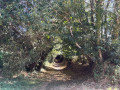
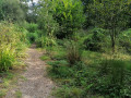
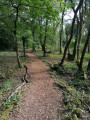
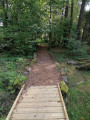
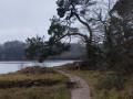
Mahé the salamander will be your guide through this 1.9-hectare protected area to the south-west of Sainte-Anne-d’Auray. An educational route highlighting the biodiversity of Sainte-Anne-d’Auray, winding through heathland, willow groves and a mosaic of oak-willow groves, birch and pine trees. This habitat is ideal for amphibians, reptiles and birds, which you can spot as you follow a route made of wood chips and footbridges.
A little corner of paradise, ideal for a family stroll.

Details

17705119
Creation:
Last update:
Last review:
  • Walking
    Activity: Walking
  • ↔
    Distance: 1.90 mi
  • ◔
    Average duration: 0h 55 
  • ▲
    Difficulty: Easy

  • ⚐
    Back to start: Yes
  • ↗
    Ascent: + 13 ft
  • ↘
    Descent: - 13 ft

  • ▲
    Highest point: 174 ft
  • ▼
    Lowest point: 154 ft

Photos

Description of the walk

(S/E) Starting point: Camping du Motten. A car park is available near the campsite.
Head south from the campsite towards a hedge on the embankment.
At the chalet, cross the campsite for 250 m, enter the site and turn right to go round the wetland.

(1) At the end, you’ll see another embankment concealing a path. Take this path, heading to your right, and continue along it
You’ll arrive in Pluneret. Walk through the wooded area and, 100 m before the riding school at Kerniolen, turn left (at a sign pointing back towards the wetland). Do not take the farm track but walk through a wooded area leading to a sunken path.

(2) At the end of the sunken lane, you’ll come to a local road (with a pylon nearby). Turn left and carry on straight on towards the hamlet of Lomelec.

(3) In the hamlet, turn left and you’ll reach a sunken track. Follow the signposts. These will take you to the right and then, 300 metres further on, to the left (to the west of a housing estate).

(4) Walk alongside the properties, continue straight on to the buffer reservoir and cross the Kerdeliau housing estate. Turn left onto Chemin de Kerdeliau and continue straight on for 300 metres.
Enter the Lann Hir wetland on the right.
After 400 metres, you’ll reach the car park near the campsite (S/E).

Waypoints

  1. S/E : mi 0 - alt. 161 ft - Starting point - Camping du Motten
  2. 1 : mi 0.16 - alt. 164 ft - Zones humide de Lann Hir
  3. 2 : mi 0.59 - alt. 157 ft - Village le Gumenen
  4. 3 : mi 0.88 - alt. 164 ft - Chambres d'hôtes Ar Gwenniled, Breizh'îles, d'Evelyne Pluneret.
  5. 4 : mi 1.54 - alt. 157 ft - On the left: Chemin de Kerdeliau
  6. S/E : mi 1.9 - alt. 161 ft - Finish - Camping du Motten

Notes

And if you fancy visiting in autumn or winter… for safety’s sake, make sure you bring wellies! After all, wetlands mean wet feet!
Yellow signposts with a blue dot will guide you all the way along the route.
Guidebooks are available at Sainte-Anne-d’Auray Town Hall or on the council’s website.

Reviews and comments

3.9 / 5
Based on 3 reviews

Reliability of the description
4 / 5
Ease of following the route
3.7 / 5
Route interest
4 / 5
BrunoLx
BrunoLx

Overall rating : 3.3 / 5

Date of your route : Aug 10, 2026
Reliability of the description : ★★★★☆ Good
Ease of following the route : ★★★☆☆ Average
Route interest : ★★★☆☆ Average
Very busy route : No

The start of the route, which passes through the campsite, is a little confusing, as it has to follow the campsite’s internal layout. Do not rely on the marked trail, but stick to the original aim, which is to reach the wetland.

The wetland remains an interesting area to walk through; it’s probably best to visit in autumn or spring to spot some of the wildlife.
Note that part of the circular route runs alongside a small road, which is of little interest and offers no shade.

Machine-translated

User 3719294

Overall rating : 5 / 5

Date of your route : Jul 28, 2026
Reliability of the description : ★★★★★ Very good
Ease of following the route : ★★★★★ Very good
Route interest : ★★★★★ Very good
Very busy route : Yes

A lovely walk, mostly in the cool shade of the forest. The path is very easy to follow and clearly marked.

Machine-translated

User 25255088

Overall rating : 3.3 / 5

Date of your route : Sep 16, 2025
Reliability of the description : ★★★☆☆ Average
Ease of following the route : ★★★☆☆ Average
Route interest : ★★★★☆ Good
Very busy route : No

Pleasant walk; not very easy to find and then a bit unclear, but impossible to get lost;

Machine-translated

Other walks in the area

For more walks, use our search engine .

The GPS track and description are the property of this route's author. Please do not copy them without permission.