The Vézère and the Bois de Chaleix

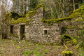
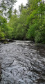
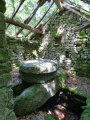
A walk taking you along the banks of the Vézère for around three kilometres. A pleasant stretch through the woodland. Also worth seeing is a ruined farmhouse with the date of construction, 1886, on its pediment. Best undertaken in dry weather, as some stream crossings can become muddy in wet weather and are impassable if the Vézère is in flood.

Details

47686300
Creation:
Last update:
Last review:
  • Walking
    Activity: Walking
  • ↔
    Distance: 5.28 mi
  • ◔
    Average duration: 2h 45 
  • ▲
    Difficulty: Easy

  • ⚐
    Back to start: Yes
  • ↗
    Ascent: + 404 ft
  • ↘
    Descent: - 417 ft

  • ▲
    Highest point: 2,510 ft
  • ▼
    Lowest point: 2,205 ft

Photos

Description of the walk

On arrival in Bugeat, head towards the SNCF station, then follow the Chemin du Petit Chaleix towards the lake: car park.

(S/E) Head towards the Bois de Chaleix, walking past the football stadium stands, and continue until you reach a Fork in the road.

(1) Take the path on the left which runs alongside the Vézère. When you reach a junction, carry straight on along the path that climbs uphill.

(2) Follow the path down towards the Vézère; look for the yellow marker on a tree. Please be careful: the descent is steep and often covered in leaves, which can be slippery in wet weather.

(3) When you reach a Fork in the road, follow the path on the left.

(4) Leave the river behind and follow the path which climbs to the right. The climb is steep at first. You’ll reach a T-junction.

(5) Turn right onto the path signposted ‘path number 3’. Stay on this path and walk for about 1.5 km, ignoring any paths to the right or left. You’ll reach the junction with ‘path number 1’.

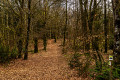
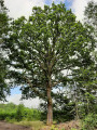
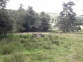
(6) Head up to the left along this path – a very scenic stretch amongst magnificent trees. You’ll reach a clearing.

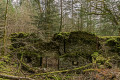
(7) Take the first path on the right, marked by a wooden gate (numbers 33, 40, 41). As you pass, you’ll see the ruined farmhouse on your left; walk round the back to see the façade with its pediment and the construction date of 1886. Then return to the path and carry on.

(8) Turn left onto the path leading downhill (numbers 33, 4); ignore the side paths and head back to the junction you passed on the way out.

(1) Follow the outbound route in the opposite direction to return to the car park (S/E).

Waypoints

  1. S/E : mi 0 - alt. 2,224 ft - Lake car park - Vézère (rivière)
  2. 1 : mi 0.25 - alt. 2,205 ft - Fork
  3. 2 : mi 0.65 - alt. 2,241 ft - To the left towards the Vézère
  4. 3 : mi 1.36 - alt. 2,254 ft - Fork in the road, turn left
  5. 4 : mi 2.18 - alt. 2,290 ft - Path on the right
  6. 5 : mi 2.59 - alt. 2,438 ft - Path number 3
  7. 6 : mi 3.51 - alt. 2,333 ft - Path number 1
  8. 7 : mi 4.27 - alt. 2,402 ft - Path on the right
  9. 8 : mi 4.79 - alt. 2,300 ft - Path numbers 33, 4
  10. S/E : mi 5.28 - alt. 2,224 ft - Lake car park

Notes

Take care on a few sections which may be difficult for young children.
(S/E) Tables and benches

Reviews and comments

4.6 / 5
Based on 3 reviews

Reliability of the description
4.7 / 5
Ease of following the route
4.3 / 5
Route interest
4.7 / 5
User 22445057
• Edited:

Overall rating : 4.7 / 5

Date of your route : Aug 25, 2026
Reliability of the description : ★★★★★ Very good
Ease of following the route : ★★★★★ Very good
Route interest : ★★★★☆ Good
Very busy route : No

A lovely, very easy walk
The first section along the banks of the Vézère is very pleasant and it might be worth doing the circular route in the opposite direction so you can have a swim at the end of the walk
The second section is pleasant under the trees (notably two lovely avenues of beech trees) but unfortunately offers almost no views

Machine-translated

User 21863449

Overall rating : 5 / 5

Date of your route : Aug 03, 2026
Reliability of the description : ★★★★★ Very good
Ease of following the route : ★★★★★ Very good
Route interest : ★★★★★ Very good
Very busy route : No

A wonderful, easy walk.
Shaded and running alongside the river.
A lovely discovery

Machine-translated

LpKz86
LpKz86

Overall rating : 4 / 5

Date of your route : Aug 07, 2025
Reliability of the description : ★★★★☆ Good
Ease of following the route : ★★★☆☆ Average
Route interest : ★★★★★ Very good
Very busy route : No

Very pleasant hike
The hike is really pleasant and takes place mainly in the forest or on wooded paths, which are nice in hot weather or bad weather
The only tricky part is the start, which involves a steep climb straight ahead, even though the GPS says to continue along the stream (perhaps I made a mistake).

Machine-translated

Other walks in the area

For more walks, use our search engine .

The GPS track and description are the property of this route's author. Please do not copy them without permission.