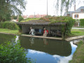
The Vinette Valley

A lovely mountain bike ride through the Perche region. The scenery varies: countryside, ponds and woodland. A chance to switch off. Passing not far from Thiron Gardais, you can enjoy the charm of its abbey or the Royal and Military College.

Details

n°26192250
Creation:
Last update:
Last review:
  • Mountain biking
    Activity: Mountain biking
  • ↔
    Distance: 6.86 mi
  • ◔
    Duration according to the author: 1.5 hrs 
  • ▲
    Difficulty: Easy

  • ⚐
    Back to start: Yes
  • ↗
    Ascent: + 177 ft
  • ↘
    Descent: - 148 ft

  • ▲
    Highest point: 902 ft
  • ▼
    Lowest point: 745 ft
  • ⚐ Country: France
  • ⚐
    Area: Perche
  • ⚐ City: Saint-Denis-d'Authou (28480)
  • ⚑
    Start/End: N 48.345337° / E 0.98465°
  • ❏
    IGN map(s): Ref. 1917SB

  • ◶
    Type of surface:
  •  
     
     
    ■ 60% Road ■ 30% Byway ■ 10% Path
  • ⇧
    Bike carrying: No
  • ▲
    Difficulty: Easy
  • Hour-by-hour weather

Description of the route

You can park in the town hall car park, which is the starting point for the walk.

(S/E) Setting off from the town hall, walk down past the church. Turn slightly left to head towards Combres onthe D10310, which is opposite. This road then turns right and continues straight on at the next junction. Follow it for 900 metres, passing the ponds, and climb up to the Stop sign.

(1) Turn right onto the D3515, towards Nogent-le-Rotrou.

(2) At a place called Les Bordes, take the second road on the left, pass through the hamlet and then follow the track.

(3) Before reaching Les Gauleries, turn right onto the track and join a road.

(4) At La Petite Borde, turn left, then right, and pass in front of Les Joussalinières.

(5) At the end of this track, turn right and join the D5 north of Thiron-Gardais.

(6) Take the D5 on the right, then the first road on the left after La Ménagerie.

(7) Pass the Petit Gauffeuillu, leave the Grand Gauffeuillu on your right and continue along the track on the left until you reach the Mare Chauveau.

(8) Cross theD3515 and take the path opposite. At the next junction, carry on straight ahead, following the old railway line.

(9) At the bridge, turn right then follow the D5 for 200 m to the right.

(10) Turn left onto thefirst track and head towards Saint-Denis-d’Authou (S/E).

Waypoints

  1. S/E : mi 0 - alt. 768 ft - Town Hall - Église Saint-Denis (Saint-Denis-d’Authou)
  2. 1 : mi 0.73 - alt. 889 ft - D351.5 road
  3. 2 : mi 1.1 - alt. 876 ft - Chemin les Bordes
  4. 3 : mi 1.59 - alt. 892 ft - Towards Les Gauleries
  5. 4 : mi 2.04 - alt. 853 ft - La Petite Borde
  6. 5 : mi 2.79 - alt. 833 ft - Edge of the forest
  7. 6 : mi 3.02 - alt. 820 ft - D5 road
  8. 7 : mi 3.42 - alt. 869 ft - Le Petit Gauffeuillu
  9. 8 : mi 4.74 - alt. 879 ft - D351.5 road
  10. 9 : mi 5.89 - alt. 820 ft - Bridge
  11. 10 : mi 6.09 - alt. 850 ft - GR35
  12. S/E : mi 6.86 - alt. 768 ft - Town Hall - Église Saint-Denis (Saint-Denis-d’Authou)

Worth a visit

- Royal and Military College.
- Church of Saint-Denis-d’Authon.
- Royal and Military College.

Reviews and comments

4.7 / 5
Based on 1 review

Reliability of the description
5 / 5
Ease of following the route
5 / 5
Route interest
4 / 5
User 3474553

Overall rating : 4.7 / 5

Date of your route : Jun 09, 2025
Reliability of the description : ★★★★★ Very good
Ease of following the route : ★★★★★ Very good
Route interest : ★★★★☆ Good
Very busy route : No

Beautiful walks in the Perche region.

Machine-translated

Other walks in the area

For more walks, use our search engine .

The GPS track and description are the property of this route's author. Please do not copy them without permission.