The Châteauneuf Forest

In the heart of the Thymerais grain-growing plateau, between the Eure and Perche valleys, you’ll walk through the Châteauneuf State Forest, which then opens out onto the peaceful Blaise Valley.

Details

n°31885652
Creation:
Last update:
Last review:
  • Mountain biking
    Activity: Mountain biking
  • ↔
    Distance: 14.90 mi
  • ◔
    Duration according to the author: 2.5 hrs 
  • ▲
    Difficulty: Easy

  • ⚐
    Back to start: Yes
  • ↗
    Ascent: + 325 ft
  • ↘
    Descent: - 358 ft

  • ▲
    Highest point: 669 ft
  • ▼
    Lowest point: 410 ft
  • ⚐ Country: France
  • ⚐
    Area: Perche
  • ⚐ City: Châteauneuf-en-Thymerais (28170)
  • ⚑
    Start/End: N 48.585914° / E 1.243864°
  • ❏
    IGN map(s): Ref. 2015SB, 2016SB

  • ◶
    Type of surface:
  •  
     
     
    ■ 10% Road ■ 60% Byway ■ 30% Path
  • ⇧
    Bike carrying: Not specified
  • ▲
    Difficulty: Easy
  • Hour-by-hour weather

Description of the route

Set off from the car park on the outskirts of Châteauneuf, Rue Émile Vivier, D928.

(S/E) Cross the Route de Dreux, then turn right onto the road between the forest and the business park. At the 90° left-hand bend, carry on straight ahead along a track and continue for 1 km until you reach the Allée Royale.

(1) Turn right, cross two roads, then take thesecond path on the left, ‘Route de Frévent’. Continue straight on until you reach the road.

(2) Take the path on the right at the edge of the woods, which runs alongside the road on your left. At the next junction, first turn left then right and carry on straight on until you reach Torçay. Follow Rue du 18 novembre until you reach the three-way junction.

(3) Turn right onto the path leading down to the Moulin de Torçay. Cross a road and carry on until you reach the 90° right-hand bend.

(4) Ignore the Moulin de Torçay on your right (private property) and follow the path opposite down into the valley.

(5) At the Moulin de Mongneau, take the footpath on the right and cross the Blaise.

(6) At Saint-Ange, take the road on the right, Chemin de l’Église, then continue straight ahead along the path. Just after the village, ignore a turn-off to the left and carry on straight ahead. Return to the tarmac road and head uphill to the next junction.

(7) Head downhill to the right until you reach the junction after a house on your left.

(8) Take the path, at an acute angle, to the left. At Le Grand Moulin, continue along the small road and, at the three-way junction, carry on straight ahead until the next junction.

(9) Turn right onto theD1341, Rue des Ponts, towards Torçay. Cross the bridge over the Blaise and, at the crossroads in Fontaine-les-Ribouts, turn left towards Châteauneuf-en-Thymerais, then right onto Rue du Relais. You’ll soon come to the start of a path on the right between the houses.

(10) Take this path and, at the next junction, go straight on, skirting a woodland on your right, until you reach a road.

(11) Turn right, pass the wayside cross on your left, then take the path on the right a few metres further on. Continue straight on, cross the forest and come to a road.

(12) Carry on to the left until you reach the corner of the Châteauneuf State Forest.

(13) Turn right onto the path that leads into the woodland, and walk straight through the forest until you reach the large road junction.

(14) Cross the D928 with care, follow the D138 for about ten metres, then take the path on the right which leads into the forest. Continue straight on until you reach the entrance gate to the Château de la Jaglu.

(15) Take the forest track opposite the château entrance, then return to the car park at the end of the Route du Jaglu (S/E).

Waypoints

  1. S/E : mi 0 - alt. 669 ft - Car park – Rue Émile Vivier – D928
  2. 1 : mi 0.98 - alt. 653 ft - Allée Royale
  3. 2 : mi 3.42 - alt. 558 ft - Path on the right at the edge of the woods
  4. 3 : mi 4.5 - alt. 528 ft - Torcay
  5. 4 : mi 4.95 - alt. 449 ft - 90° right-hand bend
  6. 5 : mi 5.75 - alt. 466 ft - Mongneau Mill - Blaise (rivière) - Affluent de l'Eure
  7. 6 : mi 5.93 - alt. 459 ft - Saint-Ange
  8. 7 : mi 6.45 - alt. 538 ft - Crossroads
  9. 8 : mi 7.03 - alt. 430 ft - Path on the left
  10. 9 : mi 8.69 - alt. 417 ft - D134.1 Road – Rue des Ponts
  11. 10 : mi 8.91 - alt. 430 ft - Path on the right between the houses
  12. 11 : mi 9.32 - alt. 512 ft - Road
  13. 12 : mi 10.41 - alt. 486 ft - Road
  14. 13 : mi 10.95 - alt. 499 ft - Path on the right
  15. 14 : mi 13.08 - alt. 604 ft - D928 road x D138 road
  16. 15 : mi 14.13 - alt. 633 ft - Château du Jaglu
  17. S/E : mi 14.9 - alt. 666 ft - Car park – Rue Émile Vivier – D928

Notes

Motorhome stopover nearby.
Accommodation and dining in Châteauneuf-en-Thimerais.

Worth a visit

The Châteauneuf-en-Thymerais State Forest, managed by the National Forestry Office (ONF), covers 1,743 hectares. It was formed by the amalgamation of the former royal forest, various woodlands belonging to religious orders, and the acquisition of the Bois de Jaudrais in 1965. It is primarily used for the production of timber from various deciduous species, the main one being oak. The introduction of a few coniferous species helps to enhance its botanical diversity.

The forest is home to two 18th-century pyramids situated at the Rond de France and the Rond du Roi. It is likely that these structures served as boundary markers and rallying points for hunts with hounds under the Ancien Régime. Today, hunting is still practised in this forest, but there has been a steady increase in the deer population (roe deer, red deer and does). Spotting them, however, requires patience and discretion. The Blaise Valley is dotted with water mills:
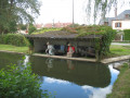
Torçay Mill, Saint-Ange Mill, the Grand Moulin… Throughout the Drouais region, and particularly in the valleys of the Eure, the Avre and the Blaise, mills began to appear as early as the Middle Ages but mainly from the 18th century onwards. Depending on their location, the mills in these three valleys served as forges, tanning mills, fulling mills, paper mills or, of course, grain mills. The machinery all utilised hydraulic power but, depending on the case, drove bellows, beaters or millstones.

Torçay Mill

Reviews and comments

5 / 5
Based on 1 review

Reliability of the description
5 / 5
Ease of following the route
5 / 5
Route interest
5 / 5
Papaguide
Papaguide

Overall rating : 5 / 5

Date of your route : Aug 20, 2023
Reliability of the description : ★★★★★ Very good
Ease of following the route : ★★★★★ Very good
Route interest : ★★★★★ Very good
Very busy route : No

A lovely walk. However, the path from point 5 to point 6 was impassable, so I had to turn back and take the path on the right before point 5, about 8.83 km from the starting point.
One to do again

Machine-translated

Other walks in the area

For more walks, use our search engine .

The GPS track and description are the property of this route's author. Please do not copy them without permission.