


Refine your search for walks in Surfonds
Surfonds walks


 The Sourice Valley
 Tourism professional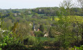
 6.31 mi
 +203 ft
 -190 ft
 3h 05
3h 05
 Moderate
 Departure from Surfonds (Sarthe)
The parish underwent a re-demarcation in 1836: certain farms such as La Bardouillère and houses in the village were part of Volnay. Since then, the south-eastern boundary has been formed by the Ruisseau la Sourice. Under the Ancien Régime, the parish seigneury was annexed to the Château du Coudray, which you will see to the right of the hill as you head towards La Bardouillère. The village still has traditional houses near the church; it has gradually expanded towards the crossing point over the Sourice, where the roads from Surfonds to Bouloire and from Le Breil to Volnay used to meet, later transformed inthe 19th century into the main road from Tuffé to Le Grand-Lucé.
The Pescheray Estate
 7.19 mi
+174 ft
-174 ft
3h 25
Moderate
Departure from Le Breil-sur-Mérize (Sarthe)
7.19 mi
+174 ft
-174 ft
3h 25
Moderate
Departure from Le Breil-sur-Mérize (Sarthe)
Le Breil and Nuillé are two villages of ancient origin. In the Middle Ages, Le Breil, or Breuil, was a seigneurial hunting ground. Nuillé, first mentioned in the9th century, still has a small Romanesque church.
Lutin route
 Visorando Member6.33 mi
+331 ft
-331 ft
3h 10
Moderate
Departure from Soulitré (Sarthe)
Visorando Member6.33 mi
+331 ft
-331 ft
3h 10
Moderate
Departure from Soulitré (Sarthe)
This route owes its name to the shape of its route, which evokes the silhouette of a leprechaun for dreamers. It offers a path between Jalais, a bocage plain on the Soulitré side, and the Huisne valley.
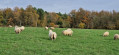
On the edge of the woods from Volnay
 13.34 mi
+502 ft
-492 ft
6h 35
13.34 mi
+502 ft
-492 ft
6h 35
 Difficult
Departure from Volnay (Sarthe) (Sarthe)
Difficult
Departure from Volnay (Sarthe) (Sarthe)
The name Val-de-la-Hune, adopted at the time of the merger, refers to the location of the two villages situated in the valley at the confluence of the Ruisseau de l’Arche and the Hune. The area has been inhabited since ancient times, as evidenced by the dolmen on the border with Tresson, dating from the Neolithic period, and the ancient road, the Via Turniacensis, linking Le Mans to Blois; passing through Volnay and Saint-Mars-de-Locquenay before heading towards the Loir Valley. This facilitated the development of large agricultural estates, explaining the presence of numerous fiefdoms in medieval times, of which few remains are left (Champion, Pois, Le Grand Yvay, Mélève, Sargilet), with the exception of La Chesnaye, which incorporated most of them during the Modern Era (16th–18th centuries).
Bird trail from Nuillé-le-Jalais
 4.43 mi
+151 ft
-174 ft
2h 10
4.43 mi
+151 ft
-174 ft
2h 10
 Easy
Departure from Nuillé-le-Jalais (Sarthe)
Easy
Departure from Nuillé-le-Jalais (Sarthe)
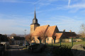
Nuillé-le-Jalais, first mentioned in the9th century , still has a small Romanesque church. Surprisingly, many of the local place-names refer to birds: La Pie qui Couette, La Grande Oiselerie and Le Chardonneret. The route’s signposting is a nod to this unique feature.
Loudon Ponds and Wood
2.56 mi
+177 ft
-171 ft
1h 20
Easy
Departure from Parigné-l'Évêque (Sarthe)
This circular walk allows you to discover a site not far from Le Mans that is rich in natural beauty. Ponds, peat bogs, wet and dry heathland, and marshy woods... all form a mosaic of landscapes that are home to species rare in the region: harriers, hobby falcons, goshawks, purple herons (among the birds); and royal ferns, marsh marigolds and sundews (among the plants).
Discovering the woods and ponds of Loudon
 4.85 mi
+36 ft
-36 ft
2h 15
Easy
Departure from Saint-Mars-la-Brière (Sarthe)
4.85 mi
+36 ft
-36 ft
2h 15
Easy
Departure from Saint-Mars-la-Brière (Sarthe)
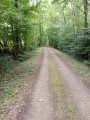
Parigné-Lévêque is a very large and heavily wooded commune: northern pines with sand dunes, and southern chestnut and birch trees. The route allows you to discover the charm of numerous woodlands, vast moors and ponds. The Loudon Stream is crossed in several places.
Les Sapins des Pauvres
 11.37 mi
+302 ft
-289 ft
5h 30
Moderate
Departure from Saint-Mars-de-Locquenay (Sarthe)
11.37 mi
+302 ft
-289 ft
5h 30
Moderate
Departure from Saint-Mars-de-Locquenay (Sarthe)
The name adopted at the time of the merger refers to the location of the two villages situated in the valley at the confluence of the Arche and Hune streams. The area has been inhabited since ancient times, as evidenced by the dolmen on the border with Tresson, dating from the Neolithic period, and the ancient road – the Via Turniacensis – linking Le Mans to Blois; passing through Volnay and Saint-Mars-de-Locquenay before heading towards the Loir Valley. This facilitated the development of large agricultural estates, explaining the presence of numerous fiefdoms in medieval times, of which few traces remain (Champion, Pois, Le Grand Yvay, Mèleve, Sargilet), with the exception of La Chesnaye, which incorporated most of them during the Modern Era (16th–18th centuries).
The Maquis des Bois de la Croix in Connerré
 3.50 mi
+233 ft
-220 ft
1h 50
Easy
Departure from Connerré (Sarthe)
3.50 mi
+233 ft
-220 ft
1h 50
Easy
Departure from Connerré (Sarthe)
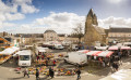
Situated in the Huisne valley, inhabited since prehistoric times, Connerré developed in the Middle Ages around a religious centre comprising the Church of Saint-Symphorien and a priory. The town, enclosed by a wall at the end of the 16th century, opened up at the end of the Ancien Régime thanks to the construction of bridges replacing fords and the expansion of transport links: the construction of the Paris–Nantes royal road around 1780, followed by the opening of a station on the Le Mans–Paris line in 1854. These developments fuelled the economic boom of the 19th century through fairs and markets and the growth of industry. The market town modernised and expanded gradually, then more rapidly from the 1970s onwards. Today, Connerré is an attractive small town, situated halfway between Le Mans and La Ferté-Bernard.
In the footsteps of Gohan in Bouloire
 10.05 mi
+486 ft
-509 ft
5h 05
Moderate
Departure from Bouloire (Sarthe)
10.05 mi
+486 ft
-509 ft
5h 05
Moderate
Departure from Bouloire (Sarthe)
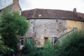
Bouloire is nestled in the heart of a vast, hilly agricultural region crossed by the Dué and Tortue rivers. Human presence along the ancient road between Le Mans and Orléans is attested to by a coin dating back to the Merovingian period. Its name comes either from a Celtic place name meaning "fortification" or from an etymology meaning "between two coasts ". The town centre is rich in ancient architectural heritage. The Church of Saint-Georges, destroyed by a fire that ravaged the village in 1680, bears the coat of arms of Marshal Guillaume Testu de Balincourt, who enabled its reconstruction. The town's coat of arms is also linked to this figure.
The starting point of the 24 Hours of Le Mans from Montfort-le-Gesnois
 5.15 mi
+230 ft
-230 ft
2h 35
Easy
Departure from Montfort-le-Gesnois (Sarthe)
5.15 mi
+230 ft
-230 ft
2h 35
Easy
Departure from Montfort-le-Gesnois (Sarthe)
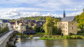
The present-day commune, formed by the merger of two former major market towns, stretches out parallel to the Huisne valley across uneven terrain. The old Pont de Gennes is at the lowest point (60 m), whilst the highest point (100 m) is at Montfort-le-Rotrou. The former is a crossroads village situated at the mouth of an old crossing point over the Huisne. The latter, situated on a strategic defensive site, is a linear settlement built under the protection of the castle. The two were joined by a gradual urban expansion in the 19th century. The walk takes you past the starting point of the first major motor race organised by the Automobile Club de France (ACF) in 1906, the forerunner of the 24 Hours of Le Mans.
In the shade of the hedgerows towards Thorigny-sur-Dué
 7.30 mi
+203 ft
-213 ft
3h 30
Moderate
Departure from Thorigné-sur-Dué (Sarthe)
7.30 mi
+203 ft
-213 ft
3h 30
Moderate
Departure from Thorigné-sur-Dué (Sarthe)
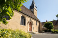
A few archaeological finds attest to human presence in Thorigné as far back as the Neolithic period. In Gallo-Roman times, a large agricultural estate (villa) is thought to have been the origin of a permanent settlement, which is better documented from the Middle Ages onwards. Despite the destruction of its medieval castle, which was replaced by a bourgeois house in the19th century, Thorigné stands out as a fairly large village offering a wide variety of civil architecture, spread out along the main axis linking the Dué valley to the church. Probably of Romanesque origin, the church was enlarged in the16th century and remodelled inthe 18th century . It houses interesting stained-glass windows and furnishings, such as the high altarpiece dating from 1669 and the18th-century side altarpieces.
On the Via Turniacensis in Maisoncelles
 5.48 mi
+82 ft
-82 ft
2h 35
Easy
Departure from Maisoncelles (Sarthe) (Sarthe)
5.48 mi
+82 ft
-82 ft
2h 35
Easy
Departure from Maisoncelles (Sarthe) (Sarthe)
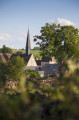
The village of Maisoncelles, described as a ‘street village’, has developed linearly along the road linking Bouloire to Tresson and Écorpain, running perpendicular to the Ruisseau de l’Étangsort. Although difficult to date precisely, the imposing Church of Notre-Dame, possibly dating back to the Romanesque period, is undoubtedly the oldest building in the village. You can, however, see typical rural features from theThird Republic, such as the public pump at the foot of the church. Heading towards the cemetery, you will see on the right the old communal washhouse, recently converted to welcome walkers, and further up, a former school recognisable by its two-storey structure and brick window frames.
Around Duneau
2.42 mi
+138 ft
-138 ft
1h 15
Easy
Departure from Duneau (Sarthe)
The village of Duneau is located in a dominant position on the left bank of the Huisne, on a route that has been highly sought-after since prehistoric times. The Pierre Fiche menhir and the Pierre Couverte dolmen, dating from the Neolithic period (around 4000 BC), bear witness to this. These are the only visible archaeological remains among many others covering the periods of Antiquity and the Middle Ages.
The Étangsort Valley towards Tresson
 8.68 mi
+348 ft
-351 ft
4h 20
Moderate
Departure from Tresson (Sarthe)
8.68 mi
+348 ft
-351 ft
4h 20
Moderate
Departure from Tresson (Sarthe)
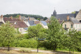
The origins of the settlement of Tresson are very ancient, as evidenced by a dolmen situated not far from Les Basses Poches. Furthermore, the territory of Tresson is crossed by the Via Turniacensis, near which a large agricultural estate is recorded in 572. This villa was donated by Bishop Domnole to Saint-Vincent Abbey, which established a priory in Tresson. This combination of factors led to the development of the present-day village in the Étangsort valley.