Country:
 City:


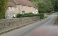
(S/E) From the car park behind the church, at the top of the hill, head towards the village for about 100 metres, then turn right onto the D818 towards Lonlay-l’Abbaye. Walk past the cemetery and continue down this road for about 500 metres.
(1) Leave the D818 by turning right onto a track. Follow this lovely, gentle descent through the hedgerow-lined countryside until you reach the lowest point of the route (alt. 164 m) at the bottom of the valley, near a small tributary of the Égrenne. You will arrive at the D25.
(2) Carefully turn left to follow the road for a few tens of metres, then make a slight left-right detour to take the track that gradually climbs towards the hamlet known as Le Bossu. Then follow the valley floor towards La Noë Verte. After about 1 km of gentle ascent through the valley, you’ll come out onto the D269.
(3) Follow the road to the left down towards the Noë Verte waterworks, then turn immediately right towards Les Sourcettes.
(4) Begin the main ascent of the route on a path that climbs steadily through the hedgerow-lined countryside to reach the heights of the plateau.
(5) After about 500 m of climbing, at the first junction on the plateau, turn right.
(6) After 300 m, turn left to follow the ridge line at an altitude of over 250 m. Continue straight on to reach the hamlet of Le Goulet.
(7) At the junction, turn right to begin the return journey along a small road that descends gently for about 1.1 km towards the village of Beauchêne.
(8) Once you reach the D25, turn carefully right towards the centre of the village and continue for about 200 m through the village.
(9) Turn left onto the winding path that climbs up to the church forecourt. Walk round the church on the left to reach the car park at the starting point (S/E).
 Visorando Member

 Moderate