From washhouses to fountains. So much water!

From washhouses to fountains, this trail is all about water! It will also take you on a journey of discovery to the seven public wells (out of the hundred or so that exist!) and on to the port of Valence-sur-Baïse.

Details

10871836
Creation:
Last update:
Last review:
  • Walking
    Activity: Walking
  • ↔
    Distance: 2.24 mi
  • ◔
    Average duration: 1h 10 
  • ▲
    Difficulty: Easy

  • ⚐
    Back to start: Yes
  • ↗
    Ascent: + 118 ft
  • ↘
    Descent: - 118 ft

  • ▲
    Highest point: 387 ft
  • ▼
    Lowest point: 269 ft

Description of the walk

Starting point and car park at the harbour or the motorhome site (D930).

(S/E) Head south-east, cross Avenue Ernest Vila at the bridge (on your right) and, following the River Baïse, take Chemin des Plapès opposite for 900 m, leaving the botanical trail on your left.

(1) When you reach the D571 (former railway line), turn left towards the motorhome park, then take the short path on the right to the Lavoir de Hount de Las.
Head back and walk along the road towards the village centre, passing the basketball hall, built on top of the stands of the old amphitheatre, near an old quarry.

(2) Just before the water tower, turn left onto the path that runs behind the houses, leading to the Place des Pyrénées.

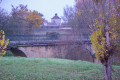
Turn left and follow the ramparts on the south side to reach the Porte de l’Hérisson and enter the bastide.

(3) Take Rue de la Porte d’Espagne, then, at the Grande Rue, turn left (don’t miss the Espace Bastide). You’ll arrive at the square with arcades, featuring the church and its belvedere. Take Rue Branly, opposite the church, all the way to the end.

Turn right onto Rue Saint-Jean. At the large well, continue right onto Rue de la République, then turn left to reach Place Voltaire via the street of the same name.

(4) At the far end of the square, turn left onto Avenue des Acacias and, before the long descent, take the path on the left that follows the cliffs to reach the fortified gate, Porte de l’Hérisson.

(3) Follow the route back for a few metres, then turn right onto Côte de l’Hérisson. Cross the D939 and arrive at the harbour car park (S/E).

Waypoints

  1. S/E : mi 0 - alt. 269 ft - Harbour car park - Baïse (rivière)
  2. 1 : mi 0.6 - alt. 335 ft - D571
  3. 2 : mi 1.1 - alt. 367 ft - Water tower
  4. 3 : mi 1.54 - alt. 367 ft - Porte de l’Hérisson
  5. 4 : mi 1.9 - alt. 367 ft - Place Voltaire
  6. S/E : mi 2.24 - alt. 269 ft - Harbour car park – Baïse (river)

Notes

Car park:
Port de Valence
or
motorhome area (D930)

Toilets:
Rue Jules Ferry (opposite the chemist’s)
Port of Valence
Motorhome stopover

Elevation
Minimum altitude 80m
Maximum altitude 120m

Mountain bike route:
Suitable for mountain bikes

Picnic spots:
Port, church park, Place des Pyrénées, motorhome site,
Hount de Las washhouse, Place Voltaire

Restaurants:
La Barge: Valence Harbour
La Table d’Emma and Le Massalet: Village square

Worth a visit

From the harbour, take the Chemin des Plapès and walk past a cherry orchard before reaching the old public baths, below the botanical trail (alternative route). Then, a pleasant woodland path follows a bend in the River Baïse.
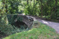
The Hount de Las washhouse is the oldest in the village (19th century). It is fed by a spring and by rainwater, thanks to the roof which provides shelter for the washerwomen. Behind it lies a remnant of the railway bridge.
Before the 1960s and the construction of the village hall, a pond (known as Plan du Haut) ran alongside the road. Opposite, a washhouse dating from the 1950s is awaiting restoration. At the entrance to the Grande Rue, near the old tower gate, the first well comes into view.
Below the Porte de l’Hérisson, there is an old fountain, followed by a second one at the bottom of the grassy path – reminders of the many springs typical of karst landscapes.
Finally, a superb well on Place Voltaire (formerly known as Plan du Bas, which once featured a basin and a washhouse), two wells on Rue Saint-Jean and three on Place de la Mairie serve as a reminder that a vast water table lies beneath your feet.
A sign at the harbour recounts the history of the ‘Rivière d’Argent’.

Reviews and comments

4.3 / 5
Based on 3 reviews

Reliability of the description
5 / 5
Ease of following the route
4.7 / 5
Route interest
3.3 / 5
beniat1870
beniat1870

Overall rating : 3.7 / 5

Date of your route : Aug 26, 2024
Reliability of the description : ★★★★★ Very good
Ease of following the route : ★★★★★ Very good
Route interest : ★☆☆☆☆ Very disappointing
Very busy route : No

Much of the route is rather unsightly (passing by rubbish bins, unkempt houses, etc.), with a particularly ugly stretch of road that you come across quite often. It’s of no interest whatsoever; the wash house is neglected and in a rather dreary spot… Best avoided.

Machine-translated

LiliG
LiliG

Overall rating : 4.3 / 5

Date of your route : Oct 01, 2023
Reliability of the description : ★★★★★ Very good
Ease of following the route : ★★★★☆ Good
Route interest : ★★★★☆ Good
Very busy route : No

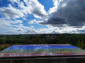
Taken on a sunny morning, this walk also offers several views of the Pyrenees. A little surprise: you can climb up to the church’s viewing platform for free (it closes at 7 pm).
A quick note on the description:
-(1) When you reach the D571, turn left, cross the D930, and continue to the motorhome site
-(4) At the end of the square, turn left onto Avenue des Acacias ; as you begin the long descent, pass Rue Anatole France and take the path on the left that follows the cliffs

Machine-translated

FF32190
FF32190

Overall rating : 5 / 5

Date of your route : Oct 24, 2021
Reliability of the description : ★★★★★ Very good
Ease of following the route : ★★★★★ Very good
Route interest : ★★★★★ Very good
Very busy route : No

More of a stroll than a hike. I did it on a lovely sunny day with my grandson, who isn’t even seven yet. A lovely, very appealing route with some really interesting views out over the town.

Machine-translated

Other walks in the area

For more walks, use our search engine .

The GPS track and description are the property of this route's author. Please do not copy them without permission.