The crossing of Mont Veyrier

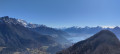
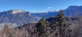
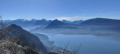
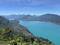
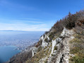
A long traverse along the ridges of Mont Veyrier and Mont Baret, a visit to the Grotte des Sarrazins, and a return via the Biclop. Magnificent views of Lake Annecy and the Aravis mountain range.

⚠️ A by-law issued by the municipalities of Annecy and Veyrier-du-Lac prohibits motorised vehicles from accessing the Col des Contrebandiers and Pré Vernet.

Some sections require caution as the path runs along the edge of a cliff, just a few metres away in places. The route to the Grotte des Sarrazins includes a section with a cable and a drop-off.

Details

45047589
Creation:
Last update:
Last review:
  • Walking
    Activity: Walking
  • ↔
    Distance: 10.51 mi
  • ◔
    Average duration: 8h 55 
  • ▲
    Difficulty: Very difficult

  • ⚐
    Back to start: Yes
  • ↗
    Ascent: + 4,672 ft
  • ↘
    Descent: - 4,665 ft

  • ▲
    Highest point: 4,259 ft
  • ▼
    Lowest point: 1,768 ft

Photos

Description of the walk

Park near the Sur les Bois mast on the edge of the Route du Plan de Sagran. An alternative starting point is available from the small harbour in Annecy, which adds to the elevation gain but is more convenient for those without their own transport. See § Practical Information.

(S/E) At the gate, take the small path leading uphill to the left. Follow a few hairpin bends, then turn right.

(1) At the end of the path, follow the tarmac section for about 150 m, then take the path on the right to cut across a hairpin bend. Return to the road, negotiate the bend, then leave the road again to follow the path on the right. Return to the road one last time and turn right to reach the Pré Vernet car park.

(2) Take the path to the left of the signpost, the one that climbs steeply, marked ‘Chemin du Pré Vernet’ on the IGN map: an alternative route is possible via the main path opposite, which leads directly to the Col des Sauts. Continue to the next junction.

(3) Turn right onto a wide stone path and continue climbing; it is very steep, and this isn’t the last one.

(4) A few dozen metres before the Col des Sauts, turn left and head for the ridge. Follow the ridge until you reach the junction for Mont Baron. I recommend youtake care on this section of the walk.

(5) Enjoy the lovely view and continue along the ridge to reach the old cable car station and its viewpoint: a good spot for a break.

(6) Take the path opposite where you arrive, which descends to the Col des Contrebandiers: the descent includes a secured section that has been relatively smoothed by frequent use.

(7) In the Col des Contrebandiers car park, follow the path on the left near the sign by the bench. This is the second very steep section of the walk. It isn’t as well marked as the others but is visible; traces of blue paint may help if you’re in any doubt. Reach Mont Baret.

(8) Take a short break to admire the Bauges and La Tournette, then begin the descent to join a wider path at the bottom of the steep section: a wooden sign points towards Bluffy.

(9) Ignore this sign and take the path that heads right before veering left. Turn right at the junction and continue to the fork leading to the Grotte des Sarrazins.

(10) Take the narrow, very steep path that branches off to the right.

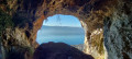
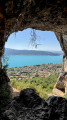
(11) Keep well to the right and carry on to the cave: there’s a short secured section just before you reach it; there’s a lovely view of the cave’s vaulted ceiling.

Turn back.

(11) Resume the route by turning right. You’ll come out onto the Route de la Corniche in Morat.

(12) Turn right and follow this road straight on; this section is rather uninteresting but unavoidable. Continue to a junction with a ‘dead end’ sign opposite and, on the right, a sign for ‘La Combe’.

Take the road on the right and continue to a small car park with a fountain (water not suitable for drinking).

(13) Take the path on the left. Pass the mast, then turn left at the three-way junction: the path on the right leads up to the Col des Sauts. Continue to the Biclop junction, which you’ll reach about fifty metres after passing a path on the left that descends to Chavoire.

(14) Follow the path which climbs steeply to the right.

(15) At the junction, take the path on the right which leads directly to the Pré Vernet car park.

(2) Retrace your steps along the ascent route in the opposite direction to return to the car park at the mast (S/E).

Waypoints

  1. S/E : mi 0 - alt. 2,139 ft - Near the Sur les Bois mast
  2. 1 : mi 0.62 - alt. 2,743 ft - The start and end of the route are on tarmac.
  3. 2 : mi 1 - alt. 3,009 ft - Pré Vernet car park
  4. 3 : mi 1.46 - alt. 3,530 ft - At the crossroads, turn right
  5. 4 : mi 1.86 - alt. 3,934 ft - Junction, turn left - Mont Veyrier
  6. 5 : mi 2.61 - alt. 4,222 ft - Mont Baron (1299 m)
  7. 6 : mi 3.01 - alt. 4,114 ft - Old cable car
  8. 7 : mi 3.59 - alt. 3,461 ft - Col des Contrebandiers (1052m)
  9. 8 : mi 4.01 - alt. 4,039 ft - Mont Baret
  10. 9 : mi 5.21 - alt. 2,927 ft - Junction: turn right
  11. 10 : mi 5.79 - alt. 2,041 ft - Turn right at the fork
  12. 11 : mi 6.02 - alt. 2,300 ft - Junction towards the - Grotte des Sarrazins (Veyrier-du-Lac)
  13. 12 : mi 6.45 - alt. 1,798 ft - Route de la Corniche
  14. 13 : mi 7.23 - alt. 1,916 ft - La Combe
  15. 14 : mi 8.53 - alt. 2,165 ft - Le Biclop. View of the - Lac d'Annecy (Haute-Savoie)
  16. 15 : mi 9.14 - alt. 2,467 ft - Junction: turn right
  17. S/E : mi 10.51 - alt. 2,139 ft - Arrival

Notes

Alternative starting point: for the route starting from the small harbour, follow the signs for Pré Vernet: take the path between the ‘Puits Savoyard’ shop and the low wall; the path is then clearly marked, like a motorway – it’s impossible to go wrong as it’s very well-used.

A challenging hike with some very steep ascents and similarly steep descents.

Some sections require caution as the path runs along the edge of a cliff, just a few metres away in places.

Access to the Grotte des Sarrazins involves a section with a cable and a drop-off.

Estimated time for a good walker with few breaks is 5 h 30 min, but for a leisurely hike, allow at least 7 h 30 min.

Make sure you take plenty of water, especially in summer, as this is a long and challenging hike.

Wear suitable footwear for your level of experience, as the terrain is stony, slippery and littered with roots.

Reviews and comments

4.2 / 5
Based on 2 reviews

Reliability of the description
4.5 / 5
Ease of following the route
4 / 5
Route interest
4 / 5
Vince25200
Vince25200

Overall rating : 4 / 5

Date of your route : May 29, 2026
Reliability of the description : ★★★★★ Very good
Ease of following the route : ★★★★☆ Good
Route interest : ★★★☆☆ Average
Very busy route : No

Hike done today. Mixed results. Some lovely views of Annecy, the lake and the surrounding mountains. It’s quite steep in places, but that was to be expected
However, for the descent, try to take a different route (even if it means going a bit further) as it’s really (very) steep and almost dangerous in places. I think it’s better to walk an extra 3 or 4 km and avoid certain very steep and technical sections.

Machine-translated

Lotte
Lotte

Overall rating : 4.3 / 5

Date of your route : Feb 23, 2026
Reliability of the description : ★★★★☆ Good
Ease of following the route : ★★★★☆ Good
Route interest : ★★★★★ Very good
Very busy route : Yes

Trail still snow-covered in places (advice: wear suitable footwear with crampons). However, the trail remains clearly visible overall. Some sections are steep (suitable level recommended).

The circular route took 7 hours to complete, covering 23 km and 1,700 m of elevation gain, with a few minor errors in the trail in places.

A very beautiful, challenging outing.

Machine-translated

Other walks in the area

For more walks, use our search engine .

The GPS track and description are the property of this route's author. Please do not copy them without permission.