


Refine your search for walks in Col des Contrebandiers (1052m)
Col des Contrebandiers (1052m) walks


 Mont Veyrier
 Visorando Member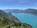
 6.57 mi
 +2,795 ft
 -2,795 ft
 5h 25
5h 25
 Difficult
 Departure from Annecy-le-Vieux (Haute-Savoie)
The ridge trail from Mont Veyrier to Mont Baron overlooks Lake Annecy from a height of over 800 metres and offers panoramic views of the Bauges peaks.
⚠️ A decree issued by the municipalities of Annecy and Veyrier-du-Lac prohibits motorised vehicles from accessing the Col des Contrebandiers and Pré Vernet.
Mont Veyrier from end to end
 7.82 mi
+3,540 ft
-3,537 ft
6h 40
Difficult
Departure from Veyrier-du-Lac (Haute-Savoie)
7.82 mi
+3,540 ft
-3,537 ft
6h 40
Difficult
Departure from Veyrier-du-Lac (Haute-Savoie)
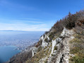
Mont Veyrier is one of the mountains most familiar to residents of the Annecy region: I suggest you explore it from north to south.Please note that the route includes a few tricky sections: see below for details.
⚠️ A decree issued by the municipalities of Annecy and Veyrier-du-Lac prohibits motorised vehicles from accessing the Col des Contrebandiers and the Pré Vernet.
Circular route via the Col des Contrebandiers starting from Veyrier-du-Lac
 5.46 mi
+2,178 ft
-2,172 ft
4h 25
5.46 mi
+2,178 ft
-2,172 ft
4h 25
 Moderate
Departure from Veyrier-du-Lac (Haute-Savoie)
Moderate
Departure from Veyrier-du-Lac (Haute-Savoie)
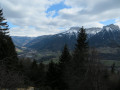
A walk through the woods between Veyrier-du-Lac and the Col de Bluffy, via the Col des Contrebandiers.Best done in winter when the trees have shed their leaves to enjoy the views over Lake Annecy.
⚠️ A decree issued by the municipalities of Annecy and Veyrier-du-Lac prohibits motor vehicles from accessing the Col des Contrebandiers and Pré Vernet.
The crossing of Mont Veyrier
 10.51 mi
+4,672 ft
-4,665 ft
8h 55
10.51 mi
+4,672 ft
-4,665 ft
8h 55
 Very difficult
Departure from Annecy-le-Vieux (Haute-Savoie)
Very difficult
Departure from Annecy-le-Vieux (Haute-Savoie)
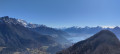
A long traverse along the ridges of Mont Veyrier and Mont Baret, a visit to the Grotte des Sarrazins, and a return via the Biclop. Magnificent views of Lake Annecy and the Aravis mountain range.
⚠️ A by-law issued by the municipalities of Annecy and Veyrier-du-Lac prohibits motorised vehicles from accessing the Col des Contrebandiers and Pré Vernet.
Some sections require caution as the path runs along the edge of a cliff, just a few metres away in places. The route to the Grotte des Sarrazins includes a section with a cable and a drop-off.
Walks near Col des Contrebandiers (1052m)
Parmelan loop from Dingy via the Col du Perthuis
5.71 mi
+3,005 ft
-3,091 ft
5h 15
Difficult
Departure from Dingy-Saint-Clair (Haute-Savoie)
Le Parmelan, via a slightly less traditional route.
At the summit, sharp limestone pavement, Grotte de l'Enfer (and other caves), Mont Blanc range.
The Semnoz
 9.24 mi
+2,513 ft
-3,406 ft
6h 25
Moderate
Departure from Leschaux (Haute-Savoie)
9.24 mi
+2,513 ft
-3,406 ft
6h 25
Moderate
Departure from Leschaux (Haute-Savoie)
Crossing the Semnoz between the villages of Leschaux and Machevaz.
Combe refuge - Le Reposoir
 6.84 mi
+2,021 ft
-3,307 ft
4h 55
Moderate
Departure from Chevaline (Haute-Savoie)
6.84 mi
+2,021 ft
-3,307 ft
4h 55
Moderate
Departure from Chevaline (Haute-Savoie)
Second day of the hike: Around Charbon Mountain with a stop at Dent des Portes.
The Col de la Forclaz from Entremont to Le Petit Bornand
 7.27 mi
+3,100 ft
-3,707 ft
6h 05
Difficult
Departure from Entremont (Haute-Savoie)
7.27 mi
+3,100 ft
-3,707 ft
6h 05
Difficult
Departure from Entremont (Haute-Savoie)
In the commune of Glières-Val-de-Borne, in the Bargy massif, Lac de Lessy is a true gem at the foot of the Pic de Jalouvre. The walk takes you through forests and mountain pastures. It features a short rocky section. The start from La Joux and the return via Montagne de Paradis and Cocogne are what make this walk unique. You pass the two-hundred-year-old hamlet of Les Chalets de Mayse. The Chalet de Lessy is nestled on the lakeside after the Col de la Forclaz.
Le Reposoir - Refuge de la Combe
 3.14 mi
+1,719 ft
-436 ft
2h 55
Moderate
Departure from Bellecombe-en-Bauges (Savoie)
3.14 mi
+1,719 ft
-436 ft
2h 55
Moderate
Departure from Bellecombe-en-Bauges (Savoie)
This hike can be done either:
- as a day trip,
- or as part of a longer hike (first stage of the circular route: Around Charbon Mountain). It was during this tour that it was completed.
Chalets de l’Eau Froide – Stream Fourchu car park
10.52 mi
+2,142 ft
-4,190 ft
6h 40
Difficult
Departure from Giez (Haute-Savoie)
The second day of a two-day route around the Pointe d’Arcalod, the highest point in the Bauges, passing through wild areas, valleys and along rivers. The proposed route mainly follows the western section of the GR® de Pays Tour de l’Arcalod, marked in yellow and red. Spectacular views of the mountains and Lake Annecy. This wild and little-used route is situated mainly within a sensitive, regulated area. The terrain is good and presents no particular difficulties.
Aiguille des Calvaires and Combe de Borderan
4.54 mi
+1,762 ft
-2,923 ft
3h 35
Moderate
Departure from La Clusaz (Haute-Savoie)
A great pointy summit with a cross on top and good views followed by a descent of Borderan Combe. This could easily be done in reverse and/or without the use of the cable cars.