Country:

 City:
City:


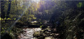
Park in the car park at the Olhette Chapel, at the junction of the D4 and the Chemin d’Inzola.
(S/E) Head due south along the small tarmac road towards Venta Inzola.
Keep left at this junction to follow the track suitable for vehicles which runs alongside the river (Insolako Erreka). Continue along the path which leads to a crossroads.
(3) Turn left, leaving the path that leads directly to the Col des Abeilles. The walk follows a “galzada”, i.e. a Roman road (see info). Cross into Spain and arrive at Venta Inzola, where the route joins the GR®10.
(4) Turn left to cross the stream more safely at this point via the small bridge – also concrete, but wider and more stable than the EDF pylons further downstream! The GR®10 crosses back into France and leads to Deskargako Lepoa (272m), in a clearing at the junction of several paths. Legend has it that this is where the smugglers of yesteryear would set down their burdens to rest for a while.
(5) Turn right and head up to Venta Yachola (386 m).
(6) Cross the border again and follow the path as it climbs steeply. On emerging from the woods, you’ll reach the plateau; turn left to begin the ascent of Subizia (568 m).
(7) Descend and continue straight on to climb to the top of the Petite Rhune (Larruntxiki, 700 m), approaching it slightly from the right, on the Spanish side, off the beaten track towards the end via a clearly marked route.
(8) Descend to the Col de Zizkuitz (700 m).
(9) Then head for the summit of its taller neighbour by following the concrete track, still on the Spanish side. Cross back into France and reach the summit of the Rhune (900 m), the iconic mountain of the Basque Coast.
(10) Descend via the left-hand route, which is more direct, to the Col Errepausaku Lepoa (574 m).
(11) Continue straight on along the path which curves further to the left and runs along the rocky ridge of the Miramar plateau to the Miramar orientation point, also known as the “Balcony of the Queen” (550 m): there is an old orientation point here which was used by Empress Eugénie de Montijo during her ascent of La Rhune.
(12) Join the main route (GR®10) coming from Trabene.
(13) Follow the GR® route, keeping in the same direction. Pass the small hill above Jauregiko Borda on your right and emerge at the car park (95 m).
(14) Follow the small tarmac road called Chemin de Churen Borda, and reach the D4.
(14) The final stretch of the circular route consists of an 800-metre walk alongside the road on a safe cycle path, leading to the Chapel of Olhette (S/E).
 Visorando Member
 Moderate