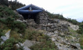
La Petite Rhune and the unusual features of La Rhune from Trabenia

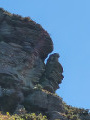
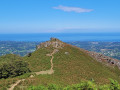
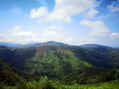
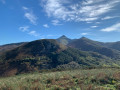
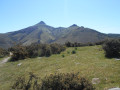
La Petite Rhune, passing by the Yasola venta, offers an unusual view of La Rhune. Follow this trail towards the Col de Kizkuitz to discover an unusual feature of the Rhune massif. The return to the Col des Trois Fontaines will allow you to seek out the little secrets of the Ihizelai rocky plateau.

Details

4664261
Creation:
Last update:
Last review:
  • Walking
    Activity: Walking
  • ↔
    Distance: 6.06 mi
  • ◔
    Average duration: 4h 35 
  • ▲
    Difficulty: Moderate

  • ⚐
    Back to start: Yes
  • ↗
    Ascent: + 2,070 ft
  • ↘
    Descent: - 2,060 ft

  • ▲
    Highest point: 2,264 ft
  • ▼
    Lowest point: 325 ft

Photos

Description of the walk

To reach the Xurien Borda car park, take the Xurien Borda path, opposite the Trabenia restaurant.

(S/E) At the top of the car park, go past the chicane and turn right. Follow the path that has been created to join theGR®®10, then follow the ‘Yasola’ signs as you cross the stream via a concrete bridge. Continue along the south-facing path, which climbs for 1 km to the Deskargako Lepoa Pass, a junction of numerous paths.

(1) Continue climbing due south, leaving a wide track and theGR®®10on your right. This path climbs for 500 m and leads to the Venta Yasola, situated on the French-Spanish border.

(2) Follow the track which heads left into the woods, heading south-east. At the edge of the woods, turn left heading due north onto a fairly steep grassy path which you follow up to the ridge. Then take the path on the right which follows the ridge south-east towards the summit of the Petite Rhune.

(3) Cut across to the right, then head northwards to reach the summit with its enormous cairn.

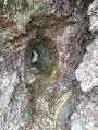
(4) Petite Rhune summit: head down towards the east, joining a track that passes to the left of a rocky mound and takes you to the foot of this cliff face. A small cave houses an unusual and surprising feature.
Around the cave, you’ll find carved stones.

Then follow this path to the Col de Zizkuitz at the foot of the Rhune.

(5) Head down to the left, towards the north, along a path that leads further into the woods. Follow this path along the hillside, first northwards then eastwards, and continue to the Col des Trois Fontaines.

(6) Continue due north to reach the “cayolar” or shelter surrounded by boulders. Go round the back of the cayolar and cross the boulders heading west to discover the Grotto of the Virgin, nestled in a recess: statue of the Virgin of La Rhune.

(7) Return to the Col des Trois Fontaines.

(6) From the pass, turn right onto theGR®®10, which descends north-west, and follow it to the car park at the Trabenia stopover lodge (S/E).


Waypoints

  1. S/E : mi 0 - alt. 325 ft - Xurien Borda car park
  2. 1 : mi 1.01 - alt. 896 ft - Col de Deskargako Lepoa (272 m)
  3. 2 : mi 1.36 - alt. 1,270 ft - Yasola shop
  4. 3 : mi 1.87 - alt. 1,893 ft - Summit of - Petite Rhune (699 m)
  5. 4 : mi 2.13 - alt. 2,218 ft - The mosaics of Zizkuitz
  6. 5 : mi 2.61 - alt. 2,215 ft - Col de Zizcuitz
  7. 6 : mi 3.48 - alt. 1,857 ft - Col des Trois Fontaines
  8. 7 : mi 3.78 - alt. 1,814 ft - Cave of the Virgin
  9. S/E : mi 6.06 - alt. 325 ft - Xurien Borda car park

Notes

IBP = 70

Worth a visit

Water available at the "Yasola" venta if open.

Always be cautious and plan ahead when you're outdoors. Visorando and the author of this route cannot be held responsible for any accidents occurring on this route.

The GR® and PR® markings are the intellectual property of the Fédération Française de Randonnée Pédestre.

Reviews and comments

4.7 / 5
Based on 17 reviews

Reliability of the description
4.7 / 5
Ease of following the route
4.4 / 5
Route interest
4.9 / 5
User 19054584

Overall rating : 5 / 5

Date of your route : Aug 20, 2026
Reliability of the description : ★★★★★ Very good
Ease of following the route : ★★★★★ Very good
Route interest : ★★★★★ Very good
Very busy route : No

It was my first hike and I was on my own, so I relied heavily on the advice and route provided by the Visorando app. It was perfect! It was a magnificent hike, of moderate difficulty, though with some steep climbs, particularly towards the end as I made my way up to Mont Esnaur. The views were stunning, and I was lucky enough to see an eagle up close – it flew down towards me, no doubt to see who I was . There was just one unpleasant sight on this hike: a poor dead pottok, half-eaten by animals, about three-quarters of the way along the route.
Machine-translated

Audreyy166
Audreyy166

Overall rating : 4.7 / 5

Date of your route : Aug 02, 2026
Reliability of the description : ★★★★★ Very good
Ease of following the route : ★★★★★ Very good
Route interest : ★★★★☆ Good
Very busy route : Yes

A really lovely walk – definitely one not to be missed!
We did, however, do the circular route in the opposite direction. And honestly, thank goodness we did! The start of the walk as shown on the app is very steep and involves narrow paths. Going the other way round, the climb is easy and very manageable.
If you’re visiting during peak season, make sure you plan ahead for parking as the car parks get very busy.
I highly recommend it!

Machine-translated

Célinerando
Célinerando
• Edited:

Overall rating : 5 / 5

Date of your route : Jul 19, 2026
Reliability of the description : ★★★★★ Very good
Ease of following the route : ★★★★★ Very good
Route interest : ★★★★★ Very good
Very busy route : No

A lovely walk, with beautiful views, and we didn’t come across many other people along the way. For my part, I took a detour to reach La Rhune via the tarmac road. Otherwise, you need to follow the sat-nav, as in some places the paths aren’t very clear – particularly before reaching La Petite Rhune on the very steep wooded section. I’d recommend this hike, which is rated as moderate as stated and is absolutely lovely.

Machine-translated

Maduba
Maduba

Overall rating : 4.7 / 5

Date of your route : Apr 27, 2026
Reliability of the description : ★★★★★ Very good
Ease of following the route : ★★★★☆ Good
Route interest : ★★★★★ Very good
Very busy route : No

A lovely hike, though the final climb to the summit is through grassy terrain with no real path. But the magnificent dome at the top is visible from everywhere. A stunning 360° view.
Requires a good level of fitness.

Well worth a visit for those looking for something a bit different, as it’s apparently less crowded than its big sister, La Rhune.
You can also reach it from the summit of La Petite Rhune.

Machine-translated

Fred33121
Fred33121

Overall rating : 4.7 / 5

Date of your route : Nov 12, 2025
Reliability of the description : ★★★★★ Very good
Ease of following the route : ★★★★☆ Good
Route interest : ★★★★★ Very good
Very busy route : No

A very enjoyable route in terms of its physical aspects (a few good climbs...) and its magnificent scenery. There were 90 km/h winds on the ridges. We decided not to climb up to La Petite Rhune but to stay on the GR trail below. The ground was dry and did not pose any major difficulties. On wet ground, it would not have been the same...

Machine-translated

g70
g70

Overall rating : 4.7 / 5

Date of your route : Oct 18, 2025
Reliability of the description : ★★★★★ Very good
Ease of following the route : ★★★★☆ Good
Route interest : ★★★★★ Very good
Very busy route : Yes

A very beautiful hike that started in the middle of the afternoon.
A great alternative to the more popular trails on La Rhune.
I had a little trouble reaching the top of Zubizia, but arriving at the top of Petite Rhune was a wonderful reward, more authentic than the summit of its big sister!
The return journey is pleasant, along the mountainside and through the woods, and the short detour to see the kayola is interesting.

Machine-translated

User 26298818

Overall rating : 5 / 5

Date of your route : Jun 23, 2025
Reliability of the description : ★★★★★ Very good
Ease of following the route : ★★★★★ Very good
Route interest : ★★★★★ Very good
Very busy route : Yes

A beautiful hike in the drizzle, but cool and magical in the forest. You can do a loop to La Rhune.
Stop at the car park at the bottom. Don't drive to the start of the hike.
Thanks

Machine-translated

Mapie.e
Mapie.e

Overall rating : 5 / 5

Date of your route : Apr 01, 2025
Reliability of the description : ★★★★★ Very good
Ease of following the route : ★★★★★ Very good
Route interest : ★★★★★ Very good
Very busy route : No

A beautiful route that passes by the summit of Petite Rhune "Larruntxiki" and offers superb views of La Rhune itself and its slopes in France and Spain, all the way to the coast of Hendaye and the beaches of Landes. It must be said that the weather was ideal that Tuesday... The path from Trabénia, as well as at the end, is quite unpleasant, very steep, very stony and requires good footwear. But as soon as you gain altitude, it's a treat. Don't forget to bring water; it's a bit of a physical route after all.

Machine-translated

utsenea.stjeandeluz
utsenea.stjeandeluz

Overall rating : 4.7 / 5

Date of your route : Oct 13, 2024
Reliability of the description : ★★★★★ Very good
Ease of following the route : ★★★★☆ Good
Route interest : ★★★★★ Very good
Very busy route : No

A very beautiful route offering stunning views of the coast and mountains.
The last storm uprooted many trees, which sometimes force you to take a detour or climb over the trunk that is still blocking the path.
More cleaning and maintenance work lies ahead for those responsible for the trail.

Machine-translated

Thiech
Thiech

Overall rating : 4.3 / 5

Date of your route : Jul 21, 2023
Reliability of the description : ★★★★☆ Good
Ease of following the route : ★★★★☆ Good
Route interest : ★★★★★ Very good
Very busy route : No

We did sections 1 to 5 there and back, then extended the route via the Ciboure mountain for the descent (see other hike). Not sure we saw the path that would have allowed us to complete the full circular loop.
A superb hike accessible to all if you take your time, with magnificent views of the ocean throughout. The steepest part is the forest after the Venta Yasola bistro. Avoid in hot weather as there is little shade.

Machine-translated

Thiech
Thiech

Overall rating : 4.3 / 5

Date of your route : Jul 21, 2023
Reliability of the description : ★★★★☆ Good
Ease of following the route : ★★★★☆ Good
Route interest : ★★★★★ Very good
Very busy route : No

We did sections 1 to 5 there and back, then extended the route via the Ciboure mountain for the descent (see other hike). Not sure we saw the path that would have allowed us to complete the full circular loop.
A superb hike accessible to all if you take your time, with magnificent views of the ocean throughout. The steepest part is the forest after the Venta Ysola bistro. Avoid in hot weather as there is little shade.

Machine-translated

vynis85
vynis85
• Edited:

Overall rating : 4.7 / 5

Date of your route : Apr 20, 2023
Reliability of the description : ★★★★★ Very good
Ease of following the route : ★★★★☆ Good
Route interest : ★★★★★ Very good
Very busy route : No

Excellent route completed in 4 hours
Superb, breathtaking views
It is advisable to be properly equipped with good footwear, water and to be in good physical condition...

Machine-translated

PATMAUF
PATMAUF

Overall rating : 3.7 / 5

Date of your route : Jan 16, 2023
Reliability of the description : ★★★☆☆ Average
Ease of following the route : ★★★☆☆ Average
Route interest : ★★★★★ Very good
Very busy route : Yes

I couldn't find the end of the route.

Machine-translated

JeanTitouan
JeanTitouan

Overall rating : 4.7 / 5

Date of your route : Sep 06, 2022
Reliability of the description : ★★★★☆ Good
Ease of following the route : ★★★★★ Very good
Route interest : ★★★★★ Very good
Very busy route : Yes

Good information about the route, which is quite busy, especially in the sections shared with the GR10.
The route is easy to follow, except perhaps above the Venta Yasola towards Petite Rhune, where a GPS is useful.
Near the Kizkuitz pass, you should go and see the "awakened stones" by taking a path that passes under Petite Rhune (the site of these carved stones is located below a pile of rocks).
The Virgin of the Rhune was not found in a crevice in the rock but in the small chapel nearby.

Machine-translated

GOGO
GOGO
• Edited:

Overall rating : 4.3 / 5

Date of your route : Sep 06, 2022
Reliability of the description : ★★★★☆ Good
Ease of following the route : ★★★★☆ Good
Route interest : ★★★★★ Very good
Very busy route : No

A superb hike that allows you to avoid the "ordinary" tourists and their incessant flow poured out by the little train of La Rhune. It also allows you to avoid the hikers, who climb La Rhune and are much more numerous. However, the superb landscapes are there throughout the climb and a little further.
We had some difficulty following the route between points 4 and 5, but fortunately the GPS helped us find the right path after a few detours through the rocks and vegetation. It is always very difficult to describe a route through rocky terrain, as the path is generally not very well marked on the ground.
Be careful, between points 2 and 3, the climb is steep and the dry ground in part of this section does not make progress easy.
We recommend this beautiful, pleasant, peaceful hike with superb views. We also recommend wearing good walking shoes.

Machine-translated

Other walks in the area

For more walks, use our search engine .

The GPS track and description are the property of this route's author. Please do not copy them without permission.