Country:

 City:
City:



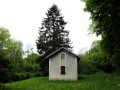
Parking behind the church in Chassagne-St-Denis or on Rue du Castel (return route). Various markings: yellow-blue, yellow-red, white-red, and mountain bike markings in places.
(S/E) Set off with your back to the church (towards the ‘Ruines’ sign), passing the public weighbridge until you reach the cross marking the first fork.
(1) Continue to the right along the Grande-Rue. On leaving the village, carry on along the small road closed to vehicles (except authorised vehicles), crossing peaceful countryside with a fine view of the Monts d’Ornans, and in particular, to the far left, the village of Malbrans, crowned by its statue of the Virgin Mary. Continue in this direction until the next fork.
(2) Turn left onto the stony track, leaving the signposted route behind, but you will soon come across MTB signposts (route 28). Continue to the edge of the forest and a hunting lodge.
(3) Continue left along the forest track (towards Château Saint-Denis) to reach, after a stretch through the forest, a stony path at a signpost for Sur Saint-Denis.
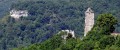
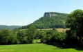
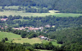
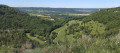
(4) Turn left towards Chassagne on this stony path for about a hundred metres until you reach a cleared area on your right. Look out for the small path on the right, passing a signpost somewhat hidden in the greenery and running alongside the cliffs, which leads you to the Rocher de Valbois viewpoint (unsecured), offering a superb view of the Ravin de Valbois Nature Reserve and the Castel Saint-Denis, Cléron and its castle, dominated by the Rocher de Colonne.
(5) Leave the viewpoint via the path that runs along the cliffs to return to the signpost.
(4) Continue left until the nearby fork and turn right up the path closed to motor vehicles, which leads you to the castle entrance and the ugly pylon that spoils the view of the entrance. Go to the foot of the pylon for a view of the Ravin de Valbois, then explore the ruins, going as far as the foot of the keep.
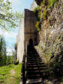
(6) Cross the footbridge at the foot of the keep to the end of the promontory and the viewpoint over the Val de Cléron. Retrace your steps a few paces and take the staircase, venturing deep into the heart of the ruins. You emerge at the foot of the walls.
(7) Go round the promontory to the right. At the tip, climb back up to the keep via the log staircase, following the base of the cliffs, and return to the foot of the keep.
(6) Take a look at the sign showing a reconstruction of the castle. Head down to the left towards the archway, known as the Porte aux Ânes, then continue to the right towards Ornans. 150 metres further down, at the fork, take the path on the left down to a stony track.
(8) Head up to the left until you reach the edge of the woods and look out for a path on the right, bordered by a wooden fence.
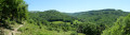
(9) Head down to the right along this nature trail, which winds through the pastures and offers beautiful views of the valley and its limestone cliffs. As you go, say hello to the donkeys, the hillside’s maintenance workers. There are a few sections with gates.
(10) Enter the woods via a final passage and begin the steep climb up this beautiful wooded hillside, carpeted with wild garlic, which leads you to the foot of the cliff at the bottom of this small valley. Follow the rocks to the right and, at the nearby fork, climb left, passing over the cliff. You’ll reach some pastures and a wooden gate in the fence, leading to a gravel track.
(11) Turn right to return to the original fork.
(1) Turn right to reach the church and the car park.
 Visorando Member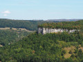
 Easy
Easy