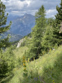
La Petite Autane and the Rouanne balconies

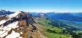
This ascent to the Petite Autane leads to a popular viewpoint offering multiple 360° panoramic views of the Champsaur and the Écrins. The descent along the ledges through the mountain pastures allows you to enjoy the pretty Rouanne valley.

Details

47417722
Creation:
Last update:
Last review:
  • Walking
    Activity: Walking
  • ↔
    Distance: 9.21 mi
  • ◔
    Average duration: 7h 05 
  • ▲
    Difficulty: Difficult

  • ⚐
    Back to start: Yes
  • ↗
    Ascent: + 3,251 ft
  • ↘
    Descent: - 3,248 ft

  • ▲
    Highest point: 8,248 ft
  • ▼
    Lowest point: 5,312 ft

Description of the walk

From the village of Ancelle, take the Rouanne track and drive to the very end of the valley (4 km). The small tarmac road becomes a wide track, with several fords along the way. The track isn’t in perfect condition but remains passable in a standard passenger car (minibuses manage to get up there).
Park at the Rouanne Haute car park (end of the road).

(S/E) From the car park, set off to the left along the Col de Combeau path, heading west. Follow the ‘Petite Autane’ signposts. After about a hundred metres, follow the track that climbs to the right, heading due north. Pass to the right of a renovated sheepfold, then cross a stream. Climb up a few hairpin bends until you pass under a cross; shortly afterwards, you’ll reach a fork in the road.

(1) Ignore the path branching off to the right (balcony) and continue the climb to the left. The path winds in wide hairpin bends up the hillside until it reaches another junction.

(2) Then continue to the right, climbing towards the Col de Combeau. Follow several hairpin bends and reach a junction.

(3) Carry on straight ahead along the path leading up to the Col de Combeau. Make several hairpin bends and reach the pass.

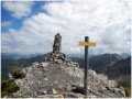
(4) Turn left towards the Petite Autane, heading south-west. Follow the ridge line (the eastern ridge of the Petite Autane). The path becomes steep but remains clearly marked with yellow markings and cairns. Take care: the ridge has a few steep sections that require caution. You will reach the Tête du Seigneur (cairn).

(5) Descend on the other side, staying on the ridge, to the Col du Seigneur.

(6) Continue westwards and follow the ridge up to the summit of the Petite Autane.

(7) Turn back and return via the same route to the Col de Combeau.

(4) Then turn right (north-east) towards the Balcon de Rouanne. Descend via numerous hairpin bends to a junction you passed on the way up.

(3) Turn left, heading due east, towards the Balcons de Rouanne. Pass beneath the Grande Autane and cross several streams. Head south, then east-north-east, to reach a junction before the Torrent du Jas Cerisier.

(8) Then take the path on the right, which winds downwards. You’ll reach the clearing by the alpine chalets.

(9) Continue to the right along the path running along the hillside. Cross a stream, then return to a junction you passed at the start of the walk.

(1) Continue straight on (west) and descend via a few hairpin bends to the Rouanne Haute car park (S/E).


Waypoints

  1. S/E : mi 0 - alt. 5,315 ft - Rouanne Haute car park
  2. 1 : mi 0.82 - alt. 6,027 ft - Southern junction of the circular loop
  3. 2 : mi 1.75 - alt. 6,634 ft - Junction
  4. 3 : mi 2.51 - alt. 7,116 ft - Northern junction of the circular loop
  5. 4 : mi 3.14 - alt. 7,543 ft - Col de Combeau (2303m)
  6. 5 : mi 3.35 - alt. 7,697 ft - Tête du Seigneur (2352m)
  7. 6 : mi 3.64 - alt. 7,595 ft - Col du Seigneur (2310m)
  8. 7 : mi 4.2 - alt. 8,248 ft - Petite Autane (2519m)
  9. 8 : mi 6.99 - alt. 6,719 ft - Crossroads
  10. 9 : mi 7.68 - alt. 6,302 ft - Peyron Roux sheepfold
  11. S/E : mi 9.21 - alt. 5,315 ft - Rouanne Haute car park

Notes

Grazing area where herds may be present, particularly near the Col du Seigneur (4), which may require you to go further to the right along the ridge.

There are some very steep sections on the ridge between the Col de Combeau (4) and the Tête du Seigneur (5).

Worth a visit

On a clear day, the view from the ridge (between (4) and (7)) offers a sweeping panorama of the Champsaur and the Écrins.

Reviews and comments

4.5 / 5
Based on 2 reviews

Reliability of the description
4.5 / 5
Ease of following the route
4.5 / 5
Route interest
4.5 / 5
diggi
diggi

My route starts and ends at the Rouanne Haute car park.
You’ve extended and altered the route – where to?

Machine-translated

User 10061776

Overall rating : 4 / 5

Date of your route : Jun 22, 2026
Reliability of the description : ★★★★☆ Good
Ease of following the route : ★★★★☆ Good
Route interest : ★★★★☆ Good
Very busy route : No

A lovely walk with a fairly steep climb up to Petite Autane
On the way back, I altered the route slightly by heading up to Rouanne Haute
An extra 2 or 3 km, but I have no regrets

Machine-translated

de Tellier Gilles
de Tellier Gilles

Overall rating : 5 / 5

Date of your route : Sep 09, 2024
Reliability of the description : ★★★★★ Very good
Ease of following the route : ★★★★★ Very good
Route interest : ★★★★★ Very good
Very busy route : No

Thank you for this walk.
The whole Roanne basin is beautiful and peaceful.
When you reach the Col de Combeau and head towards the Tête du Seigneur, you’ll soon be treated to a magnificent view of the entire Écrins massif.
Absolutely stunning
I’d recommend this walk, though you do need to be sure-footed... 😉
I think it must be possible to head straight back down from the summit of La Petite Autane, which would make this a circular route.
Happy hiking to you all.
Gilles de T

Machine-translated

Other walks in the area

For more walks, use our search engine .

The GPS track and description are the property of this route's author. Please do not copy them without permission.