The Spanish Nivelle and its surroundings

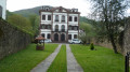
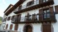
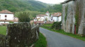
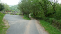
A short walk starting from the Spanish village of Urdax. An old monastery, beautiful houses, the path to the caves and the forest. After the walk, you can stroll through the village to see the mill (ask at the tourist office), and also see the water channels bringing water from the surrounding mountains.

Details

1004028
Creation:
Last update:
Last review:
  • Walking
    Activity: Walking
  • ↔
    Distance: 4.17 mi
  • ◔
    Average duration: 2h 40 
  • ▲
    Difficulty: Moderate

  • ⚐
    Back to start: Yes
  • ↗
    Ascent: + 846 ft
  • ↘
    Descent: - 853 ft

  • ▲
    Highest point: 971 ft
  • ▼
    Lowest point: 279 ft

Photos

Description of the walk

To get to the start from Espelette, head towards Dancharia and drive through the village. From the Spanish border post, follow the N-121-B towards Pamplona for 1.5 km, then turn right towards Urdax. Drive through the village and, just after the small humpback bridge before the monastery, take the road on the right and follow it to the end.
Car park next to the Trinquet.

(S/E) Head back towards the village centre and take the road on the right towards the tourist information office. Use the bridge to cross the small stream Orabidéko Erreko (La Nivelle in France).

(1) At the Fork in the road, take the left-hand road which runs alongside the small stream (Coiffure, Hostal Rural and Casa Landa Etxea). Continue along this road until you reach the junction with the NA-4402. At this junction, turn left to cross the small stream again, heading towards the village of Urdax.

(2) At the next junction, turn right towards the Urdax Caves (Cuevas). Continue along this road for approximately 1.7 km, ignoring any junctions you come across. On your way, you’ll pass the hamlet of Leorlat on your right. A little further on, you’ll see the caves’ car park on your right, followed by a large building called ‘Apartamentos Ikaburua’, also on your right. After this large building, ignore the two paths on the left.

(3) Take the third dirt track on the left, marked by a blue painting of a small horse on a very large stone at the entrance. At the end of this track, you’ll rejoin the tarmac road; turn left and continue for about 250 metres.

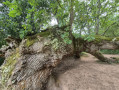
(4) At the junction with a main road (NA-4401 Dantxaria – Zugarramurdi), take the path on the left. Continue straight on; this path leads to an old quarry. After about 350 metres, at the foot of the building on the right, take the path on the left. Continue along this path until you come to a magnificent oak tree, which has unfortunately lost a large branch.

(5) Turn right onto the SL-NA 17 “Axularren” path. Continue straight uphill until you reach a small tarmac road; turn right onto this road and follow it for about 100 metres.

(6) Take the path on the left, leaving the path that climbs to your right, and continue straight on through the forest towards an old dwelling. Carry on straight ahead along this track, which is crossed from time to time by streams. The track descends almost the whole way and narrows until you reach the small torrent (with a bridge) that you have been following on the right-hand bank. As you emerge from the forest, cross a culvert and you will find yourself on a small tarmac road; carry on straight ahead for about 300 metres.

(7) Turn right, pass the Motxo Bar-Restaurant and, immediately afterwards, turn left between the car park and the houses. Carry on straight ahead, then turn right after the humpback bridge, cross the square and continue to the end of the street (S/E).

Waypoints

  1. S/E : mi 0 - alt. 325 ft - Trinquet car park
  2. 1 : mi 0.19 - alt. 315 ft - Fork in the road - Nivelle (fleuve)
  3. 2 : mi 0.93 - alt. 302 ft - Road NA-4402 – Junction
  4. 3 : mi 1.67 - alt. 377 ft - Start of the trail
  5. 4 : mi 2.06 - alt. 528 ft - Road NA-4401 – Junction
  6. 5 : mi 2.52 - alt. 620 ft - SL-NA 17 trail
  7. 6 : mi 2.96 - alt. 965 ft - Crossroads
  8. 7 : mi 3.91 - alt. 338 ft - Turn right.
  9. S/E : mi 4.17 - alt. 325 ft - Trinquet car park

Notes

As with any hike, long or short, you’ll need:
- Walking shoes or very good trainers.
- Cereal bars, fruit and water
- Hat or cap, rainwear.

Between (1) and (2), there are several water points: there will probably be a sign indicating that the water is safe to drink.

Worth a visit

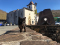
Between (S) and (1) About 150 metres after the start, on your right, you’ll find a monastery, a chapel, a cloister and a small museum explaining why the Chemin des Forges – which, incidentally, begins after the bridge behind the monastery – is so named.

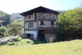
Between (1) and (2) On your left is an old farm with a shed where several old farming tools are stored.

Between (2) and (3) A small road leading to the caves and a large house available for furnished holiday lets.

Between (3) and (4) A track leading to an old quarry and then on to the remarkable oak tree at waypoint 4.

Between (4) and (5) This is the steepest section of this short walk; as it’s very sunny, it’s essential to carry a supply of water.

Between (5) and (6) This is the most pleasant section in fine weather; you’ll appreciate the coolness of the forest and the little stream below.

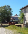
Between (6) and (E) After the “Bar Restaurant Motxo”, do take a moment to admire the façades of some of the houses. You can, without getting lost, wander down the narrow streets to see the water channels carrying water down from the surrounding hills.

Reviews and comments

5 / 5
Based on 2 reviews

Reliability of the description
5 / 5
Ease of following the route
5 / 5
Route interest
5 / 5
Castel le coze
Castel le coze

Overall rating : 5 / 5

Date of your route : Sep 24, 2024
Reliability of the description : ★★★★★ Very good
Ease of following the route : ★★★★★ Very good
Route interest : ★★★★★ Very good
Very busy route : No

Machine-translated

Hervé Bignon
Hervé Bignon

Overall rating : 5 / 5

Date of your route : Oct 18, 2023
Reliability of the description : ★★★★★ Very good
Ease of following the route : ★★★★★ Very good
Route interest : ★★★★★ Very good
Very busy route : No

The start is a bit of a road walk but not without its charm, following a path along the Way of St James with some remarkable houses and an exhibition of all sorts of items, including fountains for pilgrims.

The second section through the forest, where you come across the thousand-year-old oak, is spectacular, and the oak, although missing one of its main branches, remains impressive.

This is followed by a lovely climb, without any real difficulty, followed by a very beautiful descent through the forest back to the village.

Thank you for suggesting this route, which offers a different way of passing by this oak.

Machine-translated

Other walks in the area

For more walks, use our search engine .

The GPS track and description are the property of this route's author. Please do not copy them without permission.