Country:
 City:
City:


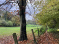
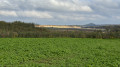
Moulin du Broukay car park, Chemin du Broukay, in Eben-Emael.
(S/E) From the car park, walk past the restaurant and continue along the concrete path at the foot of the hillside, running parallel to the stream, Le Geer. At the end, the path turns left and crosses the stream.
(1) After crossing the stream, take the first path on the left between the meadows. Carry on straight ahead at the first junction and keep left at the Fork in the road to join the Grand’Route.
(2) Cross the road , taking care of the traffic, and head straight along the dirt track. After 75 metres, turn right onto the farm track that begins to climb. Follow it uphill until you reach the small tarmac road called Rue Cherra. Follow this road downhill for about a hundred metres, then take the dirt track on the left after the bend.
(3) Once you reach the plateau, at the first junction, take the farm track on the right (downhill) and join the tarmac road (Rue de Hallembaye), turning left onto it. This road leads to the railway bridge. Shortly after the bridge, at the junction, head straight up the small tarmac road which leads out into the fields on the plateau.
(4) At the first junction (where the tarmac ends), turn right onto the dirt track running alongside a row of tall trees. This track descends into the valley and opens out onto a street near a railway bridge, Rue de la Voie de Liège: see § Practical Information.
(5) Without crossing the railway line, cross to the opposite side to take a small path just above the street: this branches off immediately to the left to follow the railway line, about ten metres below.
(6) Continue straight on to the next railway bridge: do not go under it. The path emerges at a bend in a tarmac road. Follow this road straight down the hill, ignoring the footpath that branches off diagonally to the left. At the bottom, turn right into Rue du Bâton Blanc, then take the pedestrian underpass beneath the railway line. This leads to Rue Neuve, which you follow for about fifty metres to the next junction.
(7) Turn right onto Rue de la Résistance (N619), then, 150 metres further on (at the bus stop), turn left onto the path through a hornbeam arbour. This leads to Rue Baudouin Premier, which you cross straight ahead (small white building) before soon crossing Le Geer and continuing along its extension to Chemin du Tram, heading towards the church.
(8) At the junction, turn right onto Rue de la Paille, which runs alongside the church, then, 150 metres further on, turn left onto Rue Chéra. This street climbs up the opposite side of the Geer valley through a fairly steep side valley. Continue straight on at the junction, still climbing.
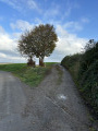
(9) At the fork in the road, keep to the right to stay on the tarmac road. At the top, the tarmac gives way to a dirt track. This farm track, running through the fields, joins another track which you take to the left to reach a slightly larger crossroads (a solitary tree in front of a silo).
(10) Carry on straight ahead, then keep well to the right at the Fork in the road 50 metres further on: the track is barely visible at first if the field has just been ploughed! Continue to the two isolated houses in the hamlet of À la Croix Colas, pass them and you’ll soon reach a tarmac road (Rue de Zichen).
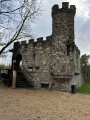
(11) Follow it to the left for about fifty metres, then turn right onto the farm track leading off at an angle (clump of trees and a bench) and follow it to the end for 2 km. This track runs along the edge of the plateau (fields to the left, the Geer valley slope to the right) and passes in front of the Tour d’Eben-Ezer.
(12) At the end of the track, follow the small road to the right to soon reach the car park where you started (S/E).

 Visorando Member

 Easy
Easy