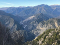
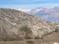
The Madone d’Utelle as seen from the Gorges de la Mescla

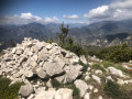
A beautiful walk with varied scenery, offering a 360° view from the sanctuary. Walking through the ruins, hidden reminders of times gone by, allows us to forget the hustle and bustle of everyday life for a few moments.

Details

43541646
Creation:
Last update:
Last review:
  • Walking
    Activity: Walking
  • ↔
    Distance: 9.56 mi
  • ◔
    Average duration: 7h 50 
  • ▲
    Difficulty: Difficult

  • ⚐
    Back to start: Yes
  • ↗
    Ascent: + 3,957 ft
  • ↘
    Descent: - 3,947 ft

  • ▲
    Highest point: 3,904 ft
  • ▼
    Lowest point: 574 ft
  • ⚐ Country: France
  • ⚐
    Area: Alps
  • ⚐ City: Utelle (06450)
  • ⚑
    Start/End: N 43.904767° / E 7.196314°
  • ❏
    IGN map(s): Ref. 3641ET, 3641OT, 3642ET, 3741ET, 3741OT
  • Hour-by-hour weather

Photos

Description of the walk

Park near marker 106, which will be our starting point. Please note that the M6202 is a busy road.

Yellow signposting in place

(S/E) From marker 106, take the path leading uphill towards Le Reveston, our first destination. The wide, winding path overlooking the Var River as it flows through the Gorges de la Mescla with its vertical cliffs. Just past some ruins, you’ll reach a fork in the path.

(1) Marker 107 is visible. Continue straight on towards Le Reveston.

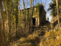
(2) Marker 108 marks the entrance to the hamlet of Le Reveston. The open doors of the ruins offer a glimpse of old furnishings and evidence of a bygone way of life. Follow the path.

(3) At marker 109, the path is barely visible. Head towards the metal cistern; the path runs just to the left of it.

(4) Cross the footbridge and continue along the path.

(5) Top of the path. At this point, keep well to the right; the yellow markings have faded. Head towards marker 119.

(6) At this junction, turn right towards Madone d’Utelle, the next stop. The stone track climbs steeply.

(7) Continue a few metres past marker 114 until you reach the tarmac road leading to La Madone d’Utelle
Please note that the M132 road, which we will be crossing twice, is dangerous. Turn right and follow the road for 100 metres.

(8) At marker 115, take the uphill path which will cross the M132 three times.

(9) Cross with care; the path continues straight ahead

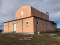
(10) At the end of this path, follow the road for about fifty metres and walk along the right-hand side of La Madone d’Utelle. It’s time for a break.

(11) From the sanctuary of La Madone d’Utelle, walk along the side of the road, heading south-west to the orientation table, passing marker 117 on the way.

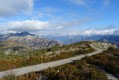
(12) From here, you’re treated to a 360° panoramic view. Then head for the Col d’Ambellarte.
This is the only section without yellow markings. The path lies below the orientation table. There are three route options: we chose to turn right next to the table and descend by sight to the marked path.

(13) Follow it to the right to reach the Col d’Ambellarte.

(14) Look out for marker 118 on the right, signposted for the Col de la Moutète. You’ll reach a grassy area as you emerge from the forest.

(15) At this crossroads of tracks, turn right towards the Col de la Moutète / Le Reveston. Be careful: the path runs alongside a sort of low terraced field and disappears into a pasture.

(16) There is a large cairn; the path veers to the left and enters the wooded valley.

(17) At this junction of paths, there is a cairn. Turn right until you reach the next fork.

(18) Turn right and follow the wooded path downwards beneath the power line.

(19) There is a solitary wash house in the middle of the woods, fed by a spring. Passing through the ruins and seeing signs of past human habitation gives pause for thought about the living conditions of the people who once lived in the Nice hinterland.

(1) Marker 107: turn left towards Route Nationale 6202 and, following the route in reverse to the one taken on the way there, head back to marker 106 and the car park (S/E).

Waypoints

  1. S/E : mi 0 - alt. 581 ft - Car park near marker 106
  2. 1 : mi 0.69 - alt. 1,460 ft - Trail junction, marker 107
  3. 2 : mi 1.09 - alt. 1,762 ft - Entrance to the hamlet. Marker 108
  4. 3 : mi 1.23 - alt. 1,877 ft - Trail junction, marker 109
  5. 4 : mi 1.7 - alt. 2,156 ft - Footbridge
  6. 5 : mi 2.66 - alt. 3,009 ft - Summit of the trail
  7. 6 : mi 2.76 - alt. 3,054 ft - Crossroads: footpath – track
  8. 7 : mi 3.72 - alt. 3,425 ft - Crossroads: footpath – track
  9. 8 : mi 3.85 - alt. 3,481 ft - Trail – Marker 115
  10. 9 : mi 4.12 - alt. 3,688 ft - Crossing the road
  11. 10 : mi 4.29 - alt. 3,819 ft - End of the trail
  12. 11 : mi 4.36 - alt. 3,852 ft - Madone d’Utelle
  13. 12 : mi 4.75 - alt. 3,904 ft - Orientation table
  14. 13 : mi 4.86 - alt. 3,629 ft - Trail
  15. 14 : mi 5.29 - alt. 3,176 ft - Col d’Abellarte – marker 118
  16. 15 : mi 5.59 - alt. 3,412 ft - Trail junction, marker 105
  17. 16 : mi 6.09 - alt. 3,448 ft - Large cairn
  18. 17 : mi 6.97 - alt. 2,851 ft - Trail junction
  19. 18 : mi 7.19 - alt. 2,740 ft - Trail junction at the Col de la Moutète
  20. 19 : mi 8.28 - alt. 1,745 ft - Spring
  21. S/E : mi 9.56 - alt. 581 ft - Car park near marker 106

Notes

This walk can be done all year round.
A GPS or the Visorando app is useful for points (12) and (15).
The mobile app will be a very welcome bonus.
Hiking boots and walking poles recommended. Stony terrain.
There is a spring at point (19).

Worth a visit

The shrine of La Madone d’Utelle.

Reviews and comments

4.8 / 5
Based on 2 reviews

Reliability of the description
5 / 5
Ease of following the route
5 / 5
Route interest
4.5 / 5
mexidoc
mexidoc

Overall rating : 5 / 5

Date of your route : Jun 27, 2024
Reliability of the description : ★★★★★ Very good
Ease of following the route : ★★★★★ Very good
Route interest : ★★★★★ Very good
Very busy route : No

This little circular loop is a real gem!
Absolutely stunning. The route alternates between rocky outcrops and woodland, offering plenty of variety.

The signposting is brand new, so it’s really easy to follow.

The mountain dogs were lovely (do let them have a good sniff of you before carrying on).
It’s the rainy season… Yum yum, mushrooms!

In short, I really recommend it! (Make sure you wear good shoes – the terrain is uneven and the path is quite rocky in places).

Machine-translated

bernard bb
bernard bb

Very well put, Oenolatre
hiking friends, b

Machine-translated

oenolatre
oenolatre

Overall rating : 4.7 / 5

Date of your route : Apr 01, 2024
Reliability of the description : ★★★★★ Very good
Ease of following the route : ★★★★★ Very good
Route interest : ★★★★☆ Good
Very busy route : No

This is a really lovely hike, with a challenging nature due to its elevation gain and distance. You’ll cross numerous small valleys with beautiful scenery and plenty of rivers and springs (during this rainy season). Do be careful, though, of the sheepdogs guarding flocks of sheep near the Madone D’Utelle. As mentioned in the walk description, don’t forget to stop by the orientation table, which offers a 360° view of the department.

Machine-translated

Other walks in the area

For more walks, use our search engine .

The GPS track and description are the property of this route's author. Please do not copy them without permission.