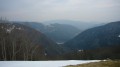
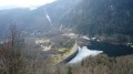
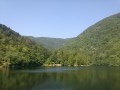
La Jumenterie as seen from Lac d’Alfeld

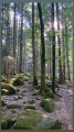
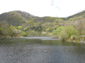
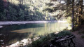
A lovely walk with views over the lakes, the summit of the Ballon d’Alsace and the Sewen valley.
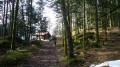
Our group opted to hike without snowshoes; snow cover was patchy, with more in the wooded areas.

Details

106749
Creation:
Last update:
Last review:
  • Walking
    Activity: Walking
  • ↔
    Distance: 11.08 mi
  • ◔
    Average duration: 7h 40 
  • ▲
    Difficulty: Difficult

  • ⚐
    Back to start: Yes
  • ↗
    Ascent: + 2,963 ft
  • ↘
    Descent: - 2,946 ft

  • ▲
    Highest point: 3,858 ft
  • ▼
    Lowest point: 2,008 ft

Photos

Description of the walk

Starting point: Lake Alfeld.

(S/E) The route begins by crossing the footbridge leading to one end of the lake. From there, follow the path marked ‘Red Saltire’ past the waterfall and the Schahling Hutte shelter in turn.

(1) Continue until you reach a fork in the path.

(2) Turn right and follow the new signposting.

(3) At the fork with new signposting, turn left.

(4) Then, shortly afterwards, turn right following the new signposting. A short while later, at a junction, turn left following the same signposting. The path takes you first to the Tête du Moinechamp and then to the Morteville hut.

(5) From there, turn right onto the signposted path, then left at the Fork in the road about 200 metres further on.

(6) At the junction with a signposted forest track, turn left and follow this track, which takes a sharp right-hand bend and leads to a Fork in the road.

(7) From there, turn left to reach a spot from which you can see the road linking Le Ballon to Saint-Maurice-sur-Moselle. Turning left, you’ll soon arrive at La Jumenterie.

(8) Follow the D465 for about 1 km, then take the path running alongside the road on the left-hand side and cross the Savoureuse.

(9) You’ll arrive at the Auberge du Ballon d’Alsace. Continue along the road.
Head straight ahead, passing the Les Sapins holiday centre (tarmac road). Over the next few hundred metres, use the departmental road as a guide; it remains visible on your right. Follow the tarmac road along a path that leads to the restaurant La Chaumière, situated on the right. The path continues following the signposting mentioned earlier; you’ll pass the Foyer Communautaire on your left.

(10) A little further on, the signposting changes. A few hectometres further on, the path eventually reaches the road.

(11) Let the signposted path continue straight ahead, then turn left onto an unmarked track.

(12) At the next fork, follow the signposted path to the right. Continuing straight on, you’ll come to the D466 road, which you cross to take a signposted path on the opposite side.

(13) After a few bends, this path leads to the road at a bridge over which the Alfeld Stream flows.

(14) Turn right to finish the walk along a short stretch of road and arrive back at the starting point (S/E).

Waypoints

  1. S/E : mi 0 - alt. 2,047 ft - Lac d'Alfeld
  2. 1 : mi 0.41 - alt. 2,234 ft - Cascade du Lac d'Alfeld
  3. 2 : mi 0.92 - alt. 2,874 ft - Markings: Red Rectangle, White Rectangle, Red Rectangle
  4. 3 : mi 1.67 - alt. 3,432 ft - Red Rectangle markings
  5. 4 : mi 1.79 - alt. 3,504 ft - Markings: Yellow Rectangle (White)
  6. 5 : mi 3.51 - alt. 2,756 ft - Green Triangle markings
  7. 6 : mi 4.27 - alt. 2,795 ft - Markings: Yellow Rectangle (White)
  8. 7 : mi 4.91 - alt. 3,035 ft - Markings: Yellow Disc
  9. 8 : mi 5.49 - alt. 3,510 ft - Road to the Col du Ballon
  10. 9 : mi 6.7 - alt. 3,845 ft - Red Rectangle markings. Auberge du > - Ballon d'Alsace
  11. 10 : mi 8.36 - alt. 3,491 ft - Red Saltire signposting
  12. 11 : mi 9.18 - alt. 3,228 ft - Unmarked path
  13. 12 : mi 9.57 - alt. 3,199 ft - Markings: Red Rectangle (White)
  14. 13 : mi 9.87 - alt. 2,861 ft - Red Triangle marked trail
  15. 14 : mi 10.49 - alt. 2,267 ft - Road to Lac d’Alfed
  16. S/E : mi 11.08 - alt. 2,041 ft - Lake Alfeld

Notes

We enjoyed our picnic at the Morteville hut.

Two shelters along the route: the Schahling Hutte and the Morteville hut. Light refreshments and drinks available at the Col du Ballon.
We had to decide whether to carry the snowshoes on our rucksacks or leave them behind. Given the conditions at the time, with soft snow, we gave our feet a rest by taking a section along the road (see La Jumenterie).
IGN map no. 3520 ET.

Worth a visit

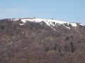
At the start of the walk, take a detour of a few metres to see the waterfall that flows into Lake Alfeld. At various points along the walk, there are views of the summit of the Ballon (the ledge, the statue of the Virgin Mary). At the Auberge du Ballon, you can see the summit of the Planche des Belles Filles (south-west) and enjoy a bird’s-eye view of the Sewen valley with its two lakes, Lake Alfeld and Lake Sewen.

Reviews and comments

4.6 / 5
Based on 3 reviews

Reliability of the description
4.7 / 5
Ease of following the route
4.7 / 5
Route interest
4.3 / 5
Tof 25
Tof 25

Overall rating : 4.7 / 5

Date of your route : Apr 23, 2022
Reliability of the description : ★★★★★ Very good
Ease of following the route : ★★★★★ Very good
Route interest : ★★★★☆ Good
Very busy route : No

A lovely route between the start and the stud farm (landmark 8), with some fairly steep climbs. From landmark 8 to landmark 12, there are too many roads or the route runs too close to the road – a shame. The final stretch is also lovely, following a narrow path up the mountainside (landmarks 13 to 15). Rather than finishing on the road alongside Lake Alfeld, I went round the lake to the left – a nicer way to finish. Note that the junction at landmark 13 is at least 300 metres further on than the GPS position of the landmark indicated on the route.

Machine-translated

Alsacienne
Alsacienne

Overall rating : 5 / 5

Date of your route : Sep 12, 2021
Reliability of the description : ★★★★★ Very good
Ease of following the route : ★★★★★ Very good
Route interest : ★★★★★ Very good
Very busy route : No

A lovely walk – just to let you know, the section of the trail (points 5 to 7) from the Morteville hut towards the Ballon d’Alsace is closed.

Machine-translated

Simon Dominique
Simon Dominique

Overall rating : 4 / 5

Date of your route : Jul 23, 2021
Reliability of the description : ★★★★☆ Good
Ease of following the route : ★★★★☆ Good
Route interest : ★★★★☆ Good
Very busy route : No

Setting off from La Jumenterie, meeting point with friends from Alsace
Some superb stretches through the forest before and after Lake Alfeld.
It’s a shame there’s such a long forest track between points 4 and 5 with minimal signposting.
The weather forecast was spot on.

Machine-translated

Other walks in the area

For more walks, use our search engine .

The GPS track and description are the property of this route's author. Please do not copy them without permission.