From the Roche de l’Enfer to Tête Ronde via Lac d’Alfeld

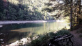
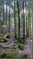
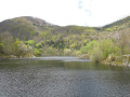
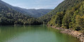
A lovely walk with the option of stopping off at a small mountain hut (closed, with a wood-burning stove; wood isn’t always available; bring your own) – ideal for winter. Much of the walk takes place through woodland. Beautiful views of the lake.

Details

13837804
Creation:
Last update:
Last review:
  • Walking
    Activity: Walking
  • ↔
    Distance: 10.24 mi
  • ◔
    Average duration: 7h 40 
  • ▲
    Difficulty: Difficult

  • ⚐
    Back to start: Yes
  • ↗
    Ascent: + 3,389 ft
  • ↘
    Descent: - 3,366 ft

  • ▲
    Highest point: 3,668 ft
  • ▼
    Lowest point: 1,739 ft

Description of the walk

Start from the Lac d’Alfeld car park via the D466.

(S/E) Cross the embankment and take the path on the right, marked with a Blue Rectangle. After about a hundred metres, turn right, cross a track and continue to a junction. Turn left onto the path marked with a Blue Triangle and head for the Bearenbach farm.

(1) Walk past the farm and, at the next fork, continue to the left. At the track, follow the Blue Rectangle markings forthe GR®531and continue to the right as far as Issenbach Farm.

(2) Walk past the farm and follow the path, marked with Blue Rectangles, towards Gresson Haut.

(3) At the star-shaped junction at Gresson Haut, take the left-hand path, marked with a Blue Cross, towards La Roche de l’Enfer. Further on, leave the prohibited path on your right (see Practical Information). Continue to the junction with theGR®5, then take it to the right as far as La Roche de l’Enfer.

(4) Retrace your steps and continue along the ridge on your right-hand side until you reach the next junction.

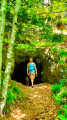
(5) Take the path on the right and head down the other side. Follow the path, marked with a Yellow Rectangle with a White Rectangle, and you’ll soon reach a small clearing with a very welcoming shelter.
Generally quiet, a very good place to take shelter. Facilities include: a table, benches and a wood-burning stove. The shelter is secured with a door and windows; thanks to the Club Vosgien. There’s plenty of space outside for a picnic.

(6) After a well-deserved break, continue along the path, rejoin the ridge, then a little further on turn left and reach a fork. Turn left, then take the path marked with a Red Rectangle on the right. You’ll reach Ronde Tête.

(7) Ignore the path branching off to the right and carry on for a further 200 m or so until you reach a junction where four paths meet.

(8) Continue to the right along the very pretty path, marked with a Blue Ring. Stay on this path until you reach La Chaumière.

(9) At the junction, turn left onto the path marked ‘Red Disc’ towards Le Boedelen.

(10) At the fork, follow the path opposite, marked ‘Red Saltire’, and rejoin the junction you have already passed.

(11) Turn right onto the path marked ‘Red Saltire’ and stay on it until you reach the Schaling refuge. Built entirely of logs, it’s a lovely spot with a superb view of Lake Alfeld. Inside, there are tables, benches and a wood-burning stove. Ideal for a final coffee break on the terrace.

(11) Continue the descent and you’ll soon reach a viewpoint.

(12) Carry on along the Red Saltire trail. Take the opportunity to visit the waterfall on the right, then continue the descent to Lake Alfeld. Cross the dam and head back to the car park (S/E).

Waypoints

  1. S/E : mi 0 - alt. 2,024 ft - Lac d'Alfeld
  2. 1 : mi 1.7 - alt. 2,431 ft - Ferme-auberge du Baerenbach
  3. 2 : mi 2.3 - alt. 2,762 ft - Refuge d'Issenbach
  4. 3 : mi 2.77 - alt. 3,179 ft - Crossroads
  5. 4 : mi 3.71 - alt. 3,596 ft - Roche de l'Enfer
  6. 5 : mi 4.42 - alt. 3,501 ft - Junction
  7. 6 : mi 4.63 - alt. 3,556 ft - Mountain hut/shelter
  8. 7 : mi 5.86 - alt. 3,579 ft - Col de Ronde Tête
  9. 8 : mi 6 - alt. 3,412 ft - Crossroads
  10. 9 : mi 7.27 - alt. 3,579 ft - La Chaumière
  11. 10 : mi 7.82 - alt. 2,756 ft - Boedelen
  12. 11 : mi 9.48 - alt. 2,559 ft - Abri Schaling
  13. 12 : mi 9.62 - alt. 2,526 ft - Viewpoint
  14. S/E : mi 10.24 - alt. 2,028 ft - Lac d'Alfeld

Notes

(3) Since November 2022, the closed path has been incorporated into the Haute Bers Massif Biological Reserve. It is no longer maintained and the signposts have been removed (Blue Triangle on the IGN map).

(6) You may wish to turn back, particularly in winter as the path can be a little difficult to find when there is snow. Return to the previous junction (5) and turn right to reach Tête Ronde at (7).

Always be cautious and plan ahead when you're outdoors. Visorando and the author of this route cannot be held responsible for any accidents occurring on this route.

The GR® and PR® markings are the intellectual property of the Fédération Française de Randonnée Pédestre.

Reviews and comments

4 / 5
Based on 3 reviews

Reliability of the description
3.7 / 5
Ease of following the route
3.7 / 5
Route interest
4.7 / 5
Louuu
Louuu

Overall rating : 4.3 / 5

Date of your route : Jun 09, 2025
Reliability of the description : ★★★★☆ Good
Ease of following the route : ★★★★☆ Good
Route interest : ★★★★★ Very good
Very busy route : No

Superb hike! Lots of forest trails but with stunning views and cute shelters along the way.
It takes 7 hours, so don't set off too late.
The route is fairly accurate but not always, for example:
- the change of signpost at the very beginning: the transition from the blue rectangle to the blue triangle is 1 km from the start of the hike, not a hundred metres
- Be careful at points 7 and 8, follow the signs carefully and you'll be fine (there are a few subtleties).

The bonus of the hike is a visit to the Alfeld waterfall, which is mesmerising.

Machine-translated

jeansimon
jeansimon

Overall rating : 4.3 / 5

Date of your route : Jul 01, 2024
Reliability of the description : ★★★★☆ Good
Ease of following the route : ★★★★☆ Good
Route interest : ★★★★★ Very good
Very busy route : No

A lovely walk, just like the whole area above Sewen

Machine-translated

Ruscht
Ruscht

Take the Blue Cross route to Roche d’Enfer instead

Machine-translated

Hirter
Hirter

Overall rating : 3.3 / 5

Date of your route : Apr 15, 2022
Reliability of the description : ★★★☆☆ Average
Ease of following the route : ★★★☆☆ Average
Route interest : ★★★★☆ Good
Very busy route : Yes

Please note: the area marked with a Blue Triangle between points three and four is off-limits to walkers due to the risk of falling trees! Danger

Machine-translated

Other walks in the area

For more walks, use our search engine .

The GPS track and description are the property of this route's author. Please do not copy them without permission.