Country:

 City:
City:


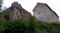
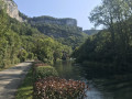
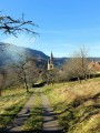
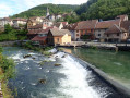
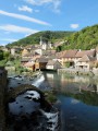
Car park at Lods, on the other side of the bridge, heading towards Longeville, along the river, at a place called Les Forges. As you get out of the car, you’ll see the Moulin Banal, the church – undoubtedly one of the most photographed spots in Franche-Comté – and the fortified house. Yellow and blue, and yellow and red signposting.
(S/E) Cross the bridge. Turn left and, at the small fountain, head up to the right along Rue de Reine. Stop briefly at No. 6 to see the remains of the lintel depicting Adam and Eve. A little further up, before the wooden wayside cross, turn left down towards the washhouse and its lovely view of the river and the Moine de la Vallée. Head back up the more or less well-maintained path on the other side of the fountain to reach a narrow lane and Rue sur la Place, which you follow down to the right for a few steps. Turn left up Rue de l’Église. Visit Saint-Théodule Church to see its clock mechanism (on the left as you enter).
(1) Turn immediately right after the church and the vicar’s garden, where you’ll soon come to a grassy path that runs above the fortified house. Stay on this lovely hillside path with fine views of the opposite slope (particularly the Rocher du Moine) and, soon, on your right, the imposing silhouette of the Roche du Soleil, which overlooks Mouthier-Haute-Pierre and the start of the Gorges de Nouailles. At the D244E, head down to the right until just past a short stretch through the woods, looking out for a signpost about thirty metres before a ‘crossroads’ sign.
(2) Take the path to the right of the circular Boucle de Sainte-Foy, passing at the foot of some beautiful rock formations. At the end of the circular route, there’s a wooden bench where you can stop for a snack whilst enjoying the view of the Haute Loue cliffs. Return to the road and head down to the right towards the village. Pass Rue des Corvées on your right and continue down Rue Robert Dame to the junction with Chemin des Carrés and its wayside cross.
(3) Continue down Rue Robert Dame, passing a wash house and some beautiful old houses full of character, until you reach the crossroads.
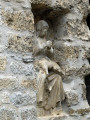
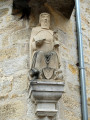
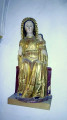
(4) Turn left onto Rue Pavée and look up at the façade of No. 2 (on the left) to see a beautiful carved head. Visit Saint-Laurent Church to see a Virgin and Child and a 15th-century polychrome wooden statue of Saint Vernier, patron saint of winegrowers.
Leaving the church, head down to the left for about twenty metres, then turn right onto Rue de l’Église. Continue left onto Grande Rue until you reach the corner, where you can say a quick hello to Saint Anthony, accompanied by his pet, a pig!
As you walk back up Grande Rue, a few metres past the statue of Saint Anthony, take a discreet peek through the gate into a private courtyard on the right to see a statue of the Virgin Mary, a Pietà, depicting Mary holding her son’s body on her lap.
(5) Walk back up Grande Rue, then along Rue Robert Dame to the Calvary you passed on the way there.
(3) Turn right onto the cul-de-sac known as the Chemin des Carrés, which ends at a junction with two forest tracks. Turn left (signpost for Roche de Hautepierre). When this lovely uphill track, flanked by old stone walls, meets a tarmac road, carry on straight ahead along the path that runs alongside the orchard.
(6) Cross the D244 and continue along the wide, stony path opposite.
(7) At the crossroads, head far to the left towards the fence and its chicane (alternative route available in the Practical Information section).
You’ll reach the open plateau of Sucrue with its beautiful views down the valley; look out for two slender marker posts on your right.
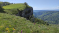
(8) At the second marker post, carry on straight ahead (without going downhill) towards the pumping station for 300 m until you reach a gap in the edge of the woodland on your left; don’t miss the 180° viewpoint over the Roche de Hautepierre, the start of the Gorges de Nouailles and the Moine de la Vallée. Return to the marker post.
(8) This time, head down the hillside to the left. A little further down, you’ll reach a departmental road which you follow to the right. After a hairpin bend, you’ll join the D32 at a stop sign. Turn sharply left onto the little path with the charming name of ‘Bout d’en Haut’.
(9) At No. 14, go down the small gate on the left and take the steps which lead you through flower-filled gardens and offer lovely views of the Moine de la Vallée and the church you passed on the way there.
(1) Walk past the church and, at the crossroads, turn left down Rue du Commandant Vuillemin, passing by the foot of the fortified house. Opposite, on the right, look out for the small flight of steps leading back to the bridge and the car park. (S/E)


 Visorando Member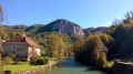
 Easy
Easy 
 Difficult