Valentin Forest in Selonnet

Family walk in Chabanon along forest paths.
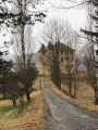
The trail is marked in yellow and signposted as ‘La Forêt de Valentin’.

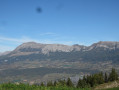
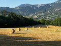
With views of the mountain ranges and grazing meadows, this walk is suitable for everyone.

Details

55533571
Creation:
Last update:
Last review:
  • Walking
    Activity: Walking
  • ↔
    Distance: 3.63 mi
  • ◔
    Average duration: 2h 05 
  • ▲
    Difficulty: Easy

  • ⚐
    Back to start: Yes
  • ↗
    Ascent: + 509 ft
  • ↘
    Descent: - 509 ft

  • ▲
    Highest point: 5,289 ft
  • ▼
    Lowest point: 4,918 ft

Description of the walk

Park in the car park at the Chabanon resort, opposite the ticket offices.

(S/E) Head towards the Hôtel Le Blanchon.

(1) Turn left onto the path below, in the forest, signposted for the Valentin Forest walk, and you’ll come to a Fork in the road.

(2) Turn left towards Saint-Martin-lès-Seyne and follow the forest track to its end at La Casse.

(3) Turn left towards Chabanon through the Valentin Forest. Continue straight on to return to the starting point (S/E).

Waypoints

  1. S/E : mi 0 - alt. 5,246 ft - Car park at the Chabanon resort ticket office
  2. 1 : mi 0.13 - alt. 5,226 ft - Le Blanchon Hotel
  3. 2 : mi 0.2 - alt. 5,135 ft - Fork in the road
  4. 3 : mi 1.92 - alt. 5,131 ft - La Casse
  5. S/E : mi 3.63 - alt. 5,246 ft - Car park at the Chabanon resort ticket office

Notes

At the Chabanon resort, you’ll find toilets, picnic tables, rubbish bins and facilities (restaurants, tourist office, accommodation, etc.).

Worth a visit

Chabanon Swimming Pool.
Chabanon mini-golf course.
Chabanon resort.

Reviews and comments

4.7 / 5
Based on 3 reviews

Reliability of the description
5 / 5
Ease of following the route
5 / 5
Route interest
4 / 5
User 22568687

Overall rating : 4.7 / 5

Date of your route : Jul 25, 2026
Reliability of the description : ★★★★★ Very good
Ease of following the route : ★★★★★ Very good
Route interest : ★★★★☆ Good
Very busy route : Yes

Two walkers aged 77 and 74 … A walk I’d recommend for a gentle return to walking. It’s best to follow the route in the direction shown on the Visorando map (downhill then uphill). Forest track all the way. A pleasant spot for a snack at “La Casse”.
The return leg is less shaded… quite gruelling in hot weather. To my knowledge, there are no drinking water points on the route.
Please note: active forestry operations. Take care!

Machine-translated

User 14162235

Overall rating : 4.7 / 5

Date of your route : Jul 27, 2026
Reliability of the description : ★★★★★ Very good
Ease of following the route : ★★★★★ Very good
Route interest : ★★★★☆ Good
Very busy route : No

Hello, an easy route along tracks suitable for 4x4s, with some lovely views. At the end of July, we could have called the route ‘Raspberries’, as there were raspberries all along the way. We hadn’t brought any containers to take some home… What a shame.

Machine-translated

User 7047074

Overall rating : 4.7 / 5

Date of your route : Aug 18, 2025
Reliability of the description : ★★★★★ Very good
Ease of following the route : ★★★★★ Very good
Route interest : ★★★★☆ Good
Very busy route : No

A very beautiful walk with no difficulty. Easily doable with children.
It took us 1 hour and 40 minutes
You can take your time
😁

Machine-translated

Other walks in the area

For more walks, use our search engine .

The GPS track and description are the property of this route's author. Please do not copy them without permission.