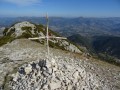
The Croix de Roussieux and La Clavelière

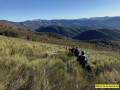
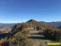
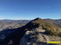
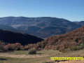
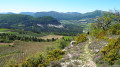
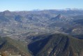
A magnificent walk to enjoy in fine weather to take in the spectacular views from the Clavelière ridge, over the Alps and the Eygues and Ouvèze valleys.
See § Practical information.

Details

2801452
Creation:
Last update:
Last review:
  • Walking
    Activity: Walking
  • ↔
    Distance: 9.28 mi
  • ◔
    Average duration: 6h 10 
  • ▲
    Difficulty: Moderate

  • ⚐
    Back to start: Yes
  • ↗
    Ascent: + 2,224 ft
  • ↘
    Descent: - 2,221 ft

  • ▲
    Highest point: 4,400 ft
  • ▼
    Lowest point: 2,254 ft

Photos

Description of the walk

Park in the car park by the lodge in the village of Montguers.

(S/E) The path descends immediately towards the Ruisseau de la Pigière and then climbs back up towards the Ruisseau de Tournège and the hamlet of Saint-Roman. Head up to the left along the track.

(1) Turn right under the power lines to follow the path running along the hillside beside the Tournège stream, which you’ll need to cross again further on.

(2) Carry on without hesitation, even though the route appears to end further up on the IGN maps.

(3) Cross the Tournège stream. Carry on along the path which leads to a track.

(4) Take this track to the left towards the Col des Aros.

(5) Just past the farm at the pass, head uphill across the lavender field to join the path on the left, which will take you to the track and the 1202-metre mark.

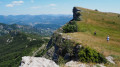
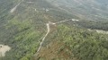
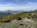
(6) Do not follow the signs for Roussieux but head in the opposite direction to the sign, to the left, to climb up to the Clavelière ridge, which will give you a direct view of the Alps as you walk along.

(7) Follow the path on your right which climbs through the forest.

(8) Col de Haute Huche. Follow the path to the right towards the Clavelière ridge and the Croix de Roussieux.

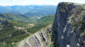
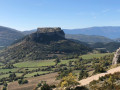
(9) Take in the view of the Eygues valley, the Vercors peaks and the Alps, and, if you turn round, the Mont Ventoux, the Chamouse mountain and the Ouvèze valley.
Caution: the path runs close to the cliff edge in places.

(10) At the Croix de Roussieux, follow the path downhill through the broom until you reach the track.

(11) Turn left onto the track and follow it for 100 metres, then leave it by taking the path on the right.

(12) Cabane des Sept Fonts: just past the hut, veer to the right and continue due south towards a track.

(13) Walk down the track opposite, which will take you gently back to the village of Montguers (S/E).

Waypoints

  1. S/E : mi 0 - alt. 2,343 ft - Lodge in the village of Montguers
  2. 1 : mi 0.55 - alt. 2,293 ft - Power lines. On the right
  3. 2 : mi 1.08 - alt. 2,592 ft - Continuation of the hillside path
  4. 3 : mi 1.67 - alt. 2,726 ft - Crossing the stream
  5. 4 : mi 1.94 - alt. 2,956 ft - The path joins a forest road
  6. 5 : mi 2.46 - alt. 3,186 ft - Col des Aros. Farm
  7. 6 : mi 3.11 - alt. 3,737 ft - Point 202
  8. 7 : mi 3.64 - alt. 3,845 ft - Ascent through the forest to the right
  9. 8 : mi 3.87 - alt. 4,029 ft - Col de Haute Huche.
  10. 9 : mi 4.99 - alt. 4,301 ft - Cliffs. Caution
  11. 10 : mi 5.74 - alt. 4,170 ft - Croix de Roussieux. Turn right
  12. 11 : mi 6.19 - alt. 3,720 ft - Track on the left
  13. 12 : mi 6.44 - alt. 3,520 ft - The Cabane des Sept Fonts
  14. 13 : mi 6.59 - alt. 3,376 ft - Opposite. Head down the track
  15. S/E : mi 9.28 - alt. 2,346 ft - Lodge in the village of Montguers

Notes

Caution: the path sometimes runs close to the cliff from (9).

Reviews and comments

4.5 / 5
Based on 2 reviews

Reliability of the description
4.5 / 5
Ease of following the route
4.5 / 5
Route interest
4.5 / 5
Magali N
Magali N

Overall rating : 4 / 5

Date of your route : Oct 25, 2021
Reliability of the description : ★★★★☆ Good
Ease of following the route : ★★★★☆ Good
Route interest : ★★★★☆ Good
Very busy route : No

Walk completed on 20 October 2021. The start is hard to find; in fact, you need to go to the second lodge (the one by the fountain) and park in front of it (preferably not under the windows!). The start of the path is on the other side of the road, beneath the low roadside wall and to the right; the path is barely marked at the start, but becomes clearer after 20 metres as it winds down between the box trees towards the stream.
But I prefer the ascent via Les Viarrands to reach the area below La Vanige and then on to the Roussieu crossroads, as it involves fewer tracks and more woodland. Nevertheless, this route has the advantage of facing due south, which is more comfortable in winter.

Machine-translated

Michel E1.
Michel E1.

Overall rating : 5 / 5

Date of your route : Jan 08, 2020
Reliability of the description : ★★★★★ Very good
Ease of following the route : ★★★★★ Very good
Route interest : ★★★★★ Very good

A lovely walk in calm, sunny weather. We had no trouble finding our way thanks to the clear directions and the app.
You can avoid crossing the lavender field by going round it to the right (to the east).
From the Col de la Haute Huche, numerous trees flattened by the snow block the path, but they’re easy to get round.

Machine-translated

Other walks in the area

For more walks, use our search engine .

The GPS track and description are the property of this route's author. Please do not copy them without permission.