The Croix de Bertranet

A short walk in the hills above Saint-Privat-des-Vieux, with most of the route on tarmac. The section between points (4) and (5) may be a little muddy after periods of rain.°°

Details

29555841
Creation:
Last update:
Last review:
  • Walking
    Activity: Walking
  • ↔
    Distance: 2.62 mi
  • ◔
    Average duration: 1h 25 
  • ▲
    Difficulty: Easy

  • ⚐
    Back to start: Yes
  • ↗
    Ascent: + 282 ft
  • ↘
    Descent: - 269 ft

  • ▲
    Highest point: 801 ft
  • ▼
    Lowest point: 551 ft

Description of the walk

Head to the Maison des Jeunes car park, where the walk starts.

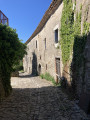
(S/E) Head down via the Chemin du Lavoir and join the Chemin de l’Usclade.

(1) Pass the “Pump Track” on your left and take the Chemin Soute de l’Usclade until you reach a four-way junction.

(2) Take the first right (Drovers' Road of Olivettes) and continue climbing. When you reach the gate of the Maison des Élèves at the École des Mines d’Alès, leave the tarmac and continue along the path running alongside the fence.

(3) The path eventually rejoins the Chemin de l’Usclade. About a hundred metres further on, turn sharply left onto the Chemin des Crêtes, which ends at a pass.

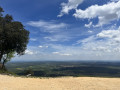
(4) Continue straight ahead along a path that follows the ridge and climbs to the Croix de Bertranet. Once you reach it, take in the view and consult the orientation table, then continue along the path as it enters the forest. At each junction, stay on the most clearly marked path and use your GPS if in doubt. You’ll emerge onto a access road leading to some houses and join the Route de Mazac (D216a).

(5) Turn right to reach the centre of Saint-Privat-des-Vieux and the car park at the Maison des Jeunes (S/E).

Waypoints

  1. S/E : mi 0 - alt. 597 ft - Maison des Jeunes car park
  2. 1 : mi 0.3 - alt. 561 ft - PumpTrack
  3. 2 : mi 0.87 - alt. 623 ft - Drovers' road to Olivettes
  4. 3 : mi 1.33 - alt. 630 ft - Chemin de l’Usclade
  5. 4 : mi 1.67 - alt. 686 ft - Pass
  6. 5 : mi 2.29 - alt. 689 ft - Route de Mazac
  7. S/E : mi 2.62 - alt. 600 ft - Maison des Jeunes car park

Notes

A GPS or the Visorando app is useful for the forest section between (4) and (5)

Worth a visit

There is an orientation table at the highest point of the walk (Croix de Bertranet).

Reviews and comments

4.2 / 5
Based on 3 reviews

Reliability of the description
4.7 / 5
Ease of following the route
4.3 / 5
Route interest
3.7 / 5
MARIE LINCY
MARIE LINCY

Overall rating : 4.7 / 5

Date of your route : Jun 22, 2026
Reliability of the description : ★★★★★ Very good
Ease of following the route : ★★★★★ Very good
Route interest : ★★★★☆ Good
Very busy route : No

A pleasant walk: at the start, you walk past the village houses, then you find yourself in the woods towards the end, with a mix of sun and shade; an easy route.

Machine-translated

mi30
mi30

Overall rating : 5 / 5

Date of your route : Feb 17, 2025
Reliability of the description : ★★★★★ Very good
Ease of following the route : ★★★★★ Very good
Route interest : ★★★★★ Very good
Very busy route : No

A lovely little walk, well signposted, mostly along quiet roads and the rest on paths that aren’t too slippery – ideal for after a rainy spell

Machine-translated

jackysatis
jackysatis

Overall rating : 3 / 5

Date of your route : Apr 10, 2023
Reliability of the description : ★★★★☆ Good
Ease of following the route : ★★★☆☆ Average
Route interest : ★★☆☆☆ Disappointing
Very busy route : No

This walk, which we followed, takes place largely on tarmac. Its only attraction is the view of Alès and the surrounding area when you reach the foot of the Bertranet cross. Best avoided in hot weather.

Machine-translated

Other walks in the area

For more walks, use our search engine .

The GPS track and description are the property of this route's author. Please do not copy them without permission.