Surbourg Collegiate Church from Biblisheim

Circular route through fields and woodland to visit Surbourg Collegiate Church, listed as a Historic Monument since 1874.

Details

3991509
Creation:
Last update:
Last review:
  • Walking
    Activity: Walking
  • ↔
    Distance: 7.45 mi
  • ◔
    Average duration: 3h 30 
  • ▲
    Difficulty: Moderate

  • ⚐
    Back to start: Yes
  • ↗
    Ascent: + 105 ft
  • ↘
    Descent: - 112 ft

  • ▲
    Highest point: 610 ft
  • ▼
    Lowest point: 486 ft
  • ⚐ Country: France
  • ⚐ City: Biblisheim (67360)
  • ⚑
    Start/End: N 48.898654° / E 7.791826°
  • Accessible from the train station Gare de SURBOURG RUE ST ABOGAST.
  • ❏
    IGN map(s): Ref. 3814ET
  • Hour-by-hour weather

Photos

Description of the walk

Park in the car-share area near Biblisheim Town Hall.

(S/E) With your back to the Town Hall, leave the primary school on your left and walk along the D772 (Route de Walbourg). Take care at the right-hand bend; the road continues straight ahead (to the right is Rue de l’Église). Cross over the Sauer and carry on straight ahead until you reach the village boundary. Cross the small bridge over the Altbach.

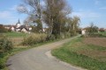
(1) Take the first farm track on the right after the stream. Follow the ditch on your left and carry on straight ahead. Turn left onto the track before the railway line and you’ll come to a T-junction.

(2) Carry on straight ahead along this track, which makes a first turn right then a second turn left, before running alongside the railway line. Walk on until you reach the D250.

(3) Turn right, cross the bridge and follow the first farm track on the right, which runs alongside the railway line in the opposite direction. Turn left towards Scharrenberger Farm, walking past the various farm buildings; at the end, pass between the farm buildings to reach the residential houses.

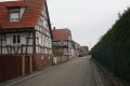
(4) Take the farm track on the right, then the first on the left, which curves to the left and climbs slightly. At the junction, continue to the right along the farm track which runs alongside orchards and leads to the houses on Rue Saint-Arbogast. Take the first left, Petite Rue des Écoles, then the first right, Rue de l’École, and again the first left, Rue de l’Église. On your right, look out for the remains of the monastery’s ramparts. You will reach the collegiate church of Surbourg.

(5) Continue along Rue de l’Église. At the end, turn right onto Rue du Maréchal Leclerc. You will come out onto Rue du Général de Gaulle (D264); follow it to the right until you reach the 6th-century Christian stele.

(6) Retrace your steps and turn left into Impasse du Cheval Noir (Chemin de Compostelle). After 50 metres, take the first street on the right, Rue de l’École (Green Cross). Walk round the back of the collegiate church and you’ll come to another remnant from the monks’ era.

(7) On your right are the remains of the monastery’s ramparts. At the bend, go down the steps (Green Cross) which lead to Rue Saint-Arbogast. Turn left to reach the main road (D264), then right, heading towards the village exit, and follow the road downhill for about 500 m.

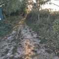
(8) Turn slightly right onto a small path that follows the route of the old railway line. Cross a private company’s access road and continue straight on along the path (Green Cross) towards the forest until you reach the tarmac road.

(9) Leave the old railway line and take the forest track diagonally to the right (Green Cross). Cross the railway line. At the junction, continue along the track on the right and, at the next junction, take the one on the left. You will reach a tarmac road, the Route de l’Oberstritten.

(10) Turn right onto it and follow it to the entrance to the village of Biblisheim.

(11) Take the first street on the left, Rue de la Forêt, then follow the cycle path to the right, which will take you straight back to the car park near the town hall (S/E).

Waypoints

  1. S/E : mi 0 - alt. 512 ft - Car park near the Town Hall. Towards the - Sauer (rivière)
  2. 1 : mi 0.46 - alt. 505 ft - Path on the right
  3. 2 : mi 1.71 - alt. 509 ft - Fork in the road
  4. 3 : mi 2.37 - alt. 545 ft - D250 road – Railway bridge
  5. 4 : mi 3.09 - alt. 571 ft - Scharremberger Farm
  6. 5 : mi 4.01 - alt. 600 ft - Collégiale Saint-Martin et Saint-Arbogast (Surbourg)
  7. 6 : mi 4.18 - alt. 597 ft - Christian memorial stone
  8. 7 : mi 4.3 - alt. 584 ft - Remains of the ramparts of the former monastery
  9. 8 : mi 4.74 - alt. 495 ft - Former railway line
  10. 9 : mi 5.81 - alt. 502 ft - Junction of the road and the forest track
  11. 10 : mi 6.81 - alt. 509 ft - Oberstritten Road
  12. 11 : mi 7.21 - alt. 512 ft - Rue de la Forêt
  13. S/E : mi 7.45 - alt. 512 ft - Car park near the Town Hall

Notes

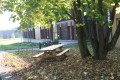
For families, I recommend setting off from Surbourg and having a picnic at the Biblisheim playground. The walk can be done either way: it’s up to you whether you want to start with the fields or the forest.

Worth a visit

Former Collegiate Church of Saint Arbogast

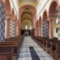
The abbey’s origins date back to the second half of the 6th century, when Saint Arbogast was Bishop of Strasbourg, but the present church dates mainly from thefirst half of the 11th century (early Alsatian Romanesque).
The building is laid out on a basilica plan with three covered naves, ending in a transept and semi-circular apses. Inside, the large arches rest on alternating supports: columns with cubic capitals and masonry piers with a single impost. Of particular note is the quality of the masonry, laid in small rubble stone alternating red and grey sandstone (on the exterior of the nave and the chevet of the northern apsidal chamber), as well as the decorative carving on the facing stones (the interior piers of the nave).

Reviews and comments

4.4 / 5
Based on 3 reviews

Reliability of the description
5 / 5
Ease of following the route
5 / 5
Route interest
3.3 / 5
mach
mach

Overall rating : 4.3 / 5

Date of your route : Jun 17, 2024
Reliability of the description : ★★★★★ Very good
Ease of following the route : ★★★★★ Very good
Route interest : ★★★☆☆ Average
Very busy route : No

A short, very flat walk completed in 3 hours

Machine-translated

Jms 0729
Jms 0729

Overall rating : 4.7 / 5

Date of your route : Mar 03, 2021
Reliability of the description : ★★★★★ Very good
Ease of following the route : ★★★★★ Very good
Route interest : ★★★★☆ Good
Very busy route : No

A walk on flat ground for a bit of a change from the Vosges, comprising three distinct sections: one across open fields with little of interest, one through the village and past the abbey church, and one through the forest on the way back.
Took 3 hours, including stopping to take photos.

Machine-translated

SM BISCHE
SM BISCHE

Overall rating : 4.3 / 5

Date of your route : Feb 04, 2021
Reliability of the description : ★★★★★ Very good
Ease of following the route : ★★★★★ Very good
Route interest : ★★★☆☆ Average
Very busy route : No

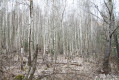
After heavy rain (which was the case for us), the start of the route (particularly between points 1 and 2) is almost impassable: we were wading through water and mud! It’s worth noting that at the playground in BIBLISHEIM, there are various information boards about the local flora and fauna, as well as oil extraction.

Machine-translated

Other walks in the area

For more walks, use our search engine .

The GPS track and description are the property of this route's author. Please do not copy them without permission.