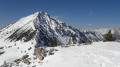
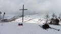
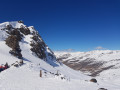
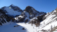
The summit of Mélézet

A winter walk across the Ceillac plain leading to the hamlet of La Cime du Mélézet.

Details

1760477
Creation:
Last update:
Last review:
  • Snowshoeing
    Activity: Snowshoeing
  • ↔
    Distance: 4.43 mi
  • ◔
    Duration according to the author: 4 hrs 
  • ▲
    Difficulty: Easy

  • ⚐
    Back to start: Yes
  • ↗
    Ascent: + 587 ft
  • ↘
    Descent: - 587 ft

  • ▲
    Highest point: 5,974 ft
  • ▼
    Lowest point: 5,384 ft

Description of the walk

Park in the car park near the Salle Polyvalente in Ceillac.

(S/E) Stay on the road and, at the first junction, turn right. Head for the start of the snowshoe trail, marked by a sign. Cross the cross-country ski tracks and carefully follow the markers along the trail. Head towards the large Chalp farm.

(1) Continue on, passing the Rua des Reynauds chalets a little further on. A few metres further on, you’ll reach the junction with the D60 road.

(2) Turn 90° to the left, then immediately 90° to the right to reach the Pied du Mélezet chalets.

(3) Head slightly to the left to join the road further on at the Saint-Claude chalets. Return to the track, keeping well to the right, to reach the hamlet of La Cime du Mélezet.

(4) Return along the track in the opposite direction, veer left to reach, via a gentle descent, the footbridge spanning the Ruisseau du Mélezet. Cross the footbridge and follow the left bank of the stream. After crossing the ski run, you’ll reach the lower station of the chairlift.

(5) Follow the road back to the junction with the path you took earlier.

(2) Follow the outbound route back to the community hall (S/E).

Waypoints

  1. S/E : mi 0 - alt. 5,387 ft - Ceillac Community Hall
  2. 1 : mi 0.74 - alt. 5,420 ft - La Chalp
  3. 2 : mi 1.18 - alt. 5,476 ft - D60 junction
  4. 3 : mi 1.44 - alt. 5,610 ft - Foot of the Mélezet
  5. 4 : mi 2.1 - alt. 5,945 ft - The summit of Mélezet, near the - Refuge de la Cime du Melezet
  6. 5 : mi 2.88 - alt. 5,551 ft - Chairlift station
  7. S/E : mi 4.43 - alt. 5,387 ft - Ceillac Multi-purpose Hall

Notes

Snowshoe hike organised as part of the 2019 Snowshoe Festival. This event, organised by the FFRP’s Departmental Committee 05, was:
- a resounding success thanks to the heavy snow that had fallen the previous night,
- a complete failure in terms of turnout because, due to the snow disrupting road traffic, 120 people were unable to join us.
However, the 30 who did attend thoroughly enjoyed themselves, blazing a fine trail that will be of use to future holidaymakers.

Worth a visit

The entire route takes place on the plain to the south-east of Ceillac. This is the plain along which the famousGR®5runs, allowing hikers to cross from the Queyras to the Ubaye via the Col Girardin.

Always be cautious and plan ahead when you're outdoors. Visorando and the author of this route cannot be held responsible for any accidents occurring on this route.

The GR® and PR® markings are the intellectual property of the Fédération Française de Randonnée Pédestre.

Reviews and comments

3.8 / 5
Based on 3 reviews

Reliability of the description
3.7 / 5
Ease of following the route
3.7 / 5
Route interest
4 / 5
pasapas1
pasapas1

Overall rating : 4 / 5

Date of your route : Jan 16, 2020
Reliability of the description : ★★★★☆ Good
Ease of following the route : ★★★★☆ Good
Route interest : ★★★★☆ Good

An ideal snowshoe walk to get you up and running at the start of your holiday.
We had a bit of trouble finding our way back… but we managed to get back safely in the end, despite straying slightly from the route.

Machine-translated

bernardino
bernardino ★

That’s a shame. I think there must have been a few snowfalls between the 2 February outing – when 25 people had actually made their way up – and your outing on the 17th, which must have covered our tracks.
That probably explains your ‘Average’ ratings.

Machine-translated

o&p
o&p

Overall rating : 3.3 / 5

Date of your route : Feb 18, 2019
Reliability of the description : ★★★☆☆ Average
Ease of following the route : ★★★☆☆ Average
Route interest : ★★★★☆ Good

Snowshoes came in handy right at the end of the climb; couldn’t find the end of the route, so we returned via the route we’d taken on the way up

Machine-translated

Other walks in the area

For more walks, use our search engine .

The GPS track and description are the property of this route's author. Please do not copy them without permission.