Route du canal de Pierre Dimanche

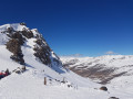
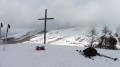
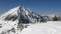
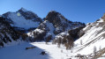
A pleasant route through the valley leading to the highest village in Europe, Saint-Véran.
Please note that this route is described as having been completed on snowshoes in winter. In summer, it is blocked off by nets to protect the farmland.

Details

22522
Creation:
Last update:
Last review:
  • Snowshoeing
    Activity: Snowshoeing
  • ↔
    Distance: 3.78 mi
  • ◔
    Duration according to the author: 3 hrs 
  • ▲
    Difficulty: Easy

  • ⚐
    Back to start: Yes
  • ↗
    Ascent: + 666 ft
  • ↘
    Descent: - 650 ft

  • ▲
    Highest point: 6,099 ft
  • ▼
    Lowest point: 5,528 ft

Description of the walk

By car, head for the hamlet of Prats Haut, first taking the D205 from the Ville Vieille roundabout, then turning left onto the D5. Drive through Prats Bas and continue to the car park at Prats Haut (S/E).
On leaving the hamlet, at the first bend, turn right (signposted) onto thePR® (yellow) marked trail which winds through the woods. You will reach the Serre des Chambrands chalets.

(1) Continue along the track until you reach the D5 road to Saint-Véran. Keep to the left for a few metres until you reach the junction with the road leading to the hamlet of Rua.

(2) Head left up through the large field to reach the Maison de Gaudissart lodge.

(3) Look out for the road on the right leading to the upper chalets (road sign for ‘Cul de Sac’). Walk past the last chalets until you reach the canal path.

(4) Turn left and follow the well-marked canal path (signposted ‘sentier Raquettes’). This level path is the Pierre Dimanche Canal path.

(5) Continue due north until you reach the area above the hamlet of Prats Haut.
At the first junction, take the path on the left which leads to the hamlet and the car park (S/E).

Waypoints

  1. S/E : mi 0 - alt. 5,850 ft - Prats Haut car park
  2. 1 : mi 1.15 - alt. 5,574 ft - Serre de Chambrand
  3. 2 : mi 1.65 - alt. 5,577 ft - Rua crossroads
  4. 3 : mi 2.14 - alt. 5,968 ft - Maison de Gaudissard
  5. 4 : mi 2.39 - alt. 6,083 ft - Last chalets
  6. 5 : mi 3.09 - alt. 6,066 ft - Canal de Pierre Dimanche
  7. S/E : mi 3.78 - alt. 5,869 ft - Prats Haut car park

Notes

There are no shelters or water sources on this route.

Worth a visit

This is the Queyras tourist area; Saint-Véran is very close by, as are the villages leading up to it, which are also well worth a visit.
Gaudissart and Pierre Grosse, on the road to the Col Agnel, are two of Molines’ neighbourhoods and are well worth a thorough visit.
Before reaching Molines, on the right-hand side of the road, a visit to La Demoiselle Coiffée is a must.
There are a wealth of hiking trails in this area, in both winter and summer. You’ll need to set aside a few days for this, and the Queyras has a particularly good range of accommodation. The lodges here are of a high standard, notably the Vie Sauvage in Prats Haut.

Always be cautious and plan ahead when you're outdoors. Visorando and the author of this route cannot be held responsible for any accidents occurring on this route.

The GR® and PR® markings are the intellectual property of the Fédération Française de Randonnée Pédestre.

Reviews and comments

4 / 5
Based on 3 reviews

Reliability of the description
4 / 5
Ease of following the route
4 / 5
Route interest
4 / 5
bernardino
bernardino ★

Thank you, jdobagne, for your comment on this short route along the canal.
You’ll no doubt have noticed that this route is described as being for snowshoes. And in winter, you do indeed need to head up through the field marked off by a net towards the Molines lodge. And of course, in the mountains (and elsewhere), when a field is marked off by a net, it’s still up to the walker to choose an alternative route – which, incidentally, is what you did.
But on reviewing the route, I’m going to make a few changes and make it clear that farmers close their fields in summer.
Enjoy your walks this lovely summer.

Machine-translated

alainemile
alainemile

Overall rating : 4.7 / 5

Date of your route : Jul 16, 2016
Reliability of the description : ★★★★★ Very good
Ease of following the route : ★★★★★ Very good
Route interest : ★★★★☆ Good

An easy and enjoyable walk suitable for all ages.
Taken at the end of June amongst the flowers of the alpine pastures.

Machine-translated

Other walks in the area

For more walks, use our search engine .

The GPS track and description are the property of this route's author. Please do not copy them without permission.