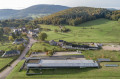
Explore the three peaks of the Morvan: Beuvray, Préneley and Haut Folin

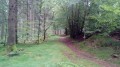
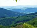
The second part of our hike exploring the Morvan’s peaks. Explore the Grand Site de France and discover the Morvan’s three main peaks: Mont Beuvray (821 m), Mont Préneley (855 m) and Haut-Folin (901 m). A relatively easy hike, fully signposted and set in the heart of nature.
Accommodation is located along the first part of the route.

Details

n°24485082
Creation:
Last update:
Last review:
  • Walking
    Activity: Walking
  • ↔
    Distance: 11.88 mi
  • ◔
    Average duration: 6h 45 
  • ▲
    Difficulty: Difficult

  • ⚐
    Back to start: No
  • ↗
    Ascent: + 1,486 ft
  • ↘
    Descent: - 2,149 ft

  • ▲
    Highest point: 2,805 ft
  • ▼
    Lowest point: 1,519 ft
  • ⚐ Country: France
  • ⚐
    Area: Morvan
  • ⚐ City: Arleuf (58430)
  • ⚑
    Start: N 47.005505° / E 4.03494°
  • ⚑
    End: N 46.932863° / E 4.04853°
  • ❏
    IGN map(s): Ref. 2824OT
  • Hour-by-hour weather

Description of the walk

(S) At the Préperny chalet and the wooden picnic tables, take the track that branches off to the left of the chalet (peat bog), then quickly take a path on the left that climbs gently southwards. About 200 metres past the Fontaine des Trois Bornes, turn right at a 90° angle until you come to a forest track.

(1) Cross it to reach theGR®13(red and white markings) on the opposite side and follow it to the left. Walk alongside the Préperny forest road, which you’ll cross at a car park. Carry on straight ahead, following the Ruisseau de la Fontaine Blanche, which feeds into the Étang de la Goulette. You’ll come to a picnic area.

(2) Carry on southwards until you come to a track.

(3) Turn left onto it for a few hundred metres, then leave it to follow a path on the right which climbs gently up to La Croisette (a beautiful sequoia).

(4) At the junction (elevation 663), continue left along the signposted path to reach a car park.
Then follow the road to the right and join the D179.

(5) Cross the road carefully and, at the multi-way junction just ahead, take a signposted path on the right and follow it to Crot Morin.

(6) Walk through the hamlet along the road to the right, pass the cross, and carry on straight ahead until you reach the path that veers to the right.

(7) Follow this red and yellow signposted path onthe GR® de Pays Tour du Morvan. Cross a road and carry on straight ahead. At the next junction, turn right, then right again about 250 metres further on; ignore a path on the right before reaching the D179.

(8) Cross the D179 again with the same caution, then head straight on to reach La Petite Chaux. Keep going in the same direction, negotiate the left-hand bend and cross La Grande Chaux until you reach the pretty wayside cross.

(9) Take the signposted path on the right. After passing through a section of woodland, continue along the edge of the forest, then turn 90° to the left and arrive at La Reinge.

(10) Leave the path and turn right, cross the stream, pass the Puits de la Mine (caution: danger) and follow the path to Villechaise.

(11) Walk through the hamlet, following the road to the left, then take the path on the right which leads down to Argentolle.

(12) Follow the road through three successive bends, then take the path on the left and head south until you come out onto the D18.

(13) Follow it to the left with care as far as the Col du Rebout, then turn right to reach the museum car park (E).


Waypoints

  1. S : mi 0 - alt. 2,651 ft - Préperny Pond
  2. 1 : mi 0.58 - alt. 2,779 ft - Forest track
  3. 2 : mi 1.39 - alt. 2,582 ft - Picnic area
  4. 3 : mi 2.17 - alt. 2,448 ft - Trail
  5. 4 : mi 3.41 - alt. 2,169 ft - Crossroads
  6. 5 : mi 3.94 - alt. 2,041 ft - D179
  7. 6 : mi 5.33 - alt. 1,870 ft - Crot Morin
  8. 7 : mi 5.9 - alt. 1,755 ft - Turn right
  9. 8 : mi 6.42 - alt. 1,745 ft - D179
  10. 9 : mi 7.15 - alt. 1,946 ft - La Grande Chaux, wayside cross
  11. 10 : mi 8.05 - alt. 1,742 ft - La Reinge
  12. 11 : mi 9.43 - alt. 1,873 ft - Villechaise
  13. 12 : mi 10.41 - alt. 1,752 ft - Argentolle
  14. 13 : mi 11.62 - alt. 1,959 ft - D18
  15. E : mi 11.88 - alt. 1,988 ft - Musée de Bibracte

Worth a visit

If you’d like to extend your experience in Bibracte, do come back and explore the site with a guide.
From mid-March to mid-November, the museum is open daily; guided tours and workshops are available throughout the school holidays and long weekends, and ‘Le Chaudron’, a Gallic restaurant, allows you to extend the experience.
Please remember to book in advance for guided tours, workshops and the Gallic restaurant. Further information is available at bibracte.fr.
Sources de l’Yonne, Mont Preneley, a former timber-floating port, and Haut-Folin, a former ski resort.
We hope you enjoy your journey back in time!
A lovely experience: at Plume de Mouton, discover the art of wool working with Cécile – a wonderful time to share!

Always be cautious and plan ahead when you're outdoors. Visorando and the author of this route cannot be held responsible for any accidents occurring on this route.

The GR® and PR® markings are the intellectual property of the Fédération Française de Randonnée Pédestre.

Reviews and comments

4.7 / 5
Based on 1 review

Reliability of the description
5 / 5
Ease of following the route
5 / 5
Route interest
4 / 5
User 3854500

Overall rating : 4.7 / 5

Date of your route : Oct 13, 2025
Reliability of the description : ★★★★★ Very good
Ease of following the route : ★★★★★ Very good
Route interest : ★★★★☆ Good
Very busy route : No

A very immersive two-day route in beautiful, peaceful natural surroundings. The forest landscapes change as you wander along. Given the forest setting, I opted to camp in a hammock, which I am used to doing. There aren't many places to pitch a tent, and they don't always come up at the right point along the route. No worries about water, as there are multiple sources available. Using a filtration system, there's no risk of getting sick! The app is always top-notch, an essential companion for not getting lost on all these beautiful paths in the Morvan.
NB: the descriptions for points 1 to 7 on the first part of the hike are missing.

Machine-translated

madydou
madydou ★

Hello,
Thank you for pointing this out.
I’ll correct the title.

Machine-translated

jpraff
jpraff

The ‘3 Summits’ circular route is not a circular route

Machine-translated

Other walks in the area

For more walks, use our search engine .

The GPS track and description are the property of this route's author. Please do not copy them without permission.