Country:
 City:


Access: head towards Bourg-Murat and take the Route Forestière du Volcan. Stay on this road, passing the Nez de Bœuf viewpoint, the Piton Textor mast and then the Bois Ozoux picnic area. Park by the footpath a little further up on the left, as indicated by a sign.
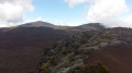
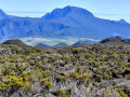
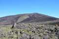
(S/E) You can walk up to the rampart to enjoy a magnificent view over the valley of the river of the same name. Then set off along the path – the GRR2, marked in red and white – and turn right after the first few metres. The path is very stony but offers beautiful views of the island’s highest peaks.
You’ll then reach the memorial to Josémont Lauret, which is beautifully decorated with flowers.
(1) Continue straight ahead along the path. Note, however, that the vegetation will hardly change: it will consist solely of branles. To the left lies the Piton des Feux. Follow the path until you reach two warning tape markers at the junction for the Caverne des Lataniers.
(2) Turn right onto the track, following the orange markings. At the third marking, turn right onto a very inconspicuous path. Within a few seconds, it leads to the beautiful, deep Caverne des Lataniers.
(3) Return to the previous junction.
(2) Turn right, rejoining the GRR2.
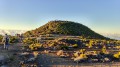
The path remains flat. You’ll reach the foot of the oratory. Make the short climb to reach the Rempart des Basaltes, then turn right to reach the Oratoire Sainte-Thérèse.
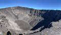
Enjoy the view of the Piton des Basaltes mast, the Savane Cimetière, the Fond de la Rivière de l’Est and the volcano.
Note: it is possible to do a longer route by taking one of the three other paths leading from the oratory (see the ‘Practical information’ section).
(4) Follow the route back in the opposite direction to return to the car park where you started (S/E).

 Visorando Member

 Moderate

 Tourist office
 Difficult