Country:
 City:
City:


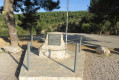
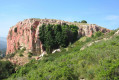
From Plan-de-Cuques, take the D908 towards the village of Le Logis Neuf. At a roundabout, turn left onto Avenue Jean Moulin (with the school and fire station on your left), then follow signs for the shooting range along the old Chemin de Mimet. Park by the 1944 War Memorial.
(S/E) Set off along the track to the right of the memorial, heading west, then south-west. Continue in this direction.
(1) At the three-way junction, turn right and head due north (elevation 286) with the Vallon des Escombes on your left. You’ll come to a junction with a track used for gas pipeline works (yellow posts).
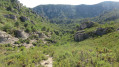
(2) Turn left onto this track, then keep left, following the yellow posts. After a junction, the descent becomes very steep and slippery. Take great care. Reach the bottom of the Vallon des Escombes. Continue to the right along the wide, flat, grassy path. Ignore the trailheads on the left and right and carry on northwards. Cross a few rocky slabs without difficulty and arrive at a fork in the road.
(3) Turn right at the Fork in the road, heading east, to reach the Puits de Besson, then carry on straight ahead to join a DFCI track further up. Turn left onto this track.
(4) At the left-hand bend in the track, head right (elevation 341). Pass by some beehives and then a small hut; turn right after the hut and head towards the ruins of the Jas de Mimet.
(5) Walk to the left of the Jas de Mimet. After a short climb, the path winds its way back down. Pass the start of the Vallon du Petit Cornillon on your left, followed further on by the path leading to the Grotte des Ermites. You’ll arrive at a place called La Débite. Cross this open area and you’ll come to a closed gate. Walk along the right-hand side of the wire fence and, at the end, you’ll find an opening in the bushes.
(6) Turn left onto the Chemin de Mimet (oratory), walk for about 400 m along the tarmac road and arrive at the Oratoire de la Tourdre.
(7) Turn right and stay on the track on the right (ET214). At the bottom, turn right at the hairpin bend and follow this track eastwards, then north-eastwards, passing under some power lines. You’ll come to a hairpin bend on the right.
(8) Turn left onto the grassy path heading north. You’ll catch sight of the Aire de la Moure. Cross a meadow, go over a small bridge made from a beam, then over rocky slabs. After a flat, leafy area, you’ll come to some very large rocky slabs.
(9) Turn right and climb up the rock slabs to reach the DFCI track at the underground cistern no. 174. Please note: there are no signposts. Continue for a few metres to the right.
(10) Take the red-marked path on the left (elevation 521) which leads to the foot of the Aire de la Moure. Keep to the left, rejoin the DFCI track further down and continue to the left.
(11) Leave the track to the left and follow the path which passes alongside two chasms roughly protected by wire fencing. You’ll reach a junction of tracks and paths.
(12) Go straight across and take the track on the right, heading south-west. Pass numerous fire lookouts and under power lines, then arrive at a junction of tracks and the underground cistern no. 248 (coordinate 338).
(13) Turn right at the cistern and reach a T-junction. Continue left along the lovely track nestled between high rock faces. Pass by facilities belonging to the Canal de Provence, then reach a concrete bridge. Look out for the yellow posts marking the gas pipeline route.
(14) Turn right for a final stretch along this track, following the yellow posts. You’ll reach the Chemin de Minet; walk a few dozen metres to the right to reach the War Memorial (S/E).



 Visorando Member
 Easy
Easy 
 Association / Club / Walk leader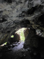


 Difficult