Country:

 City:


Head towards Vallouise, turn left after the village entrance and drive up to the Puy-Saint-Vincent 1400 ski resort. Turn right before the village and head for the 1600 ski resort. After about 1 km, turn right onto the small tarmac road leading up to the Narreyroux valley. Watch out for potholes. Finish on a 1 km track suitable for vehicles. Park at the Narreyroux Bridge.
(S/E) Walk to the footbridge and cross the Narreyroux torrent. Follow the right bank to reach a junction of paths.
(1) Leave the path leading to the Cabane des Grands Plans on your right and take the one on the left. You’ll very quickly reach another junction at Les Prés des Fonds, heading towards Lac des Neyzets.
(2) Take the well-marked path on the right – marked with yellow signs and cairns – along the right bank of the stream. You’ll reach the stream’s headwaters.
(3) Continue the ascent through the vast Grand Fond cirque. You will then emerge at Lac des Neyzets.
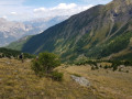
(4) Take care here. From the lake onwards, there is no proper path but a fairly visible track through the grassy areas. Cairns are clearly visible all along the route and help you find your way through the scree fields at Les Sagnières.
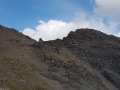
(5) Pass over a rocky outcrop and take a track that climbs towards the summit up very steep slopes of earth and stones.
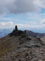
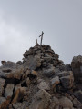
(6) Turn left, then traverse rightwards beneath a rocky outcrop and reach the ridge. This is wide, and an intermittent track makes it easy to reach the summit of the Pointe de l’Aiglière by skirting around the rock formations on the north-western slope.
(7) Return: follow the same route in the opposite direction, descending to the previous junction.
(6) Leave the ascent path on your right and continue straight ahead due east, reaching a small pass and heading towards a large cairn overlooking the valley.
(8) Then descend off-track due north through the Vallon des Lauses, below the Col d’Entraygues and the summit of Rochebrune, keeping to the right bank of the Lauses streams at all times. A track is visible but then disappears into a scree slope. Keep well to the right of the torrent without crossing it. Then head due east and descend across the grassy slopes, following the least steep route as far as the eye can see, until you reach the path to the Cabane des Grands Plans.
(9) Continue to the right to quickly reach the crossroads you passed on the way out.
(1) Turn left and retrace your steps along the route you took on the way there to return to the Pont de Narreyroux car park (S/E).

 Visorando Member
 Moderate

 Difficult
 Easy