Nottonville Abbey

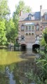
The abbey – or, more precisely, its priory – is striking for its two turrets with hipped roofs, flanking the old drawbridge, set amidst the Beauce plain and the Conie valley.

Details

n°24187734
Creation:
Last update:
Last review:
  • Walking
    Activity: Walking
  • ↔
    Distance: 7.84 mi
  • ◔
    Average duration: 3h 40 
  • ▲
    Difficulty: Moderate

  • ⚐
    Back to start: Yes
  • ↗
    Ascent: + 85 ft
  • ↘
    Descent: - 89 ft

  • ▲
    Highest point: 466 ft
  • ▼
    Lowest point: 367 ft

Description of the walk

You can park along the road near the abbey’s goat farm.

(S/E) In front of the abbey’s turrets, take the path almost directly opposite, which skirts the gardens to the north.

(1) Return to the village via Rue des Romains. At the last house on the right on the main street, take the path heading south.

(2) At the end, carefully follow the D3571 to the left towards Pontault, where you’ll take the D127 at the hairpin bend to the right to cross the River Conie.

(3) After the bridge, turn right again towards La Natterie (stone polisher on the right). Go round the farm on the left and enter the woodland. Continue until you reach the D123.

(4) Turn right onto it, then turn left onto the D3571 at the entrance to Nottonville. After 300 m, you’ll see the Goure de Spoy (the confluence of the two branches of the Conie and a resurgence). Join the D357.

(5) At La Chaussée, leave the D357-1 by turning right onto the track towards the Bois de l’Abbaye. (You’ll pass another route ahead of you that leads to La Vallière).
Continue along this track at the edge of the woodland (site of stone-cutting and polishing, and the Puits aux Ladres dolmen) until you reach the junction with the D111-7. (You are heading in the opposite direction to another route, ‘Le Val de Conie’.

(6) Turn right onto the D111-7 towards Le Mesnil.

(7) After the landscaped green space, turn right

(8) Then immediately take the first track on the right as you leave the village.

(9) At the junction with a road running perpendicular to it, turn left and follow the signs for Villiers-St-Orien.

(10) About 400 metres before Villiers, turn right and follow the track for 500 metres

(11) turn sharply left, then follow the path alongside the woodland until you reach the D123.

(12) Take the D123 on the right to return to the abbey (a place known as Le Bois) (S/E).

Waypoints

  1. S/E : mi 0 - alt. 456 ft - The goat farm at Nottonville Abbey
  2. 1 : mi 0.37 - alt. 463 ft - Rue des Romains
  3. 2 : mi 1.07 - alt. 413 ft - D 3571
  4. 3 : mi 1.76 - alt. 387 ft - Junction after the bridge
  5. 4 : mi 2.58 - alt. 371 ft - D123 - Conie (rivière) - Affluent du Loir
  6. 5 : mi 3.83 - alt. 390 ft - D357
  7. 6 : mi 5.15 - alt. 436 ft - Le Larry
  8. 7 : mi 5.49 - alt. 446 ft - Le Mesnil
  9. 8 : mi 5.54 - alt. 449 ft - Le Larry path
  10. 9 : mi 6.08 - alt. 433 ft - towards Villiers
  11. 10 : mi 6.72 - alt. 446 ft - towards the Moleans woods
  12. 11 : mi 7.04 - alt. 440 ft - Moléans Wood
  13. 12 : mi 7.47 - alt. 417 ft - D123
  14. S/E : mi 7.84 - alt. 453 ft - The goat farm at Nottonville Abbey

Worth a visit

- Local produce: goat farm at Nottonville Abbey.

- Cultural site: Abbaye du Bois de Nottonville

- Natural site: La Chenardière Pond.

Reviews and comments

4.7 / 5
Based on 1 review

Reliability of the description
5 / 5
Ease of following the route
5 / 5
Route interest
4 / 5
Igor le breton
Igor le breton

Overall rating : 4.7 / 5

Date of your route : Feb 15, 2026
Reliability of the description : ★★★★★ Very good
Ease of following the route : ★★★★★ Very good
Route interest : ★★★★☆ Good
Very busy route : No

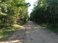
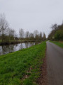
A bucolic, varied and pleasant walk.

Machine-translated

Other walks in the area

For more walks, use our search engine .

The GPS track and description are the property of this route's author. Please do not copy them without permission.