Notre-Dame d’Acey Abbey

Set off to explore some charming villages in the Ognon Valley and round off this route with a visit to the peaceful setting of Acey Abbey.

Details

n°51623566
Creation:
Last update:
Last review:
  • Walking
    Activity: Walking
  • ↔
    Distance: 7.17 mi
  • ◔
    Average duration: 3h 25 
  • ▲
    Difficulty: Moderate

  • ⚐
    Back to start: Yes
  • ↗
    Ascent: + 98 ft
  • ↘
    Descent: - 102 ft

  • ▲
    Highest point: 728 ft
  • ▼
    Lowest point: 633 ft
  • ⚐ Country: France
  • ⚐ City: Bresilley (70140)
  • ⚑
    Start/End: N 47.257691° / E 5.64241°
  • ❏
    IGN map(s): Ref. 3223E
  • Hour-by-hour weather

Description of the walk

Parking is available next to the church in Bresilley or a little further on towards the children’s playground.

(S/E) Take Rue des Graviers and leave the village at a leisurely pace. On leaving the village, carry on straight ahead for about 1 km, then take the path on the left at a 90° angle.

(1) Turn sharply right, also at a 90° angle. Then continue along this path until you reach a road: there is little traffic, but do take care when using it.

(2) Carry on straight along this road for about 2 km until you reach the village of Malans.

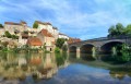
(3) When you come to the church (currently undergoing renovation), turn left onto Rue de la Reine and then right to carefully make your way down Rue du Bac. Follow the course of the Ognon at a leisurely pace.

(4) Cross the metal bridge and take the tarmac road on the other side. Continue for about 2 km until you reach the village of Thervay. Carry on along the main road (Rue des Malans) until you reach the church and the magnificent Fontaine aux Cygnes.

(5) Walk back a few metres and take the road sloping off to the right, running alongside the church. At the bottom of the village, there is a spot where you can have a picnic.

(6) At the junction, turn right to leave the village and carry on straight on to the castle and the Balançon fish spawning ground.

(7) Turn left onto the tarmac road (ideal for rollerblading), carry on straight ahead for about 1.5 km until you reach the D21.

(8) Turn right, then left, following the signs for “abbaye” to visit this Cistercian abbey.

(9) After your visit and perhaps a picnic break, retrace your steps towards the village of Bresilley.

(8) Cross the bridge over the Ognon. Leave the departmental road and turn left to make your way at a leisurely pace to Bresilley Church (S/E).

Waypoints

  1. S/E : mi 0 - alt. 646 ft - Church of Bresilley
  2. 1 : mi 0.88 - alt. 640 ft - Crossroads, turn right
  3. 2 : mi 1.34 - alt. 640 ft - Road
  4. 3 : mi 2.67 - alt. 679 ft - Church of Malans
  5. 4 : mi 2.91 - alt. 643 ft - Bridge over the - Ognon (rivière)
  6. 5 : mi 4.19 - alt. 666 ft - Thervay, Fontaine aux Cygnes
  7. 6 : mi 4.36 - alt. 640 ft - Crossroads
  8. 7 : mi 4.81 - alt. 640 ft - Balançon Castle
  9. 8 : mi 5.92 - alt. 643 ft - D21. T-junction. Return to the abbey
  10. 9 : mi 6.39 - alt. 673 ft - Abbaye d'Acey
  11. S/E : mi 7.17 - alt. 646 ft - Church of Bresilley

Notes

Picnic facilities – tables and benches:

  • at the bottom of the village of Thervay.
  • in front of the abbey, with shade under the trees (9).

Worth a visit

Malans, a ‘Town of Art’: a superb contemporary art trail where young and old alike will enjoy a stroll.

Fontaine des Cygnes in Thervay: in a large round basin, beautiful swans with raised wings ‘swim’. The water comes from the Colombier spring, which rises in the Forêt de la Serre, and flows from the beaks of each of the swans. In the centre of the basin stands a short column, on the capital of which rests a cast-iron vase, which, like the three swans, comes from the Baudin forges in Toulouse-le-Château. This foundry left its mark on the industrial and social history of the Jura.

Ruins of Balançon Castle: built in the 13th century by the Lords of Thervay to control the bridge over the river and the crossroads leading to Salins and the Saône, it was one of the most imposing castles in the County of Burgundy during the Middle Ages. It subsequently belonged to Duke Philip the Good, a staunch defender of Countess Mary of Burgundy, which in 1477 led to reprisals by Louis XI, whose troops ransacked his castle at Balançon.

Acey Abbey: a large Cistercian complex founded at Cîteaux, it has been occupied and put to various uses on numerous occasions, but unlike so many other monasteries, Acey Abbey was not demolished.
Today, the community of Notre-Dame d’Acey comprises 19 monks who run an electrolysis workshop.
Part of the church has been renovated using modern concrete with very clean lines; together with the modern stained-glass windows, the overall effect is rather successful.

Reviews and comments

3.7 / 5
Based on 2 reviews

Reliability of the description
3 / 5
Ease of following the route
4.5 / 5
Route interest
3.5 / 5
fabulon
fabulon

Overall rating : 3.7 / 5

Date of your route : Sep 16, 2024
Reliability of the description : ★★☆☆☆ Disappointing
Ease of following the route : ★★★★★ Very good
Route interest : ★★★★☆ Good
Very busy route : No

The route is entirely on tarmac, which is very disappointing; for us, the aim is to go hiking on footpaths, not on a tarmac road..........a shame, despite the beautiful scenery

Machine-translated

NanaDidi
NanaDidi

Overall rating : 3.7 / 5

Date of your route : Jun 19, 2024
Reliability of the description : ★★★★☆ Good
Ease of following the route : ★★★★☆ Good
Route interest : ★★★☆☆ Average
Very busy route : No

What a pleasure it is to discover a new walk around Acey Abbey!
There are plenty of lovely places of interest along the way: the abbey, of course, but also the Fontaine aux Cygnes and the banks of the Ognon.
BUT there’s a big ‘but’: three-quarters of the route is on tarmac roads, which isn’t very pleasant, especially in hot weather. The worst bit is the road between Malans and Thervay, which is quite busy – 2.5 km with a car passing every two or three minutes (on a weekday, between 2.30 pm and 3 pm): this is unworthy of a hiking ‘trail’ (?).
Let’s look on the bright side: there’s still scope to find alternative routes to preserve the charm of what could be a lovely walk!

Machine-translated

Other walks in the area

For more walks, use our search engine .

The GPS track and description are the property of this route's author. Please do not copy them without permission.