


Author: Odenwald
Way of St James from Bad Wimpfen to Bad Rappenau-Grombach


A short section of the pan-European Way of St James from Bad Wimpfen to Bad Rappenau.
The historical route of the Way of St James from Bad Wimpfen via Bad Rappenau towards Sinsheim is not precisely documented in the archives. However, it is assumed – and historical evidence supports this assumption – that the route followed a long-distance route dating back to prehistoric times, and that it still does so today.
Details
Creation:
Last update:
–
–
Last review:
–
–
-
 Activity: Walking
 -
 Distance: 12.00 mi
 -
 Average duration: 6h 05
 -
 Difficulty: Moderate
 -
-
 Back to start: No
 -
 Ascent: + 604 ft
 -
 Descent: - 374 ft
 -
-
 Highest point: 948 ft
 -
 Lowest point: 472 ft
-
 Country:
Germany
Country:
Germany
-
 City:
Bad Wimpfen
City:
Bad Wimpfen -
 Start: N 49.231466° / E 9.190853°
 -
 End: N 49.227713° / E 8.965333°
 -


 Hour-by-hour weather
Waypoints
- S : mi 0 - alt. 486 ft
- E : mi 12 - alt. 712 ft
Notes
Other walks in the area
Circular walk: Galgenberg – Steinerner Tisch, Bad Rappenau
 Tourism professional4.64 mi
+220 ft
-210 ft
2h 20
Tourism professional4.64 mi
+220 ft
-210 ft
2h 20
 Easy
Departure from Bad Rappenau (Regierungsbezirk Stuttgart)
Easy
Departure from Bad Rappenau (Regierungsbezirk Stuttgart)
This circular walk near Bad Rappenau takes you through the gentle, rolling hills of the Kraichgau region, with its vast fields, meadows and peaceful woodland sections. The contrast between open views and shady paths at the edge of the forest and within the communal woodland is particularly charming. A lovely highlight along the way is the ‘Steinerne Tisch’ (Stone Table) with its shelter – a great spot for a short break. Anyone who appreciates nature, varied trails and tranquil landscapes will find this a thoroughly enjoyable walk.
Westlicher Limesweg (E5) from Neckarburken to Neckarzimmern
 Visorando Member
 9.15 mi
+919 ft
-1,024 ft
5h 00
Moderate
Departure from Elztal (Regierungsbezirk Karlsruhe)
9.15 mi
+919 ft
-1,024 ft
5h 00
Moderate
Departure from Elztal (Regierungsbezirk Karlsruhe)
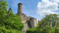
After conquering France, the Romans advanced across the Rhine. The Odenwald Limes was built to secure the route between the Main and Neckar rivers, which were considered natural borders. Built around 85 AD, this border wall was intended to protect the Roman province of Germania Superior.
The fifth and final stage of your hike takes you along the former border line from Neckarburken to Neckarzimmern.
During this scenically and culturally enriching tour, you will pass the remains of Roman watchtowers, forts (troop quarters), bathing facilities and border fortifications. Informative boards point out the sights and provide insights into life in the former border region.
Lemberger Tour, 3B-Land
6.39 mi
+640 ft
-643 ft
3h 30
Moderate
Departure from Bönnigheim (Regierungsbezirk Stuttgart)
From Bönnigheim to Michaelsberg – a stunning panoramic view over the Zabergäu, Germany’s oldest adventure park and the Lembergermeer!
The path winds its way up to Michaelsberg, past seemingly endless rows of vines, which hang heavy with grapes in summer.
Even from a distance, St Michael’s Chapel greets you – a stunning sight, surpassed only by the view once you’ve climbed the hill, which stands at just under 400 metres.
Felsengarten Tour, 3B-Land
10.90 mi
+745 ft
-768 ft
5h 40
Moderate
Departure from Besigheim (Regierungsbezirk Stuttgart)
With half-timbered houses, panoramic views of the Neckar and breathtaking gorges – discover the vineyard and rock scenery around Besigheim.
Starting in Hessigheim, the tour leads along narrow paths up into the Felsengärten and offers views across the Neckar to the medieval town church of Besigheim. Following quiet country lanes, you reach the historic old town, which, with its traditional half-timbered houses and cosy alleyways, invites you to linger. On the banks of the Neckar, through tranquil vineyards, the route takes you past the Salenkanzel back to the starting point.
Western Limes Trail (E4) from Limbach-Wagenschwend to Neckarburken
 10.06 mi
+499 ft
-1,575 ft
5h 05
Moderate
Departure from Limbach (Regierungsbezirk Karlsruhe)
10.06 mi
+499 ft
-1,575 ft
5h 05
Moderate
Departure from Limbach (Regierungsbezirk Karlsruhe)
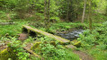
After conquering France, the Romans advanced across the Rhine. The Odenwald Limes was built to secure the route between the Main and Neckar rivers, which were considered natural borders. Built around 85 AD, this border wall was intended to protect the Roman province of Germania Superior.
The fourth stage of your hike takes you along the former border line from Limbach-Wagenschwend to Neckarburken.
During this scenically and culturally enriching tour, you will pass the remains of Roman watchtowers, forts (troop quarters), bathing facilities and border fortifications. Informative boards point out the sights and provide insights into life in the former border region.
“Die Bach nab” – Three footbridges in the Elz Valley
7.03 mi
+548 ft
-535 ft
3h 45
Moderate
Departure from Buchen (Odenwald) (Regierungsbezirk Karlsruhe)
A varied walk through the tranquil Elz Valley: from Einbach, the route follows historic paths over panoramic heights, past old mills, wayside shrines and small cultural monuments, all the way to the ‘Dreistegen’ near Scheringen. Time and again, beautiful views open up over the Wiesental valley and the stream that winds its way through the valley. Anyone who enjoys nature, history and quiet paths will find this a particularly charming route.
The Katzensteig – an alternative to stages 5 & 6 of the Neckarsteig
 16.33 mi
+3,114 ft
-2,992 ft
10h 15
16.33 mi
+3,114 ft
-2,992 ft
10h 15
 Difficult
Departure from Eberbach (Regierungsbezirk Karlsruhe)
Difficult
Departure from Eberbach (Regierungsbezirk Karlsruhe)
The Katzensteig connects the towns of Eberbach and Neckargerach. This route, which is around 26 kilometres long, is an interesting alternative to stages 5 and 6 of the Neckarsteig and offers a mix of nature, impressive views and cultural attractions.
In 7 stages through the Neckar Valley from Heidelberg to Bad Wimpfen
 22.62 mi
+3,684 ft
-3,589 ft
7 days
Difficult
Departure from Hirschhorn (Regierungsbezirk Karlsruhe)
22.62 mi
+3,684 ft
-3,589 ft
7 days
Difficult
Departure from Hirschhorn (Regierungsbezirk Karlsruhe)
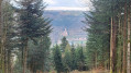
The Neckarsteig stretches over 128 kilometres from Heidelberg to Bad Wimpfen, winding its way along the majestic Neckar River through the picturesque region of Baden-Württemberg. This route promises an unforgettable journey through a variety of landscapes, from gentle vineyards to imposing rock formations.
Along the route, you can expect challenging climbs as well as relaxed sections along the river. You can look forward to varied landscapes ranging from wooded slopes in the Neckar Valley to charming half-timbered towns and historic castles.
We have designed the sections so that you can reach every start and end point of a stage by public transport.
For more walks, use our search engine .
The GPS track and description are the property of this route's author. Please do not copy them without permission.

