Country:
 City:
City:


The route starts from the car park at the junction of Rue Sainte-Anne and Rue George Clémenceau (D19).
Red signposting: “Ça roule avec Richard Cœur de Lion”
(S/E) Take Rue Sainte-Anne, continue straight on along Rue du Boisdet, and you’ll come to two roundabouts in succession.
(1) As you leave the second roundabout, turn left onto Rue de la Tourette and, at the next roundabout, take thesecond exit onto Route de l’Abbaye du Lieu Dieu. Pass number 102 and you’ll soon reach a fork in the road.
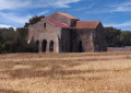
(2) Ignore Rue de la Sausaie on the right (which leads back), and carry on straight ahead. At No. 127, turn right onto the road (Chemin de l’Abbaye), and you will reach the Abbey of Notre-Dame du Lieu Dieu.
(3) Then turn round and head back to No. 102, Route de l’Abbaye du Lieu Dieu.
(2) Turn left onto Rue de la Sausaie, then continue along the cul-de-sac, Chemin du Plumat.
(4) On leaving Jard-sur-Mer, continue along Chemin des Grippaudières until you reach the next junction. Turn left, and you’ll soon reach the next one.
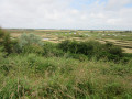
(5) Carry on straight ahead (no entry, except for residents and cyclists), and stay on the main track, which cuts through the marsh, until you reach the hamlet of La Vinière.
(6) At the crossroads, turn left (Route de la Vignère) and you’ll reach a four-way junction in the village of Ilaude.
(7) Ignore the village and turn right, towards Talmont-Saint-Hilaire. Carry on straight ahead until you reach a three-way junction.
(8) Turn left at the next junction, head straight ahead, and continue straight on. Pass through the tunnel under the motorway, enter Talmont-Saint-Hilaire, and reach the end of Chemin du Réémetteur.
(9) Turn left onto the cycle path (Rue de l’Océan, D21), then follow it as it continues to the left after No. 25. Pass under a road bridge and come to two successive roundabouts.
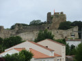
(10) As you leave the second roundabout, turn right onto Rue des Arcettes, continue along Rue des Puits Doux and arrive at a four-way junction. Ignore the Passage du Plan d’eau opposite and carry on to the left until you reach the foot of the castle (the entrance is a few metres further on, to the right).
(11) Head left, straight on until you reach the D2949. First turn right then left and continue along Rue du Vigeau. At the next roundabout, turn right onto the cycle path and proceed through two successive roundabouts.
(12) As you leave the second roundabout, keep left onto the cycle path, Avenue des Sports. Leave the village, go under the road bridge, and turn left onto Rue des Eaux.
(13) Turn left onto the cycle path and ride straight through the hamlet of Les Eaux. At the next junction, turn left onto Rue de la Clartière and continue for 200 m.
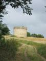
(14) Take thefirst path on the right and head towards a tower near Les Hautes-Mers.
(15) Turn round.
(14) At the road, carry on to the right. Continue for about 200 m, take the cycle path on the left, and, at the three-way junction, keep left. Head for the Passerelle du Cul d’Âne footbridge over the Chenal du Payré.
(16) Continue along the cycle path; at the next junction, first turn left then right and carry on straight ahead until you reach a crossroads. Turn right then left onto Rue des Salines, enter La Guittière and take thefirst street on the right, Rue des Castors. Continue along the cycle path which runs alongside the houses on your left, ignore Rue des Marguerites on the left, and arrive at a four-way junction.
(17) Head straight ahead onto Rue du Bitor and, at the end of this street, turn right (Rue des Courpes) until you reach a three-way junction with a small copse in the centre.
(18) Keep to the right and carry on straight ahead until you rejoin the route you took earlier at Ilaude.
(7) Carry on straight ahead along Rue de la Vinière, and follow the route in the opposite direction to the outward journey. Cross the marsh and reach the end of Route des Amourettes.
(5) Leave the route you’ve already taken and turn left onto Route des Amourettes, heading towards the Observatoire du Marais, which you’ll reach quickly. Do stop off there if you like, then carry on along the road. Pass the recycling centre and, at the next junction, turn right onto Rue de l’Île Perdue. Enter Jard-sur-Mer and carry on to the end of this street.
(19) Turn left (Rue de la Perpoise) and, at the roundabout opposite the church, turn right (Rue Paul Baudry) to reach the car park on Rue Sainte-Anne (S/E).


 Tourist office
 Moderate