Country:

 City:


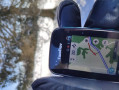
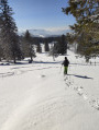
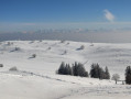
Important preliminary note: the walk described here is designed for winter, which is what makes it so appealing. However, this is a season when it is not possible to navigate by the terrain at this altitude. A GPS is therefore recommended, especially for the return journey, which is less straightforward (or a compass, altimeter and map for the more traditional among you).
Park at the small car park known as Chez-les-Favres, which fills up very quickly from 10.00 am. Latecomers usually manage to park as best they can along the road towards Provence.
(S/E) Head due east for a few metres until you quickly reach a junction with thefirst yellow sign.
(1) Turn slightly left and follow the signs for Le Soliat and Le Creux du Van. The road is hidden under the snow. Follow the Yellow Diamonds along this route. Head towards the junction at the Petites Fauconnières farm.
(2) Leave the farm on your right. Continue to follow the Yellow Diamonds. You’ll reach another junction marked by a yellow sign.
(3) Head straight ahead and follow the signs for Ferme du Soliat and Cirque du Creux du Van. The wide track narrows to a path, crosses a flat stretch before climbing through the woods towards Ferme du Soliat. You’ll spot it at the very last moment at the end of the climb through the woods.
(4) Walk past the farm on the right and head for the yellow sign with its eight directional arrows. Walk alongside the front of the farm and carry on straight ahead towards the ‘Sentier des 14 Contours’ and Noraigue. You’ll soon reach the northern corner of the cirque with its information boards.
(5) At the northern corner of the cirque, carry on for 50 metres towards Noraigue to enjoy the view, then turn back to the corner. Next, walk along the edge of the cirque, heading southwards uphill.
Halfway there, stop at the promontory to admire the cirque and its cliffs. But take care and give the experimental alpine flora replanting area a wide berth. Continue along the ridge and pass the commemorative plaque for Sapeur Jean Pilloud, who tragically lost his life here. Carry on to the southern viewpoint of the cirque.
(6) Head south to reach the highest point of the hillock. Then turn right to reach the clearly visible cross at Le Soliat.
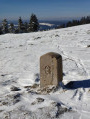
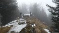
(7) Continue south-west, then turn north-west until you first see a historic stone boundary marker, followed by a partially buried shelter. Then head north-west until you reach a post with yellow arrows, but no directional sign.
(8) Turn left towards the south-west and head down through the sparse woodland. You’ll cross a cross-country ski trail; continue in the same direction towards the complex of buildings at the Petites Fauconnières farm-restaurant.
When you reach it, turn right to reach the edge of the woodland, which you follow for a few metres until you come to a yellow marker. Head due east into the sloping woodland, descending for 180 metres until you reach some fields.
Turn right towards the north-west and carry on until you reach the Y-junction with the first yellow signpost you passed on the way out.
(1) Turn left and follow the same route as on the way there to reach the Chez-Les-Favres car park (S/E).

 Visorando Member


 Easy
 Association / Club / Walk leader