


Refine your search for walks in Hasselt
Hasselt walks


 The land of 1001 ponds between Hasselt and the Demer valley
 Visorando Member
 10.68 mi
 +66 ft
 -75 ft
 5h 00
5h 00
 Moderate
 Departure from Hasselt (Province de Limbourg)
Between Hasselt and the Demer valley lies a world of water and mist, shaped by floods and time. Herkenrode Abbey, founded in the 12th century, marks the starting point: a Cistercian centre, it recalls the ancient link between spirituality and nature.In Stokrooie, the landscape becomes wetter before reaching the Albert Canal, dug in the 20th century, a marriage between industry and ecology.The Wijvenheide nature reserve reveals its peaceful ponds, where herons, kingfishers and ospreys thrive. The Kleine Vijver, Witven and Grote Platwijer are home to a rich variety of flora and fauna, between reed beds and floodplains.The Zonderikbeek and Vrankenschans meander through peat bogs and fields, witnesses to a time when the Demer shaped local life.The walk ends at the Bosvijver and the Vossen Kuil, where the silence of the water mingles with the breath of the wind.
The Wijers ponds
 9.09 mi
+36 ft
-36 ft
4h 15
9.09 mi
+36 ft
-36 ft
4h 15
 Easy
Departure from Zonhoven (Province de Limbourg)
Easy
Departure from Zonhoven (Province de Limbourg)
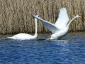
This region, with its 1,001 ponds and numerous nature reserves, is full of beautiful trails for hikers. Here is one that takes you between the main Wijers ponds and the Albert Canal, which connects the Meuse and Scheldt rivers between Liège and the port of Antwerp.The ponds and the surrounding aquatic and rural landscapes are absolutely magnificent in good weather.
In the heart of Limburg's fruit-growing region since Kozen
10.29 mi
+102 ft
-102 ft
4h 50
Moderate
Departure from Nieuwerkerken (Province de Limbourg)
The Sint-Truiden region is renowned for its cherry (to a lesser extent), apple and pear orchards. The walk offers the chance to see them up close (very close). We particularly recommend it during the flowering season, usually in April.
Schulensboek, Demer valley
9.82 mi
+36 ft
-36 ft
4h 35
Moderate
Departure from Herk-de-Stad (Province de Limbourg)
Welcome to the Demer valley, where water, reeds and meadows form a living landscape, shaped by time and floods. Around the village of Schulen, the Gulkerveld is reminiscent of the former floodplain, once feared, now a refuge for birds and botanists.With its 700 hectares, the Schulensbroek nature reserve is one of the largest wetlands in Flanders. Herons, greylag geese, lapwings and bitterns share the ponds and meadows.The Halbekerdijk, an old dyke, bears witness to the struggle against the waters, while the drier Vijversheide contrasts with its pine and birch trees. The Schulensmeer, created to regulate the floods of the Demer, has become a paradise for aquatic wildlife.Area: +700 ha, origin: floodplain, special features: artificial lake turned reserve, migratory birds, wetland flora.Here, the water tells the story of the landscape and the passage of time.
Schulensmeer and Schulensbroek
 7.74 mi
+20 ft
-20 ft
3h 35
Moderate
Departure from Herk-de-Stad (Province de Limbourg)
7.74 mi
+20 ft
-20 ft
3h 35
Moderate
Departure from Herk-de-Stad (Province de Limbourg)
Schulen Lake and the adjacent marshes are part of the Wijers region , which is home to 1,001 ponds. It is a paradise not only for birds, but also for birdwatchers and walkers. Of course, bird populations vary depending on the season, but you will almost always see egrets, ducks, cormorants, coots, herons, geese and sometimes even the odd kingfisher. Goats and sheep are helping to rehabilitate some of the banks.
Through the orchards around Hoepertingen
 11.38 mi
+266 ft
-246 ft
5h 30
Moderate
Departure from Sint-Truiden (Province de Limbourg)
11.38 mi
+266 ft
-246 ft
5h 30
Moderate
Departure from Sint-Truiden (Province de Limbourg)
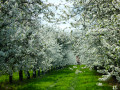
Pear, apple and cherry trees, a few vines and strawberry plants ensure the richness and reputation for fruit-growing of this part of the Limburg Hesbaye. Orchards galore to admire in spring during the blossom and later in the season for their fruit production.
Borgloon and its Transparent Chapel
3.43 mi
+174 ft
-167 ft
1h 45
Easy
Departure from Borgloon (Province de Limbourg)
A short, peaceful walk in Borgloon, through the countryside and past fruit orchards. The walk follows land consolidation and country lanes used by a few farm vehicles and cyclists, with a brief detour past the Transparent Chapel and the Roman Villa landmark.
Circular through the Limburg orchards starting from Helshoven
 8.11 mi
+213 ft
-220 ft
3h 55
Moderate
Departure from Borgloon (Province de Limbourg)
8.11 mi
+213 ft
-220 ft
3h 55
Moderate
Departure from Borgloon (Province de Limbourg)
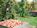
Pear, apple and cherry trees, as well as vines, strawberry plants and currant bushes, ensure the wealth and reputation of this part of Limburg's Hesbaye region for its fruit production. There are orchards galore to admire in spring when they are in bloom and later in the season when they are producing fruit.
Het Vinne
10.99 mi
+30 ft
-30 ft
5h 05
Moderate
Departure from Zoutleeuw (Brabant flamand)
Country walk starting from the provincial estate "Het Vinne".Ponds, rivers, orchards, pastures and crops for the hiker's enjoyment!There are a few observation points at the edge of the pond.
From castles to orchards in Sint-Pieters-Heurne
 10.32 mi
+374 ft
-354 ft
5h 05
Moderate
Departure from Heers (Province de Limbourg)
10.32 mi
+374 ft
-354 ft
5h 05
Moderate
Departure from Heers (Province de Limbourg)
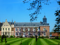
Starting from Sint-Pieters-Heurne, the walk takes you through the rather hilly countryside of Limburg Hesbaye, passing by a castle here, a chapel there, a limestone cave, an orchard, or a large square-shaped Hesbaye farmhouse.Although the region is criss-crossed by land consolidation tracks and concrete cycle paths, traffic is usually limited to a few farm vehicles, bicycles and occasionally a group or two of Vespa enthusiasts.That said, the route also follows numerous country lanes and forest tracks where you mainly come across only walkers or joggers.The numerous orchards (pear and apple trees) add a pleasant touch to the route when in bloom.
Route des Châteaux à Tongeren
 8.40 mi
+272 ft
-279 ft
4h 05
Moderate
Departure from Tongeren (Province de Limbourg)
8.40 mi
+272 ft
-279 ft
4h 05
Moderate
Departure from Tongeren (Province de Limbourg)
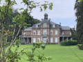
A pleasant walk in the north-western part of the town of Tongeren, following old tree-lined railway tracks, crossing the Herkwinning Nature Reserve and taking in a few castles and fortified farms in a varied environment of copses, low-stem orchards, meadows and fields.
Route proposed by the walking club "Les Pantouflards de Wihogne" (FFBMP, LG041).
Historic centre of Tongeren and Kevie Nature Reserve
 7.73 mi
+66 ft
-69 ft
3h 35
Moderate
Departure from Tongeren (Province de Limbourg)
7.73 mi
+66 ft
-69 ft
3h 35
Moderate
Departure from Tongeren (Province de Limbourg)
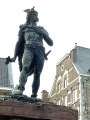
A pleasant and varied walk, combining culture and exercise, in and around Tongeren, Belgium’s oldest town. It takes you through the historic districts (the Beguinage, the ramparts, the basilica, etc.) as well as the adjoining nature reserve. The Geer (Jeker in Dutch), its branches and tributaries are a defining feature of the region.
Tongrian Hesbaye: Lauw – Hestappe
 7.82 mi
+200 ft
-190 ft
3h 45
Moderate
Departure from Tongeren (Province de Limbourg)
7.82 mi
+200 ft
-190 ft
3h 45
Moderate
Departure from Tongeren (Province de Limbourg)
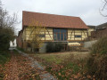
A refreshing country walk in Tongrian Hesbaye, taking us from the small village of Rutten to Lauw, following the River Geer and returning via Herstappe, a Walloon enclave in the heart of Flemish Limburg.
Walk organised by the walking club ‘Les Pantouflards de Wihogne’ (FFBMP, LG041)
Walk around Oreye
6.39 mi
+190 ft
-171 ft
3h 05
Moderate
Departure from Oreye (Province de Liège)
A walk passing through the villages of Oreye, Otrange and Lauw (in Flanders). Half of the walk follows the River Geer through a lush, relaxing green setting. The other half winds through the villages and takes you up a slight incline.
The sand dunes of the Oudsberg
 11.43 mi
+161 ft
-141 ft
5h 25
Moderate
Departure from Opglabbeek (Province de Limbourg)
11.43 mi
+161 ft
-141 ft
5h 25
Moderate
Departure from Opglabbeek (Province de Limbourg)
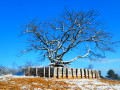
The Limburg Campine region is home to many gems, including several nature reserves with magnificent sand dunes. This walk crosses the Oudsberg nature reserve on the last authorised paths, offering alternating landscapes of heathland and pine or deciduous forests (beech, birch, etc.). Although the entire route is relatively flat, the nature reserve, at the geographical centre of the route, is quite hilly for the region.Of course, the sand under the snow is only visible in certain places. However, without the snow, the sand is clearly visible in the heart of the Oudsberg nature reserve. Most of the route is wooded, but the landscape is a little more rural at the eastern and northern ends.
Hike without description to be followed with the Visorando app.
The Geer Valley starting from Glons
 7.78 mi
+246 ft
-233 ft
3h 50
Moderate
Departure from Bassenge (Province de Liège)
7.78 mi
+246 ft
-233 ft
3h 50
Moderate
Departure from Bassenge (Province de Liège)
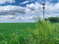
A refreshing country walk along the slopes and plateau of the Geer valley, featuring sunken lanes and paths running alongside the stream.
Walk organised by the walking club "Les Pantouflards de Wihogne" (FFBMP, LG041).
Nature walk in Meerhout
 11.74 mi
+167 ft
-167 ft
5h 35
Moderate
Departure from Meerhout (Province d'Anvers)
11.74 mi
+167 ft
-167 ft
5h 35
Moderate
Departure from Meerhout (Province d'Anvers)
Located south-east of Geel and south-west of Mol and Balen, the municipality of Meerhout remains relatively untouched by the growing encroachment of housing and industry of all kinds. So make the most of it while you can, and that is exactly what this circular route offers: the chance to explore the region’s forests, countryside and heathland, along with a few canals and rivers –pure bliss.
Keiheuvel-de-Most, dunes and marshes
11.23 mi
+66 ft
-66 ft
5h 15
Moderate
Departure from Balen (Province d'Anvers)
The Keiheuvel walk is a spectacular stretch of sand reminiscent of the Sahara, with peaceful spots, fresh forest air and a sea of purple heather. After a few steps, a vast panorama of sandy plains, ponds and dune meadows lined with fragrant pine trees opens up. Despite their desert-like appearance, the dunes are full of life, home to larks, nightjars and a multitude of insects. After a detour along the canal to Beverlo, the walk reaches De Most. The low, wet valley contrasts with the high, dry Keiheuvel. The wetlands are home to rare plants and animals. De Most, a former hunting ground and resistance refuge, is now a haven of peace. The combination of these two environments makes Keiheuvel-De Most unique.
Circular route via Slins, Glons and Boirs
 8.24 mi
+381 ft
-384 ft
4h 05
Moderate
Departure from Juprelle (Province de Liège)
8.24 mi
+381 ft
-384 ft
4h 05
Moderate
Departure from Juprelle (Province de Liège)
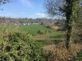
This walk on the edge of Hesbaye takes us to the Geer Valley, passing through expanses of farmland, low-stem orchards and wooded strips, whilst offering fine views of the valley.
A circular walk starting from Fexhe-Slins
 9.68 mi
+604 ft
-607 ft
5h 00
Moderate
Departure from Juprelle (Province de Liège)
9.68 mi
+604 ft
-607 ft
5h 00
Moderate
Departure from Juprelle (Province de Liège)
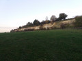
On the edge of Hesbaye, vast fields still make up the bulk of the landscape. This walk, however, takes you along a few tree-lined paths and through wooded valleys, and also allows you to discover a typical (and listed) limestone meadow that has developed following the reclamation of a former quarry.
Walk organised by the walking club “Les Pantouflards de Wihogne” (FFBMP, LG041)
Circular walk starting from Waroux Castle
4.72 mi
+75 ft
-75 ft
2h 15
Easy
Departure from Ans (Province de Liège)
A circular walk starting from Waroux Castle towards the village of Xhendremael and back.
The Henri-Fontaine stream valley between Orp and Grand-Hallet
 9.16 mi
+292 ft
-292 ft
4h 30
Moderate
Departure from Hannut (Province de Liège)
9.16 mi
+292 ft
-292 ft
4h 30
Moderate
Departure from Hannut (Province de Liège)
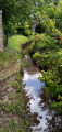
The Hesbaye region of Liège is not only characterised by its rich agricultural plain, but also by its charming sites, consisting of wetlands, copses and sunken paths. This route, which starts in the village of Petit-Hallet, offers views of the vast plain, but above all allows you to discover pleasant places in the heart or on the outskirts of the villages that stretch along the Henri-Fontaine stream. A few farmhouses and castles can also be seen along the way.