Country:

 City:
City:


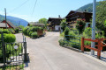
You can park in the station car park or simply come by train!
(S/E) From the station car park, head towards the village centre via Rue de la Gare and you’ll come out onto Grand’Rue.
(1) Turn right (Red Ring signposting), cross the Fecht, then turn left onto Rue du Buhl and, a little further on, right onto Rue du Braun. At the end, carry on straight ahead along the path which climbs quite steeply, signposted Blue Ring/Red Ring. At the top of the Burgstein, at the foot of a small castle, turn left onto the path which leads onto the Chemin des Sources. Continue straight on downhill. At the junction with Rue du Sillacker, turn left.
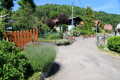
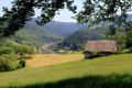
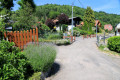
(2) Turn right onto the picturesque Rue des Vergers. Carry on straight ahead and, at the junction with Rue de l’Altenhof, turn right (marked Blue Ring/Red Saltire) and continue to the inn and chalets at Wormsa. Carry on to the left and cross the River Fecht via the small Steinabruck bridge.
(3) On the right, follow the road towards Mittlach, then take the path leading to Wolfgasse. Turn left through the small park on Wolfgasse (not via the forest path towards Schnepfenried), which serves as a venue for celebrations and social gatherings, heading towards the centre of the village of Metzeral. Walk past a small football pitch and take the pleasant path through the forest.
(4) At the first junction, turn right, following the sign for “Schnepfenried via Blue Disc”. The path winds its way uphill to a forest track. Take a detour to the viewpoint on the left, then retrace your steps and continue along the forest track (unmarked), which climbs past a small castle known as “Château Immer” and some small granite pumping stations. After a wide bend to the right, you’ll reach a small crossroads.
(5) Turn left, towards “Emm”. At the bottom of the rather steep path, turn left, then, at the junction, turn right towards the majestic church of Emm, which overlooks the Great Munster Valley. Make your way to the church.
(6) Before heading down towards the village, step inside the church, built from Carrara and Siena marble, a monument dedicated to the soldiers who fell during the First World War. Walk down the hill of Emm, keeping straight on, until you reach a bus stop, near the Maison des Associations de la Wormsa and a former factory that has been converted into a business incubator.
(7) Turn right onto the path and cross the stream known as the Fecht. Further up, at the site of a former skittle alley, take the narrow, very steep path (unmarked) opposite, which climbs through the forest and joins a marked forest track. Turn right and stay on this path, marked with a Blue Diamond, until you reach the hamlet of Meyersbuhl.
(8) On this circular path, follow the unmarked path branching off to the left towards Kuhfeil. Pass one junction and come to a second.
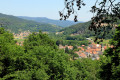
(9) Turn left onto the path marked with a Red Saltire and Red Ring towards the magnificent viewpoint, which overlooks Metzeral and the Upper Fecht Valley, with the Rothenbachkopf on the horizon.
Head down the path, which becomes a forest track, still signposted with the Red Saltire and Red Ring symbols, until you reach an idyllic path on the right. This path leads into the village at the nursery school. Walk down Rue de la Gare until you reach the school (S/E).

 Visorando Member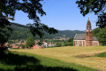

 Easy
Easy 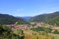
 Difficult