Country:

 City:
City:


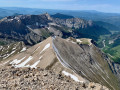
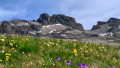
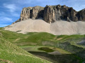
Shortly after crossing the bridge over the Buëch, you pass through the hamlet of "Les Granges des Forêts". Continue for a further 500 m or so to reach a car park on the right-hand side of the road, equipped for hiking departures.
(S/E) Head east and take the path that runs alongside the Buëch. Ignore all the turnings on the left.
(1) Just before a footbridge over the Buëch, leave the main path and take a path on the left towards Lac du Lauzon. Head uphill, heading north.
(2) Join a track and follow it to the left, uphill. After a hairpin bend to the right, the track continues eastwards for a long stretch. Then take two hairpin bends to reach a junction just before the Cabane du Fleyrard.
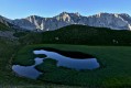
(3) Leave the track, follow the “Lac” sign and take a path that climbs. The path soon turns north-east along the ridge, with a steep gradient (terrain may be slippery after rain). You will arrive at Lac du Lauzon (a small marshy lake), from where there is a beautiful panoramic view of the Jarjatte valley.
(4) Go round the lake to the right and, at a junction on the northern shore, turn right (north-east).
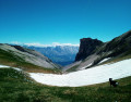
(5) At the next junction, continue north-east and climb up to the Col du Charnier (view over the whole Charnier valley).
(6) Stay on the path that heads left (do not start the descent into the valley straight away). Soon turn right and climb diagonally (north-east then north) at the foot of the Tête de Vallon Pierra.
(7) Head north-west to begin the ascent of the Grand Ferrand, climbing up the Vallon Froid.
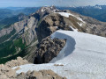
(8) Then head north up a steeper slope. Go round a rocky spur to the left and make your way across a scree slope. The slope becomes very steep and there is no real path. You must follow the few markings on the rocks to guide you. Near the top, negotiate a few rocky outcrops (using your hands). You will thus reach the summit of the Grand Ferrand.
(9) The descent follows the same route as the ascent to the junction between the Col du Charnier and Lac du Lauzon (do not descend all the way to the lake).
(5) Take the path on the right and descend diagonally (east-southeast then east) to the foot of the Tête de Lauzon. When you reach a break in the slope (shortly after the 2016 metre mark), turn left and descend via switchbacks. This will take you to the Col des Aurias.
(10) Then turn right and continue descending along theGR® (do not climb the hillock – elevation 1762 – opposite). Descend in switchbacks then traverse (west-south-west) to reach the Col de la Croix.
(11) Then take the path on the left which descends towards the Jarjatte valley (leave theGR® and follow the green and yellow markings ofthe GRP® Tour du Dévoluy). Descend, ignoring the paths branching off to the left.
(12) You will come out onto a road; follow it to the left to quickly reach the car park (S/E).

 Visorando Member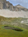
 Moderate
 Difficult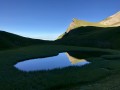
 Extremely difficult