Country:

 City:
City:


To reach Trayas station, take care when leaving the coastal road coming from the east. Take Boulevard Théo Guichard; a sign points to the station, but be careful to leave this boulevard fairly quickly at a bend and turn left. Asecond sign on the wall indicates the station. Once there, park and do not cross the tracks; there is a small car park on your left.
(S/E) The hike starts on the track opposite the car park: follow the railway line. At the first junction, keep to the right. The climb is gradual.
(1) Further up on the right, ignore the fork leading towards Col Notre-Dame. We’ll come back this way. Continue the climb to Col des Lentisques.
(2) At the pass, cross the junction by heading left straight ahead. Further on, leave the tarmac track heading towards Baisse des Sangliers by taking the path slightly downhill where there is a barrier. Begin a long descent along a track running alongside the Ravin de l’Ubac de l’Escale: stunning views. Descend to the Mal Infernet track and turn right.
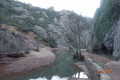
(3) At the Gué du Ravin du Mal Infernet, cross the ford and continue to the right; the path is very easy.
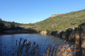
(4) Pass downstream of the former Lac de l’Écureuil, a pleasant spot with a small reservoir. Stay on the main track and begin the next climb. Pass below the area previously occupied by the Lac de l’Écureuil reservoir. Beautiful view through the eucalyptus trees. The climb is steady; further up, the gradient is less steep. Pass a small lake before a few hairpin bends leading towards the Baisse de la Grosse Vache.
(5) At the summit, turn right. The track is easier going and offers lovely views of another part of the massif opposite in the distance: Mont Vinaigre. Continue along the main track via Baisse Mathieu.
(6) Staying on this same track, reach the Col des Suvières.
(7) Then begin the ascent by turning left towards Baisse Violette
(8) The bulk of the ascent is now behind you; leave the track and head right.
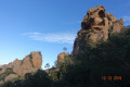
Caution: this is no longer a track. The path to follow is not very visible for the first few metres up to a place called La Clavette: superb boulders (elevation 363m).
(9) Caution: a narrow section for several metres, but no particular difficulty; however, do take care, especially if the ground is wet. The path descends then turns right into the undergrowth, leading to Pas de la Cèpe.
(10) Continue along this shaded path to the Col des Trois Termes (elevation 303 metres), a pleasant spot.
(11) Pass the crossroads. ‘To the left, the track leads to the Maison Forestière’. Head straight on towards the Col de la Cadière.
(12) At Baisse des Cascades, the route, which is more open, follows a flat tarmac track towards the Col de la Cadière, a popular crossing point for many hikers
(13) Leave the track and head straight ahead; do not take the descending track but the one slightly higher up towards the Col du Trayas, on theGR®51.
(14) At the pass, turn right and continue along the track to Pic Martin. On the slope to the right is a small wayside shrine. Leave the track straight ahead and continue to the right for the final climb to Col Notre-Dame.
(15) Cross the plateau heading due south. Take the road on the left; be careful, as the path you need to take descends immediately to the left. The path is narrow and descends steadily through the vegetation. Continue the descent until you reach the junction with the original track.
(1) At the junction, turn left to reach Trayas station (S/E).


 Visorando Member
 Moderate
 Difficult