Glen Brittle: between sea and mountains

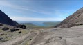
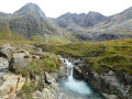
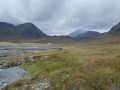
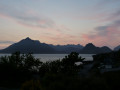
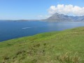
Situated at the foot of the highest peaks on the Isle of Skye, Glen Brittle and its loch offer a unique hike to the ‘end of the world’.
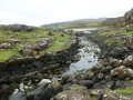
At Rudh an Dùnain, there is an ancient chapel in ruins; further on, an inland loch (Loch na h-Àirde) is strangely connected to the ocean by a so-called ‘Viking’ channel, which allows the high tides to pour in salt water, as well as a wall of what must once have been a fortress.
A massive defensive wall still encloses the south-western section.
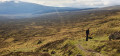
And then, in season, the Càrn Mòr plateau is covered in flowering heather: quite simply magnificent.
Another natural feature here is a huge stone staircase set right in the middle of the moor, allowing you to climb the slope.
Soak up the colours, the light and the scents of this place, where sheep are, here too, the main inhabitants.
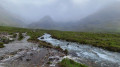
As is the case throughout the region: spongy ground, peat, waterfalls, fords… water is ever-present here and is never shy about falling from the sky at any moment.

Details

103481648
Creation:
Last update:
Last review:
  • Walking
    Activity: Walking
  • ↔
    Distance: 11.65 mi
  • ◔
    Average duration: 6h 50 
  • ▲
    Difficulty: Difficult

  • ⚐
    Back to start: Yes
  • ↗
    Ascent: + 1,709 ft
  • ↘
    Descent: - 1,709 ft

  • ▲
    Highest point: 1,276 ft
  • ▼
    Lowest point: 7 ft

Photos

Waypoints

  1. S/E : mi 0 - alt. 39 ft - Glen Brittle
  2. 1 : mi 0.43 - alt. 358 ft - Fault with waterfall
  3. 2 : mi 1.88 - alt. 1,266 ft - Access to the mountain
  4. 3 : mi 4.24 - alt. 59 ft - Waterfalls
  5. 4 : mi 6.34 - alt. 138 ft - Chapel in ruins
  6. 5 : mi 6.9 - alt. 7 ft - Viking Canal
  7. 6 : mi 7.7 - alt. 72 ft - Natural staircase
  8. 7 : mi 10.72 - alt. 10 ft - Campsite
  9. S/E : mi 11.65 - alt. 39 ft - Glen Brittle

Notes

For a change: the (small) car park at the starting point and the one at the end of the tarmac road (campsite entrance) are free of charge.

Note that the route between the chapel ruins (4) and the rejoining of the main trail is quite ‘open’… it sometimes follows a well-marked path, sometimes just a faint track, and takes twists and turns to avoid overly wet areas. In places, rely on your instincts and sense of direction: there are no cairns here, just peat and sheep watching the walker pass by without much reaction.

The ‘difficult’ rating stems not from the distance or the total elevation gain, but from the rather tricky terrain in the southern part of the walk.

Anyone wishing to go on a mountain hike should take the path on the left between (1) and (2) or continue straight on via (2). Be careful, however, to only venture into this mountain range in favourable weather conditions. Do not attempt the hike in overcast conditions or if there is a risk of a storm. The locals will confirm this.

Other walks in the area

For more walks, use our search engine .

The GPS track and description are the property of this route's author. Please do not copy them without permission.