


Circular Sligachan loop to the Fairy Pools and back


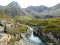
This unmissable walk to the Fairy Pools passes to the west of the Isle of Skye’s highest peaks and offers the chance to discover a multitude of ‘pools’ created by a succession of waterfalls fed by dozens of torrents rushing down the slopes of the surrounding mountains.
Whilst most of the waterfalls are on the right-hand side of the path in the lower part of the walk, there are one or two quite remarkable ones on the left-hand side too, along the stream flowing down from the north-western plateau.
Details
Creation:
Last update:
Last review:
–
–
-
 Activity: Walking
 -
 Distance: 10.94 mi
 -
 Average duration: 6h 45
 -
 Difficulty: Average
 -
-
 Back to start: Yes
 -
 Ascent: + 1,955 ft
 -
 Descent: - 1,939 ft
 -
-
 Highest point: 1,155 ft
 -
 Lowest point: 75 ft
-
 Country:
United Kingdom
Country:
United Kingdom
-
 City:
Highland
City:
Highland -
 Start/End: N 57.288977° / W 6.177218°
 -


 Hour-by-hour weather


Photos
Waypoints
- S/E : mi 0 - alt. 75 ft - Sligachan Mountain Rescue
- 1 : mi 0.18 - alt. 92 ft - Waterfall
- 2 : mi 3.18 - alt. 1,119 ft - Fork
- 3 : mi 4.78 - alt. 292 ft - Junction
- 4 : mi 5.69 - alt. 463 ft - Fairy Pools
- 5 : mi 6.6 - alt. 856 ft - Crossroads
- S/E : mi 10.94 - alt. 75 ft - Sligachan Mountain Rescue
Other walks in the area
From Sligachan to Elgol via Camasunary
 Visorando Member
 12.02 mi
+689 ft
-610 ft
6h 10
12.02 mi
+689 ft
-610 ft
6h 10
 Difficult
 Departure from Highland
It’s a wonderful adventure, but it’s a one-way trip! You’ll need to either have a car waiting for you at the end point, book accommodation there (which can be tricky), carry your sleeping gear with you on the hike, find a place to camp near Elgol, and plan a route back to Sligachan. There are two interesting options for returning on foot: take the boat to Coruisk and return to Sligachan by skirting the magnificent Loch Coruisk to the left (the longer route) or to the right (involving two wide fords across the River Scavaig); or head along the east coast via Glasnakille, Drinan and Kilmarie, where it is possible to reach Camasunary.
The Fairy Pools
 4.14 mi
+705 ft
-728 ft
2h 30
4.14 mi
+705 ft
-728 ft
2h 30
 Easy
Departure from Highland
Easy
Departure from Highland
A short walk around the Fairy Pools, so you can see them from close up, followed by a tranquil walk in the valley, away from the crowds.
The Fairy Pools
 2.27 mi
+404 ft
-433 ft
1h 25
Average
Departure from Highland
2.27 mi
+404 ft
-433 ft
1h 25
Average
Departure from Highland
A superb walk to the Fairy Pools, where you can admire multiple pools of turquoise-coloured water. The first part of the route is well-maintained, but then becomes very natural with a stony path, which may discourage those with little experience of mountain terrain.
Glen Brittle: between sea and mountains
 11.65 mi
+1,709 ft
-1,709 ft
6h 50
Difficult
Departure from Highland
11.65 mi
+1,709 ft
-1,709 ft
6h 50
Difficult
Departure from Highland
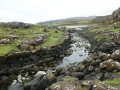
Situated at the foot of the highest peaks on the Isle of Skye, Glen Brittle and its loch offer a unique hike to the ‘end of the world’.At Rudh an Dùnain, there is an ancient chapel in ruins; further on, an inland loch (Loch na h-Àirde) is strangely connected to the ocean by a so-called ‘Viking’ channel, which allows the high tides to pour in salt water, as well as a wall of what must once have been a fortress.A massive defensive wall still encloses the south-western section.And then, in season, the Càrn Mòr plateau is covered in flowering heather: quite simply magnificent.Another natural feature here is a huge stone staircase set right in the middle of the moor, allowing you to climb the slope.Soak up the colours, the light and the scents of this place, where sheep are, here too, the main inhabitants.As is the case throughout the region: spongy ground, peat, waterfalls, fords… water is ever-present here and is never shy about falling from the sky at any moment.
Coire Lagan in the Cuillins
 4.06 mi
+1,818 ft
-1,818 ft
3h 25
Difficult
Departure from Highland
4.06 mi
+1,818 ft
-1,818 ft
3h 25
Difficult
Departure from Highland
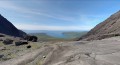
A superb walk in the Cuillins, with breathtaking views of the sea and a charming little Loch at the end.
The only challenging part is the end of the climb, where you need to climb up some scree for the last 300 metres.
Bla Bhienn from Elgol
 12.61 mi
+4,081 ft
-4,065 ft
9h 20
Difficult
Departure from Highland
12.61 mi
+4,081 ft
-4,065 ft
9h 20
Difficult
Departure from Highland
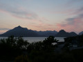
This is an ascent of the South ridge of Bla Bhienn starting from and returning to Elgol. It includes the cliff top walk to Camasunary Bay, followed by the ridge. The views are spectacular and the ridge is one of the most memorable mountain days to be had.
For more walks, use our search engine .
The GPS track and description are the property of this route's author. Please do not copy them without permission.

