


 Country:

 City:
City:


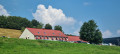
Leave your car on the lay-by near the Ferme-Auberge du Grand Ballon off the Route des Crêtes D431G.
(S/E) From the farm entrance, ignore the path on the left (which is the return route) and set off along the wide track that runs behind the farmhouse. Go through the large gate; the track enters the forest and then reaches the Chalet René Girny.
(1) Continue straight on, due north, until you reach a junction with another signposted path. (New route of the GR®5, marked with Red Rectangles).
(2) Turn left and continue uphill along the GR® to the Grand Ballon car park, to the left of the restaurant “La vue des Alpes”.
(3) Turn left, with your back to the restaurant, cross the car park and the D331G road (at the pedestrian crossing), then walk along the right-hand side of the honey shop (La Maison de l’Abeille) until you reach the road leading to the Hôtel du Grand Ballon.
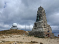
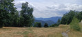
(4) Cross the road and head towards the wide, stony path that climbs up opposite towards the Col de Hagg, ignoring the path on the right that leads into the forest. The path starts in the forest, then emerges and turns left. It is joined by another path coming from the left. Continue climbing straight on until you reach the access ramp to the mast and the balloon-shaped dome housing a radar station. Take in the panoramic view.
(5) Go round them on the left and head towards the Diables Bleus monument.
(6) Then head back down the road, taking in the view (marked with Red Rectangles and White Rectangles). After about 500 m, you’ll reach a fork in the road.
(7) Take the road on the right (the one on the left is closed to traffic to protect the site). It takes a hairpin bend to the left then descends straight on towards the start of the stony path you encountered on the way up, then turns right at the junction onto the Route de l’Hôtel du Grand Ballon.
(4) Before the honey shop, turn right and join the Route des Crêtes. Follow this for about 400 m until you reach a metal gate on the left.
(8) Go through the gate and head back down to the farm inn, following the ski runs (the old GR®5 route). Go through one final gate to reach the farm inn (S/E).
 Visorando Member
 Tourism professional
 Easy
Easy 
