


Refine your search for walks in Gare de Cesson
Gare de Cesson walks


 The Bréviande Forest and the ponds of Cesson-la-Forêt
 Visorando Member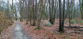
 6.49 mi
 +26 ft
 -26 ft
 3h 00
3h 00
 Moderate
 Departure from Cesson (Seine-et-Marne)
A hike mostly in the forest, with sections in suburban areas and along ponds.
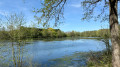
Cesson Circular and the Briard Villages
 9.65 mi
+236 ft
-259 ft
4h 40
Moderate
Departure from Cesson (Seine-et-Marne)
9.65 mi
+236 ft
-259 ft
4h 40
Moderate
Departure from Cesson (Seine-et-Marne)
Cesson, its neighbourhoods and the Briard villages to the west, the Seine, a few ponds, a wash house, calvaries, a castle and a forest. Prehistoric remains, a menhir in the Bois de Sainte-Assise and the remains of a Gallo-Roman villa in the windmill plain bear witness to the ancient occupation of our territory. Not far from the Ru de Balory, at the end of Rue de la Fontaine, there was a spring, now tapped, near which people settled in the Middle Ages, soon building a church dedicated to Saint Martin. The development of the village and its two main hamlets, Saint-Leu and Verneau, was relatively slow. A table drawn up in 1793 shows that there were around 250 citizens.
Slices of Brie from station to station
 258.96 mi
+8,763 ft
-8,609 ft
31 days
Moderate
Departure from Coulommiers (Seine-et-Marne)
258.96 mi
+8,763 ft
-8,609 ft
31 days
Moderate
Departure from Coulommiers (Seine-et-Marne)
From the medieval town of Coulommiers to Provins, via a loop around the Marne in the Paris suburbs, a series of walks starting from a station and crossing the Brie plain, its villages and its rich heritage.
Walks near Gare de Cesson
From Boissise-le-Roi to Boutigny-sur-Essonne via the Chemin de l'École
 17.05 mi
+492 ft
-436 ft
6 hrs
17.05 mi
+492 ft
-436 ft
6 hrs
 Very difficult
Departure from Boissise-le-Roi (Seine-et-Marne)
Very difficult
Departure from Boissise-le-Roi (Seine-et-Marne)
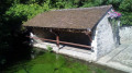
A walk from station to station showcasing the full diversity of southern Île-de-France! For the first two-thirds of the route, the path crosses back and forth over the River École, with its old mills and countless wash houses. You then wander across a plateau with its typical heathland landscape. The walk concludes with a route that is mainly through woodland. A castle and a few Romanesque or Gothic churches add to the rich heritage of this walk.
From Ponthierry to Corbeil, left bank, right bank
 11.34 mi
+26 ft
-43 ft
5h 15
Moderate
Departure from Saint-Fargeau-Ponthierry (Seine-et-Marne)
11.34 mi
+26 ft
-43 ft
5h 15
Moderate
Departure from Saint-Fargeau-Ponthierry (Seine-et-Marne)
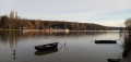
The first part of this walk from station to station follows the left bank of the Seine, keeping as close to the river as possible. You cross to the right bank after the Coudray lock and veer off slightly before rejoining the Seine on paths running alongside the water (the route may need to be adjusted depending on flood levels). The walk ends with a stroll through the historic centre of Corbeil, which boasts some beautiful heritage sites.
From Melun to Ponthierry via the Vives Eaux dam
 8.09 mi
+69 ft
-118 ft
3h 45
Moderate
Departure from Melun (Seine-et-Marne)
8.09 mi
+69 ft
-118 ft
3h 45
Moderate
Departure from Melun (Seine-et-Marne)
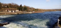
A walk from station to station during which you spend most of the time along the banks of the Seine, either on small tarmac roads or on shaded footpaths. The Collegiate Church of Notre-Dame in Melun and the church at Boissettes add a touch of heritage to this walk.
From Melun to Bois-le-Roi via the GR®1
9.74 mi
+384 ft
-328 ft
4h 50
Moderate
Departure from Melun (Seine-et-Marne)
This stage is the shortest on theGR®®1. It offers a chance to discover Melun’s historical heritage. With no elevation gain, it is ideal for families. This walk serves as a warm-up for the Forest of Fontainebleau, which will be more challenging to traverse. The walk can be divided into three sections: an urban first and third section passing through Melun, Vaux-le-Pénil, Chartrettes and Bois-le-Roi, separated by a short wooded stretch.
The banks of the Seine from Le Plessis-Chênet to Évry
 7.95 mi
+66 ft
-112 ft
3h 45
Moderate
Departure from Le Coudray-Montceaux (Essonne)
7.95 mi
+66 ft
-112 ft
3h 45
Moderate
Departure from Le Coudray-Montceaux (Essonne)
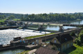
The banks of the Seine and the town of Corbeil have a rich historical and industrial past, which is highlighted on this walk. Among other things: Kings and Queens of France, famous figures, historical events, and prestigious industrial establishments. It is also a walk where, despite increasing urbanisation, nature and beautiful landscapes are still very much present.
From Corbeil to Ballancourt via Villeroy Park and the Fontenay Marshes
 12.46 mi
+354 ft
-302 ft
6h 00
12.46 mi
+354 ft
-302 ft
6h 00
 Difficult
Departure from Corbeil-Essonnes (Essonne)
Difficult
Departure from Corbeil-Essonnes (Essonne)
A walk from station to station starting in Vieux Corbeil (large mills, cathedral). After following the Seine, the route climbs before descending to Moulin Galant, then follows the Essonne. The walk concludes with a stroll through Villeroy Park, set in a wooded landscape, followed by an exploration of the Fonteanay Marshes and their birdwatching hides.
Following the Essonne
 97.78 mi
+3,153 ft
-3,136 ft
10 days
Moderate
Departure from Corbeil-Essonnes (Essonne)
97.78 mi
+3,153 ft
-3,136 ft
10 days
Moderate
Departure from Corbeil-Essonnes (Essonne)
Named after Acionna, the Gallo-Roman goddess of rivers, the Essonne flows through the north of the Loiret department and the south of the Île-de-France region. The first five stages follow its course downstream, while the last four follow it upstream. These nine stages are accessible by train. One stage, which is not accessible by train, forms a circular route upstream. The route alternates between paths along the river, passages through woods and those across cultivated plateaus.
Along the Seine from Corbeil to Juvisy
 8.46 mi
+13 ft
-23 ft
3h 55
Moderate
Departure from Corbeil-Essonnes (Essonne)
8.46 mi
+13 ft
-23 ft
3h 55
Moderate
Departure from Corbeil-Essonnes (Essonne)
A walk from station to station with a relatively straightforward route, as it mainly follows the right bank of the Seine. Apart from the approach from the starting station and the approach to the finishing station, the route stays as close as possible to the river.
From Quincy to Montgeron along the Yerres
11.29 mi
+171 ft
-302 ft
5h 20
Moderate
Departure from Combs-la-Ville (Seine-et-Marne)
This is an unusual route, as the outward journey is by train from Montgeron station to Combs la Ville-Quincy-sous-Sénart station, and the return journey is on foot along a path that largely follows the banks of the Yerres.
From Mennecy to Corbeil-Essonnes via Robinson Park
 8.16 mi
+102 ft
-135 ft
3h 50
Moderate
Departure from Mennecy (Essonne)
8.16 mi
+102 ft
-135 ft
3h 50
Moderate
Departure from Mennecy (Essonne)
This last stage of the journey along the Essonne offers many opportunities to play leapfrog with the river. It is obviously the stage with the most urban sections. The town of Corbeil-Essonnes reveals its rich religious, civil and industrial heritage.