Country:
 City:
City:




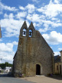
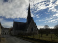
Park in the church car park.
(S/E) As you leave the car park, facing the church, take the road on the right into the village. Walk past the Town Hall, cross the D34 at the pedestrian crossing (beware of heavy traffic) and continue straight on along Rue du Stade for about 1 km.
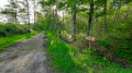
(1) After passing some sheds on the right, take the path on the left, which is signposted in yellow. Carry straight on through the woods until you come out onto a road.
(2) Follow the road to the right for a few dozen metres, then turn left onto the path.
(3) Turn right to visit the Château de la Bruyère and continue to the four-way junction. Then turn back and continue along the path on the right. Cross the D34 carefully and continue along the path opposite. Keep heading in the same direction, ignoring the small side paths.
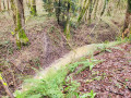
(4) Take the road on the right for 100 metres, then turn left. Further on, on the left, you’ll see some beautiful houses and the stream running below with small ponds.
(5) Follow the road to the left. Pass the Moulin du Breuil and reach a T-junction.
(6) Turn left, cross the bridge over the Breuil and turn right immediately: there are several yellow hiking signs as well as litter bins.
(7) Turn right towards Bois Guillot. Pass through the hamlet and continue to the junction after Le Mortier.
(8) Take the path on the left and go straight on, ignoring the various offshoots on either side. You’ll reach a crossroads with the entrance to the Château de la Touche, which is unfortunately private and not visible from the path, unless perhaps you happen to meet the owners.
(9) Take the path on the left just past the private property and join a road.
(10) Carry on straight ahead to La Bélissière.
(11) At the bend, take the path on the right, then 100 metres further on, turn left at the edge of the woods.
(12) Carry on straight ahead, veering slightly to the left, and enter the woods. You’ll reach the Carroi Bascule crossroads.
(13) Take the second path on the left and continue straight on until you reach the Étang du Sablonnay.
(14) Turn left: the GPS route for this path does not exactly match that on the IGN map. Turn right at the junction towards Vaugrellier.
(15) Once you reach the hamlet, turn right again and carry on until you come out onto a road at the Butte de l’Épinay.
(16) Turn right twice to go round the houses, pass near La Petite Gaudrière and head straight on to the village centre. You’ll come back to the church and the car park where you started (S/E).

 A walk enjoyed on a lovely May day. Very pleasant, with plenty of paths through the woodland. No difficult terrain; the paths are all very well marked. Please note that in winter the paths can be muddy or even impassable near the Semblançay pond (POI 10 to 14). You can shorten the circular path by heading from POI No. 7 to POI No. 15, or from POI No. 10 to POI No. 15. There are plenty of fallen tree trunks to rest on after the entrance to the Château de la Touche (POI No. 9). I highly recommend this walk.
 Visorando Member

 Easy
Easy