From Saint-Étienne-de-Chigny to Mazières and back

Through the Touraine woodlands, on the trail of wild boar.

Details

n°2352
Creation:
Last update:
Last review:
  • Walking
    Activity: Walking
  • ↔
    Distance: 9.99 mi
  • ◔
    Average duration: 4h 50 
  • ▲
    Difficulty: Moderate

  • ⚐
    Back to start: Yes
  • ↗
    Ascent: + 256 ft
  • ↘
    Descent: - 256 ft

  • ▲
    Highest point: 331 ft
  • ▼
    Lowest point: 151 ft

Photos

Description of the walk

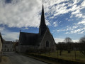
Start at the town hall in Saint-Étienne-de-Chigny, Pont de Bresme, on the D76.

(S/E) Turn left towards the cemetery.

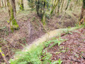
(1) Just before you reach it, head down to the right and follow the Vau upstream. Follow the path through the Parc des Grillets.

(2) Turn right once, then left at a 90° angle to leave the park.

(3) Turn right onto the road towards L’Espérance and, at the junction, turn left towards La Quintalle.

(4) Turn right at a 90° angle and, at the next bend, go straight on and continue across the fields.

(5) At the edge of the woods, turn left, following the fence, then veer right until you reach the D48.

(6) Turn right and carry on until you reach the crossroads, which comes up very quickly

(7) Turn left, pass La Brosserie and carry on to the junction with the track at La Goubaudière.

(8) Take the track on the left, carry on to a small road and turn left again. Cross a small bridge and continue along the track as it straightens out until you reach the access point to La Parcoire.

(9) Turn left to join the D48, follow it to the left until you reach the first road on the right.

(10) Take this small road which passes through La Martinière. Pass the path on your right leading to La Grande Perrée, then the road on your left leading to La Quintalle, and carry on until you reach a junction.

(11) Go straight on and follow the road until you reach a Fork in the road.

(12) Turn left at the fork and carry on straight ahead until you reach the road leading to Le Perré, which is on your right. Turn right, then immediately left.

(13) Go round the housing estate on the right, taking a path which then rejoins the road. Carry on straight ahead, then turn right towards the cemetery.

(1) Turn right onto the road that descends towards the town hall of Saint-Étienne-de-Chigny and leads back to the starting point (S/E).

Waypoints

  1. S/E : mi 0 - alt. 151 ft - Saint-Étienne-de-Chigny Town Hall - La Loire
  2. 1 : mi 0.15 - alt. 187 ft - T-junction before the cemetery
  3. 2 : mi 0.63 - alt. 289 ft - Turn right at the fork
  4. 3 : mi 1.08 - alt. 312 ft - Route
  5. 4 : mi 2.08 - alt. 325 ft - La Quintalle
  6. 5 : mi 2.7 - alt. 318 ft - Edge of the woodland
  7. 6 : mi 3.29 - alt. 289 ft - D46
  8. 7 : mi 3.94 - alt. 312 ft - Crossroads
  9. 8 : mi 5.19 - alt. 285 ft - La Goubaudière
  10. 9 : mi 6.22 - alt. 308 ft - Access to La Parcoire
  11. 10 : mi 6.76 - alt. 299 ft - Junction
  12. 11 : mi 7.89 - alt. 302 ft - Crossroads
  13. 12 : mi 8.42 - alt. 253 ft - Fork in the road
  14. 13 : mi 9.01 - alt. 276 ft - Bypassing a housing estate
  15. S/E : mi 9.99 - alt. 151 ft - Saint-Étienne-de-Chigny Town Hall

Worth a visit

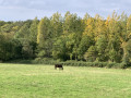
In the forest, you can spot traces of roe deer, red deer and, of course, wild boar.
At the Arnerie, excavations have been carried out, revealing a Gallo-Roman villa. Flat tiles (tegulae), hollow tiles (imbrices) and sigillata pottery have been found.
If you take a detour to the left of the Carroi de Mazières, you will find the remains of a mill known as the ‘Pot au Beurre’. Above the door, you can see a monstrance. This mill was used to grind the flour intended for communion wafers.

Reviews and comments

2.9 / 5
Based on 5 reviews

Reliability of the description
3 / 5
Ease of following the route
2.8 / 5
Route interest
2.8 / 5
Audrey et Mylène
Audrey et Mylène

Overall rating : 4 / 5

Date of your route : Sep 10, 2023
Reliability of the description : ★★★★☆ Good
Ease of following the route : ★★★☆☆ Average
Route interest : ★★★★★ Very good
Very busy route : No

Walk completed in September 2023. There were few signposts along the route, either on trees or on signs. At point no. 5, it was impossible to follow the path shown on the map (due to barriers and beehives in the way), so you have to take the white stony path straight ahead and then join the road on the right to continue towards no. 6. A very pleasant walk. Completed in 2 hours 56 minutes early in the morning at a brisk pace. Not too much elevation gain.

Machine-translated

Berger34
Berger34

Overall rating : 3 / 5

Date of your route : Oct 07, 2022
Reliability of the description : ★★★★☆ Good
Ease of following the route : ★★★★☆ Good
Route interest : ★☆☆☆☆ Very disappointing
Very busy route : No

There is far too much tarmac on this route, which is an extension of an 8.5 km route proposed by the local council.

Machine-translated

henri57
henri57 ★

Hello,

@nature and heritage

Henri has changed the route so that it now takes the road which I find dangerous. (My usual route is Chaslet, Brosserie)

For your information, I have never altered the route of this walk.

Kind regards

Machine-translated

dominique cinq
dominique cinq

Thank you for all these details.

Machine-translated

nature et patrimoine

I’ll reply point by point
In the Parc des Grillet, the path used to go through Le Vau, but apparently this winter it’s been blocked off (tree trunks etc.) and you have to take the mountain bike trail a little further up, though I only discovered this last week. You can also walk the whole of the Parc des Grillet, but that’s almost a walk in its own right
Between points 6 and 7, the path runs alongside the woodland and you need to turn as shown on the map; there’s a gate to open and close – the path is narrow between the field and the woodland.
Following the issue with the owner of Chaslet, whose property straddles the local footpath (he’d like to ban all access through the woods anyway, even though the paths are public), Henri has altered the route so that it now goes along the road, which I find dangerous. (My usual route is Chaslet, Brosserie.)
Should we allow overbearing landowners to take over public footpaths?
As for dogs between 12 and 13, that’s not a place where we usually come across any.
14 I’ve just checked the map; I can’t see where the error might be (have you downloaded the GPX file onto your phone?)
It’s true that the walk is lovely, which is why I’m keeping it.
See you one of these days out on the trails.

Machine-translated

henri57
henri57 ★

Hello,

Thank you for your feedback.

Some information has been sent via private message to the author of the walk.

See you soon

Machine-translated

dominique cinq
dominique cinq

Overall rating : 3.3 / 5

Date of your route : May 07, 2019
Reliability of the description : ★★★☆☆ Average
Ease of following the route : ★★★☆☆ Average
Route interest : ★★★★☆ Good

There were some lovely stretches on this walk, but a few difficulties worth mentioning:
- at point 1, there are several paths in the Parc des Grillets; we took the wrong one. The map helped us get back on the right route a little further on, but we weren’t able to enjoy the park – a shame
- between points 6 and 7, part of the path no longer exists, so we had to walk through the cultivated field
- We had an unpleasant encounter with some very aggressive dogs running loose on the road between points 12 and 13
- The instructions at point 14 are unclear and prone to causing confusion

To avoid the road between points 7 and 8, we cut across the woods along ‘Le Chaslet’ and reached point 9 at a place called La Brosserie, but I’m not sure if it’s a local footpath…

No snow in May, but there were still wild boar tracks in the mud on the forest paths – a promise kept!

So there are a few points to clarify regarding this walk, but nothing to discourage keen walkers.

Machine-translated

nature et patrimoine

I’d completely overlooked the comments, sorry.
Point 5 opposite La Quintalle is a wide path which then runs through the middle of fields, but there are no fields to cross and no landowners to disturb.
Between points 8 and 9, the local path runs alongside a property; the kennels and a shed are on the other side of the path. The owner would prefer the path to be private, which it isn’t.
Bibi’s suggested change is a nice idea, but the road is quite dangerous: it’s a straight stretch with vehicles travelling at high speed. The route only used it for about 150 metres.
I shouldn’t have mentioned the wild boar tracks, which were perfectly visible in the … snow … back in 2012.
As for point 11, the route planner indicates a left turn onto the track leading to the D48.
It’s a walk we do quite regularly.
Have a good evening.

Machine-translated

BernardMrd
BernardMrd

Overall rating : 3 / 5

Date of your route : Aug 25, 2017
Reliability of the description : ★★★☆☆ Average
Ease of following the route : ★★★☆☆ Average
Route interest : ★★★☆☆ Average

Good evening,
It’s great that you’ve sorted things out so quickly. By the way, well done and thank you.
Have a lovely evening.

Machine-translated

bibi
bibi ★

I’ve just amended the route and the description so that it no longer passes through the property between 8 and 9.
Thank you for bringing this to our attention.
Kind regards

Machine-translated

BernardMrd
BernardMrd

Good evening, everyone,
I went on this walk today without checking this section of the forum.
I can confirm what Pekah said about points 8 and 9. The landowner, although a decent sort, is fed up with the frequent passage of walkers crossing his property (nice of them) for about 150 metres. Which is perfectly understandable.
I’d also like to point out the difficulty we encountered at point 5; we did indeed cut across a field, so we were on a landowner’s property, and he gave us another dirty look.
Finally, point 11 is unclear; we ended up on a dead end after heading straight towards Tortecol. The compass is a brilliant invention!!!
Well, I sound like a grumbler, but this is the first time I’ve come across so many negative points on a walk. Apart from the fact that it isn’t particularly exciting, apart from points 1, 2 & 3 (the section through the forest)
Have a good evening.

Machine-translated

gazok54
gazok54 ★

Ouch, ouch, but thank you, Pekah, for bringing this to our attention – it’s something we take very seriously. The walk in question is quite old, and things may well have changed since 2012.
Let’s wait for the author of this walk to see this exchange and tell us what they think.
However, I’m keeping this walk on the back burner in case we need to remove it from the list if we don’t receive any further information.

Machine-translated

Pekah
Pekah

Overall rating : 1 / 5

Date of your route : Jul 23, 2017
Reliability of the description : ★☆☆☆☆ Very disappointing
Ease of following the route : ★☆☆☆☆ Very disappointing
Route interest : ★☆☆☆☆ Very disappointing

It’s very disappointing – the route runs through private property between points 8 and 9, which causes inconvenience for everyone...

What’s more, all the woodland is privately owned, so it’s of course forbidden to leave the path, making it impossible to spot any wild boar tracks as advertised...

I do not recommend this route....

Machine-translated

Other walks in the area

For more walks, use our search engine .

The GPS track and description are the property of this route's author. Please do not copy them without permission.