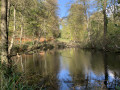
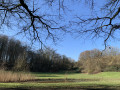
Between towns and the forest around Watermael

A mix ofGR® trails and park paths around Watermael

Details

3295024
Creation:
Last update:
Last review:
  • Walking
    Activity: Walking
  • ↔
    Distance: 5.33 mi
  • ◔
    Average duration: 2h 40 
  • ▲
    Difficulty: Easy

  • ⚐
    Back to start: Yes
  • ↗
    Ascent: + 230 ft
  • ↘
    Descent: - 236 ft

  • ▲
    Highest point: 328 ft
  • ▼
    Lowest point: 190 ft

Photos

Description of the walk

You can park along the edge of Parc de la Héronnière, on Rue des Pêcheries.

(S/E) Enter the park and walk through it to reach the Square des Archiducs.

(1) Pass through this square to enter the Logis-Floréal housing estate. Continue on to the Place du Jeu de Balle. To do this, follow the red and whiteGR® symbols. Take the narrow lanes that criss-cross the neighbourhood. After passing the Boulevard du Souverain Vorstln, you’ll arrive at the entrance to Parc Seny.

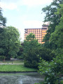
(3) Turn right to enter the park, then continue along the Ten Reuken Ponds towards the Axa – Royale Belge building until you reach the junction with Avenue Charle-Albertin.

(4) You enter the Forêt de Soignes next to the Repos des Chasseurs by taking the path on the right. Continue almost in a straight line until you reach a crossroads with four perpendicular roads.

(5) Turn right onto Rue du Grand Veneur and walk behind the Collège Saint-Hubert. You will then reach the roundabout at Place Wiener.

(6) Cross over to the opposite side towards the ponds, towards the Rives du Gange. Walk up the streets of Watermael, then pass by the Karrenberg school. You’ll come out at the gardens of the Ferme du Chant de Cailles.

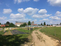
(7) Turn right to explore them. Turn left as you leave to reach the Parc Sportif des 3 Tilleuls, going round the football pitches.

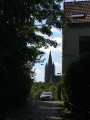
(8) Head back down towards Saint-Clément Church and Rue des Pêcheries to return to the car park at Parc de la Héronnière (S/E).

Waypoints

  1. S/E : mi 0 - alt. 220 ft - Entrance to Parc de la Héronnière – Rue des Pêcheries
  2. 1 : mi 0.6 - alt. 256 ft - Square des Archiducs
  3. 2 : mi 0.79 - alt. 243 ft - Place du Jeu de Balle – start of the narrow streets
  4. 3 : mi 1.37 - alt. 194 ft - Entrance to Seny Park
  5. 4 : mi 2.12 - alt. 240 ft - Repos des Chasseurs
  6. 5 : mi 2.69 - alt. 318 ft - Four-way junction
  7. 6 : mi 3.08 - alt. 213 ft - Place Wiener
  8. 7 : mi 3.81 - alt. 305 ft - Ferme du Chant des Cailles
  9. 8 : mi 4.29 - alt. 276 ft - Centre Sportif des 3 Tilleuls
  10. S/E : mi 5.33 - alt. 220 ft - Entrance to Parc de la Héronnière – Rue des Pêcheries

Worth a visit

(S/E) The park entrance is 200 metres from Beaulieu metro station.
If you happen to be thirsty or hungry, you’ll pass a few brasseries and restaurants on your way.
(6) On Sundays, there’s a market at Place Wiener.
(7) During your visit to La Ferme du Chant des Cailles, you can buy cut flowers or goat’s cheese. Vegetables are reserved for market gardeners and members of the co-operative.

Always be cautious and plan ahead when you're outdoors. Visorando and the author of this route cannot be held responsible for any accidents occurring on this route.

The GR® and PR® markings are the intellectual property of the Fédération Française de Randonnée Pédestre.

Reviews and comments

4.2 / 5
Based on 3 reviews

Reliability of the description
4.7 / 5
Ease of following the route
3.7 / 5
Route interest
4.3 / 5
grandin
grandin ★

Carlo Vivari

This is probably a bug. Normally, there shouldn’t be any other documents to download

Machine-translated

Gils1160
Gils1160

The map that was available in 2020 was apparently no longer available in 2022.
A new (open-source) map showing the route is now available.

Machine-translated

Carlo Vivari
Carlo Vivari

Overall rating : 3 / 5

Date of your route : Feb 19, 2022
Reliability of the description : ★★★★☆ Good
Ease of following the route : ★☆☆☆☆ Very disappointing
Route interest : ★★★★☆ Good
Very busy route : No

The suggested route was just a slightly ‘abstract’ line with no other landmarks, such as roads or other paths, etc.
It seems you need to download another map from the address shown on the diagonal ‘watermark’ on the route.
It’s odd to have to download additional elements. In any case, as we couldn’t find any clear instructions on this, we eventually gave up on following this particular route exactly, as we kept getting lost so often (we could see the blue lines indicating whether we were moving further away or getting closer).
A shame.

Machine-translated

Uatu
Uatu

Overall rating : 4.7 / 5

Date of your route : Apr 03, 2021
Reliability of the description : ★★★★★ Very good
Ease of following the route : ★★★★★ Very good
Route interest : ★★★★☆ Good
Very busy route : No

A pleasant walk. A few steps at the start (not ideal for pushchairs).

Machine-translated

Strick
Strick

Overall rating : 5 / 5

Date of your route : Sep 07, 2020
Reliability of the description : ★★★★★ Very good
Ease of following the route : ★★★★★ Very good
Route interest : ★★★★★ Very good
Very busy route : No

A lovely little family walk – a great way to get a glimpse of this Brussels municipality. Places of interest: the garden cities, the Sonian Forest, and La Ferme du Chant des Cailles (
(an urban, participatory and eco-friendly farming project in Watermael-Boitsfort).

Right at the very end of the walk, for the last 100 metres, I’d skip the return route via Rue des Pêcheries and suggest taking Rue de la Heronnière (a cul-de-sac) at the bottom of Rue des Bégonias, to finish on a high note in the park of the same name. (“a semi-natural park, an example of a contemporary space designed for both recreational and ecological purposes”)

Kind regards,
Thierry

Machine-translated

Other walks in the area

For more walks, use our search engine .

The GPS track and description are the property of this route's author. Please do not copy them without permission.