


 Country:

 City:
City:


Setting off from the sports centre, the route begins by descending into the Petit Bocq valley, crossing the Namur–Luxembourg railway line.
Passing by the ‘La Spirale’ Regional Craft Centre marks the start of the artistic aspect of the walk, which follows – either closely or from a distance – certain sections of the Sentiers d’Art circular loop.
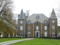
The second stage takes you through the Belgian Red Cross’s Reception Centre for Asylum Seekers before reaching Francesse Castle and its adjoining farm.
A steady climb then begins, starting gently as you approach the hamlet of Maibelle, then becoming steeper as you reach the former Ferme des Sarts, a key stronghold of the Secret Army during the Second World War.
The descent towards Skeuvre across the fields from kilometre 8 is simply splendid… even more so when the ever-present broom is in bloom.
Skeuvre Castle is the one best admired from here.
This is followed by a fairly long stretch through the countryside towards Stée – home to the ‘Fourmis’ farm and artwork – and Braibant, then the hamlet of Reuleau.
The route crosses the disused Bocq railway line twice and offers a beautiful, albeit distant, view of the towers of Mouffrin Castle and its farm.
The return journey to the starting point takes you in turn through the hamlet of Vincon, the Bois Henrard and a final artwork entitled ‘Farakas 4’.
Farms and castles starting from Natoye


There are more farms than castles: shrewd lords of the manor managed in their day to have them built away from public roads, and their descendants are keen to preserve these privileges.
Nevertheless, the delightfully undulating countryside offers walkers the pleasure of discovering a farm here and a castle there, in varying states of repair.
Details
Creation:
Last update:
Last review:
–
–
-
 Activity: Walking
 -
 Distance: 11.82 mi
 -
 Average duration: 6h 00
 -
 Difficulty: Moderate
 -
-
 Back to start: Yes
 -
 Ascent: + 689 ft
 -
 Descent: - 679 ft
 -
-
 Highest point: 997 ft
 -
 Lowest point: 679 ft
Photos
Description of the walk
Waypoints
- S/E : mi 0 - alt. 889 ft - Natoye Sports Centre
- 1 : mi 1.05 - alt. 738 ft - ‘La Spirale’ Regional Centre for Craftsmanship
- 2 : mi 1.48 - alt. 784 ft - Refugee Centre
- 3 : mi 2.09 - alt. 797 ft - Francesse Castle
- 4 : mi 4.28 - alt. 978 ft - Fork in the road
- 5 : mi 4.84 - alt. 951 ft - N921
- 6 : mi 5.97 - alt. 801 ft - Skeuvre Castle
- 7 : mi 7.73 - alt. 741 ft - Stée Farm
- 8 : mi 7.88 - alt. 702 ft - The - Bocq (rivière)
- 9 : mi 8.94 - alt. 837 ft - Braibant
- 10 : mi 10.05 - alt. 679 ft - The hamlet of Reuleau - Bocq (rivière)
- 11 : mi 10.66 - alt. 843 ft - Vincon
- 12 : mi 11.15 - alt. 912 ft - Henrard Wood
- S/E : mi 11.82 - alt. 889 ft - Natoye Sports Centre
Other walks in the area
Natoye and Braibant
 Visorando Member8.28 mi
+617 ft
-633 ft
2h 50
Moderate
Visorando Member8.28 mi
+617 ft
-633 ft
2h 50
Moderate
 Departure from Hamois (Province de Namur)
A lovely walk to do in dry weather. It takes you through woods and along quiet roads. You can catch a glimpse of Mouffrin Castle (private) and a few works of art along the way. If it rains, it’s best not to go up into the woods after Braibant station and to stay on Rue de Stée to rejoin the route and avoid two steep climbs.
Skeuvre to Les Tiennes via Maibelle
5.45 mi
+453 ft
-440 ft
2h 55
 Easy
Departure from Hamois (Province de Namur)
Easy
Departure from Hamois (Province de Namur)
A lovely walk through woods, paths and quiet roads. Suitable for everyone, but there are a few muddy patches if it rains. Don’t forget to take a short detour at the end of the route to visit Skreuvre Castle, which inspired Franquin to create Champignac Castle in the Spirou comic strip.
Skeuvre to Maibelle
3.67 mi
+276 ft
-269 ft
1h 55
Easy
Departure from Hamois (Province de Namur)
A walk through the woods along quiet paths and country lanes. At the end of the route, enjoy the view of Skeuvre Castle (private), which inspired Franquin to create the Château de Champignac in the Spirou comic strip.
A short detour to the geographical centre of Wallonia
 2.28 mi
+217 ft
-217 ft
1h 15
Easy
Departure from Yvoir (Province de Namur)
2.28 mi
+217 ft
-217 ft
1h 15
Easy
Departure from Yvoir (Province de Namur)
A family walk on the hills above Spontin, taking in the geographical centre of Wallonia as well as passing through turnstiles to cross the meadows.
Around Braibant, starting from Emptinal
 10.01 mi
+617 ft
-614 ft
5h 10
Moderate
Departure from Hamois (Province de Namur)
10.01 mi
+617 ft
-614 ft
5h 10
Moderate
Departure from Hamois (Province de Namur)
Emptinal, a hamlet in the former municipality of Emptinne, is unique in that it was split in two during the municipal mergers of the late 1970s: one part became part of Ciney, the other of Hamois. The Sainte-Madeleine Chapel, listed as part of Wallonia’s historical heritage, is part of Ciney, whilst the street running past it belongs to Hamois.This lovely walk winds through the Condroz countryside of Ciney and Hamois, crossing the Bocq river several times and the route of the Bocq Railway between Spontin and Braibant on three occasions.A new artwork entitled *Tressage Absidale* was installed in 2024 on the Sentier d’Arts, just before Reuleau.The *Fourmis* artwork in Stée, on the other hand, is suffering the ravages of time.
Spontin and the Bocq Valley
 7.07 mi
+827 ft
-810 ft
4h 00
Moderate
Departure from Yvoir (Province de Namur)
7.07 mi
+827 ft
-810 ft
4h 00
Moderate
Departure from Yvoir (Province de Namur)
This walk takes place in the Bocq valley between Spontin and Purnode. It takes you through woods and countryside to the villages of Durnal and Dorinne. Views of the river, the forest and the hills, now increasingly 'decorated' with wind turbines.
Jassogne to Crupet
4.73 mi
+846 ft
-840 ft
2h 55
Moderate
Departure from Assesse (Province de Namur)
A beautiful hike through woods and along quiet roads. The trail starts in the centre of the village of Jassogne, where there is a small car park for six cars. Alternatively, there is a larger car park next to a school, but it is best to use this outside school hours. There are beautiful views of the villages of Jassogne, Maillen and Ivoy.
Sorrinne-la-Longue and the Samson valley
11.01 mi
+1,109 ft
-1,096 ft
6h 00
Moderate
Departure from Assesse (Province de Namur)
This walk follows a discreet valley where water and forest have shaped the landscape for centuries. Each place evokes an ancient history, often linked to the passage and work of man.
Sorinne-la-Longue is a village that stretches out like an ancient road, already frequented in Roman times. The Faya wood, whose name comes from the beech tree, offers a cool and calm atmosphere. Bethléem is a place steeped in symbolism, formerly associated with refuge and passage. At the Inzéfonds quarries, blue stone has left its mark on the local architecture and landscape. In the Gesves wood and the Chaumont valley, the forest becomes denser and more enveloping.
The Samson stream structures the valley. Around it, the Bizonzon and neighbouring streams are home to a discreet and varied fauna. It is therefore a peaceful walk between water, stone and wood, ideal for slowing down and observing.
For more walks, use our search engine .
The GPS track and description are the property of this route's author. Please do not copy them without permission.

