A short detour to the geographical centre of Wallonia

A family walk on the hills above Spontin, taking in the geographical centre of Wallonia as well as passing through turnstiles to cross the meadows.

Details

3381619
Creation:
Last update:
Last review:
  • Walking
    Activity: Walking
  • ↔
    Distance: 2.28 mi
  • ◔
    Average duration: 1h 15 
  • ▲
    Difficulty: Easy

  • ⚐
    Back to start: Yes
  • ↗
    Ascent: + 217 ft
  • ↘
    Descent: - 217 ft

  • ▲
    Highest point: 791 ft
  • ▼
    Lowest point: 600 ft

Photos

Description of the walk

Car park along the Chaussée de Dinant in front of the small park.

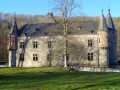
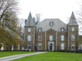
(S/E) Take a stroll through the park to see Spontin Castle. Once back on the Chaussée de Dinant, turn left. Cross the road and take Rue des Carrières. As soon as you enter the street, turn right and go up the steps. At the road, turn left and, at the Fork in the road, keep to your right.

(1) At the crossroads, turn left. When you reach the car park, turn left. Cross the small bridge on your right so that you walk along the footpath rather than the gravel road.

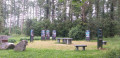
(2) At the fork in the road, discover the geographical centre of Wallonia. A very attractive, well-maintained site. Continue along the path on the left. Leave the forest and keep to your left.

(3) When you reach the motorway viaduct and before passing underneath it, look out for the gap in the meadow fence on your left and go through the gate. Head left towards the posts in the centre of the meadow. Pass the water intake point and continue across the meadow parallel to the railway line on your right. Pass through another turnstile and follow the path. The railway line recedes into the distance. The path becomes a track and runs as close as possible to the River Bocq. Walk past the Vivaqua water intake.

(4) Before the gate, take the grassy path on your left. You’ll come back onto a road in front of a wayside shrine sheltered by a magnificent thuja tree. Turn right and walk past the old ‘blue stone’ quarry. Once back on the Dinant road, cross it and return to your car park. (S/E)


Waypoints

  1. S/E : mi 0 - alt. 607 ft - Car park in the centre of Spontin in front of the castle
  2. 1 : mi 0.32 - alt. 682 ft - Crossroads
  3. 2 : mi 0.86 - alt. 787 ft - Geographical centre of Wallonia
  4. 3 : mi 1.42 - alt. 689 ft - Gateway through a fence to cross a meadow
  5. 4 : mi 2 - alt. 656 ft - Grassy path on the left - Bocq (rivière)
  6. S/E : mi 2.28 - alt. 607 ft - Car park in the centre of Spontin in front of the castle

Notes

The route crosses wet meadows; good waterproof shoes are recommended.
Much of the route is in open country.
No water along the route.
You’ll start to hear the sounds of civilisation near the Sovet viaduct and the E411.
Picnic table at the car park before the geographical centre of Wallonia.
Benches at the geographical centre of Wallonia.

Worth a visit

Along the way
Spontin Castle: not open to visitors.
Geographical centre of Wallonia: the central point of this ‘centroid’ was determined by the National Geographic Institute (IGN) in 2002 as part of a programme on public television.
The River Bocq.
Former ‘blue stone’ quarry.
Shrine and its thuja tree: A shrine is a niche containing a statuette of the Virgin Mary or a patron saint.

Reviews and comments

4.7 / 5
Based on 3 reviews

Reliability of the description
5 / 5
Ease of following the route
5 / 5
Route interest
4 / 5
marc maréchal
marc maréchal

Overall rating : 4.7 / 5

Date of your route : Mar 08, 2021
Reliability of the description : ★★★★★ Very good
Ease of following the route : ★★★★★ Very good
Route interest : ★★★★☆ Good
Very busy route : No

Apart from a steep flight of stairs right at the start, the walk is suitable for older people.
Wear wellies in wet weather (meadows...).
Beautiful views.

Machine-translated

annelisemaroye
annelisemaroye

Overall rating : 4.7 / 5

Date of your route : Feb 21, 2021
Reliability of the description : ★★★★★ Very good
Ease of following the route : ★★★★★ Very good
Route interest : ★★★★☆ Good
Very busy route : Yes

This walk is estimated to take around 1 hour, but as I was with my son, we took our time listening, breathing, looking around and taking photos at our own pace, so it took us 2 hours.
It’s an easy walk to get back into the swing of things, and it’s a lovely way to reconnect with nature.

Machine-translated

lazzerini
lazzerini

Hello Mirbou,

I can understand why this might have put you off, but as this section is signposted, I imagine the farmer wouldn’t put anyone in danger. Not running is already a good thing, but I’ll look into the matter anyway. Personally, there weren’t any cattle there when I went past.

Kind regards

Machine-translated

Mirbou
Mirbou

Overall rating : 4.7 / 5

Date of your route : Oct 22, 2020
Reliability of the description : ★★★★★ Very good
Ease of following the route : ★★★★★ Very good
Route interest : ★★★★☆ Good
Very busy route : No

A lovely walk overall. A plus: benches at various points where you can rest. We avoided crossing the meadow as there was a bull amongst the cows. It would be very useful to have an alternative route in such cases.

Machine-translated

Other walks in the area

For more walks, use our search engine .

The GPS track and description are the property of this route's author. Please do not copy them without permission.