


Around Braibant, starting from Emptinal


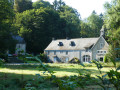
Emptinal, a hamlet in the former municipality of Emptinne, is unique in that it was split in two during the municipal mergers of the late 1970s: one part became part of Ciney, the other of Hamois. The Sainte-Madeleine Chapel, listed as part of Wallonia’s historical heritage, is part of Ciney, whilst the street running past it belongs to Hamois.
This lovely walk winds through the Condroz countryside of Ciney and Hamois, crossing the Bocq river several times and the route of the Bocq Railway between Spontin and Braibant on three occasions.
A new artwork entitled *Tressage Absidale* was installed in 2024 on the Sentier d’Arts, just before Reuleau.
The *Fourmis* artwork in Stée, on the other hand, is suffering the ravages of time.
Details
–
-
 Activity: Walking
 -
 Distance: 10.01 mi
 -
 Average duration: 5h 10
 -
 Difficulty: Moderate
 -
-
 Back to start: Yes
 -
 Ascent: + 617 ft
 -
 Descent: - 614 ft
 -
-
 Highest point: 981 ft
 -
 Lowest point: 679 ft
 Country:

 City:
City:


Photos
Waypoints
- S/E : mi 0 - alt. 778 ft - Emptinal Chapel
- 1 : mi 0.16 - alt. 768 ft - The - Bocq (rivière)
- 2 : mi 1.37 - alt. 768 ft - Le Biron
- 3 : mi 1.52 - alt. 761 ft - Le Leignon
- 4 : mi 2.74 - alt. 781 ft - Les Vaux
- 5 : mi 3.58 - alt. 971 ft - Fermer de Mont
- 6 : mi 3.91 - alt. 873 ft - Braibant
- 7 : mi 5.23 - alt. 686 ft - Le Bocq - Bocq (rivière)
- 8 : mi 6.39 - alt. 719 ft - The - Bocq (rivière)
- 9 : mi 6.51 - alt. 709 ft - The hamlet of Gemenne
- 10 : mi 7.4 - alt. 804 ft - Fork in the road
- 11 : mi 8.27 - alt. 741 ft - The hamlet of Stée - Bocq (rivière)
- 12 : mi 9.01 - alt. 955 ft - Bois des Aunes
- S/E : mi 10.01 - alt. 778 ft - Emptinal Chapel
Other walks in the area
Skeuvre to Les Tiennes via Maibelle
 Visorando Member5.45 mi
+453 ft
-440 ft
2h 55
Visorando Member5.45 mi
+453 ft
-440 ft
2h 55
 Easy
Easy
 Departure from Hamois (Province de Namur)
Skeuvre to Maibelle
3.67 mi
+276 ft
-269 ft
1h 55
Easy
Departure from Hamois (Province de Namur)
Farms and castles starting from Natoye
 11.82 mi
+689 ft
-679 ft
6h 00
Moderate
Departure from Hamois (Province de Namur)
11.82 mi
+689 ft
-679 ft
6h 00
Moderate
Departure from Hamois (Province de Namur)
Natoye and Braibant
8.28 mi
+617 ft
-633 ft
2h 50
Moderate
Departure from Hamois (Province de Namur)
Leignon circular loop
5.64 mi
+482 ft
-486 ft
2h 55
Easy
Departure from Ciney (Province de Namur)
Circular in the Bois de Porcheresse
 10.03 mi
+656 ft
-656 ft
5h 10
Moderate
Departure from Hamois (Province de Namur)
10.03 mi
+656 ft
-656 ft
5h 10
Moderate
Departure from Hamois (Province de Namur)
The Bois Poncelet, starting from Hamois
5.83 mi
+279 ft
-266 ft
2h 55
Easy
Departure from Hamois (Province de Namur)
From Hamois to Barvaux-Condroz and back
15.34 mi
+928 ft
-925 ft
7h 50
 Difficult
Departure from Hamois (Province de Namur)
Difficult
Departure from Hamois (Province de Namur)
For more walks, use our search engine .
The GPS track and description are the property of this route's author. Please do not copy them without permission.

